DVM-500 User’s Guide Digital In-Car Video System
Digital Ally DVM User Guide Rev. F (334/1.6.2) Page 29 of 36
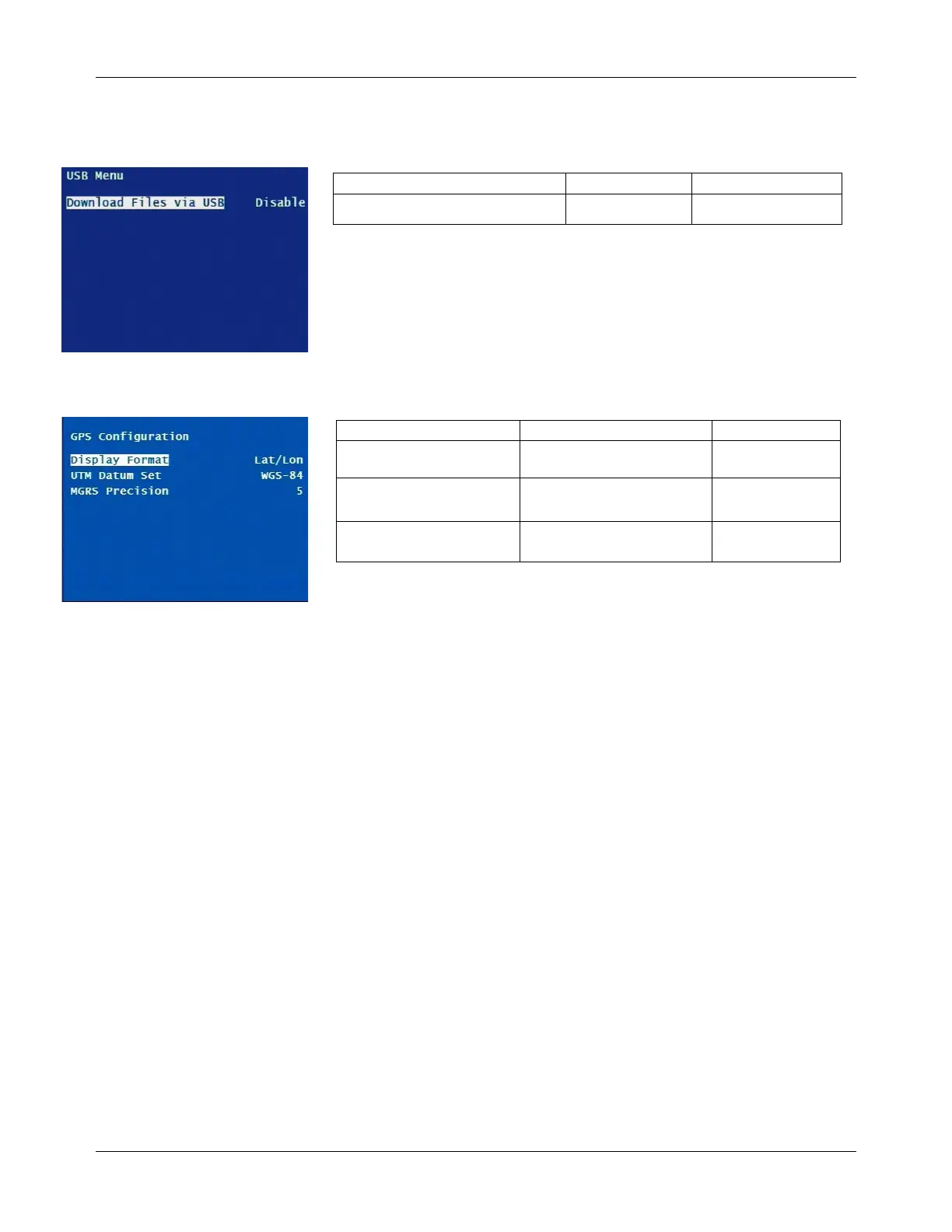
USB Menu
Download Files via USB
When this setting is enabled, files can be downloaded directly from the
DVM by accessing the Download from USB Port on the Main Menu.
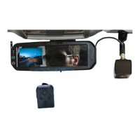
GPS Configuration
Display Format Lat/Lon, MGRS Lat/Lon
UTM Datum Set WGS-84, WGS-72 WGS-84
MGRS Precision 2, 3, 4, 5 5
Display Format
Lat/Lon is the standard latitude & longitude reading of the GPS
coordinates. MGRS (Military Grid reference system) is a military-style
mapping system that uses the UTM grid designation.
UTM Datum Set
The UTM (Universal Transmercator system) datum set is the
mathematical model for the shape of the Earth. This model is used to
determine a location of an object within a UTM grid, based on its
latitude and longitude.
MGRS Precision
MGRS (Military Grid reference system)
precision defines the length of
the grid elements that compose the world map. The length of the grid
elements can be defined by choosing one of the following four
numbers: 5 = 1 Meter, 4 = 10 Meters, 3 = 100 Meters, 2 = 1000
Meters.
Download Files via USB Enable, Disable Disable