6
©
2023 DJI All Rights Reserved.
General Information and System Description
Introduction
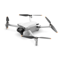
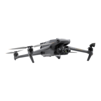
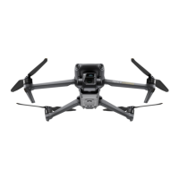
The Agras T50 aircraft has an anti-torsion structure, offering reliable operations. The Agras
T25 aircraft has a truss-style design with arms that can be folded to reduce the body size,
making the aircraft easier to transport. The integrated spraying system can be swapped with a
spreading system. The spreading payload of the T50 has increased to 50 kg for more efficient
spreading.
The aircraft is equipped with the phased array radar system and binocular vision system.
The systems provide multidirectional obstacle sensing
[1]
as well as terrain follow and bypass
functions to ensure flight safety. Boasting an ultra HD FPV camera with tiltable gimbal, the
aircraft can automatically collect HD field images for local offline reconstruction to assist in
precise field planning. Using DJI SmartFarm platform and DJI MAVIC
TM
3M, prescription maps can
be generated in order to perform variable rate fertilization.
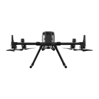
The spraying system is equipped with the magnetic drive impeller pumps, dual atomizing
sprinklers, and solenoid valve. When used with the weight sensors, the spraying system
provides real-time liquid level detection and improves spraying efficiency while saving liquid
pesticide.
Core modules adopt potting technology and has a protection rating of IP67 (IEC 60529).
The DJI RC Plus (Agras) remote controller features DJI O3 Agras image transmission technology.
[2]
Operations are more convenient and accurate than ever before thanks to the revamped DJI Agras
app design and a wide range of buttons on the remote controller. With Mapping mode added to
the app, users can complete offline reconstructions and perform precise field planning without
the need of extra devices.
[1] The downward sensing system is used to assist in Terrain Follow, while the sensing function on the other
sides is for obstacle sensing.
[2] The remote controller is able to reach its maximum transmission distance (FCC/NCC: 7 km (4.35 mi); SRRC:
5 km (3.11 mi); CE/KCC/MIC: 4 km (2.49 mi)) in an open area with no electromagnetic interference, and at
an altitude of approximately 2.5 m (8.2 ft).
 Loading...