Do you have a question about the dji MATRICE 30 Series and is the answer not in the manual?
Conditions for safe operation, including weather and terrain considerations.
Details on the aircraft's vision and infrared sensing systems for obstacle avoidance.
Information on how the aircraft detects and avoids obstacles.
Procedures and modes for the aircraft's automatic return-to-home function.
Initiating and controlling the Smart Return-to-Home feature.
Automatic return-to-home triggered by low battery levels.
Return-to-home triggered by loss of remote controller signal.
Automated safeguards to ensure safe landing procedures.
Overview of DJI's system for managing flight restrictions and airspace safety.
Definitions and types of restricted flight areas managed by the GEO system.
Specific rules and scenarios for flying within different GEO Zones.
Procedures for requesting and obtaining permission to fly in restricted areas.
Limits on flight altitude and distance based on GNSS signal strength.
Emergency landing procedure when a motor fails during flight.
Essential checks to perform before each flight operation.
Overview of the aircraft's built-in RTK module for precise positioning.
Steps to activate or deactivate the RTK positioning function.
Instructions for setting up and using the D-RTK 2 mobile station.
Guidance on connecting to and using Network RTK services.
Configuration details for using custom Network RTK settings.
Initial setup process including powering on and activating the controller.
Procedures for charging the controller and monitoring its battery status.
Procedures for pairing the remote controller with the aircraft.
Selecting between Normal, Sport, and Function flight modes.
Operating the aircraft simultaneously with two remote controllers.
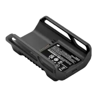
Instructions on how to operate and charge batteries with the station.
Key features and functionalities of the intelligent flight battery.
Feature for heating batteries in low-temperature environments.
Overview of the DJI Pilot 2 app's main screen and its sections.
Visualizing airspace restrictions and checking flyable altitudes.
Planning and executing automated flight missions.
Monitoring the health status of the aircraft and its components.
Interface for performing essential pre-flight checks before takeoff.
On-screen overlay of critical flight data for situational awareness.
Provides orientation, speed, and obstacle avoidance information.
Using the laser rangefinder to measure distance and altitude.
Steps to select and lock onto a target for automated tracking.
Procedures and controls for maintaining target tracking during flight.
Functionality for marking and managing specific points of interest.
Overview of automated mission flight capabilities and types.
Creating automated flight paths by defining waypoints on the map.
Recording flight paths and capturing data live for mission planning.
Checking current system health status and resolving detected errors.
Updating firmware for the aircraft and remote controller via DJI Pilot 2.
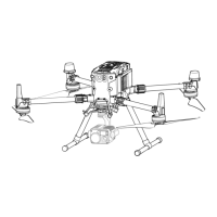
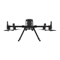
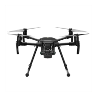
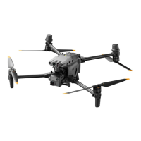
General technical specifications for the aircraft, including dimensions and weight.
| Max Flight Time | 41 minutes |
|---|---|
| Max Service Ceiling | 7000 m |
| Max Ascent Speed | 6 m/s |
| Max Descent Speed | 5 m/s |
| Ingress Protection Rating | IP55 |
| Max Speed | 23 m/s |
| Operating Temperature Range | -20°C to 50°C (-4°F to 122°F) |
| Operating Frequency | 2.400-2.4835 GHz, 5.725-5.850 GHz |
| Max Tilt Angle | 35° |
| GNSS | GPS, GLONASS, BeiDou, Galileo |
| Hovering Accuracy Range (P-mode with GPS) | ±0.5 m (Vertical), ±1.5 m (Horizontal) |
| Operating Temperature (Battery) | -20°C to 50°C (-4°F to 122°F) |
| Battery Charging Temperature | 5° to 40° C (41° to 104° F) |
| Transmission Range | 15 km |