DJI Mavic 3E/3T User Manual
77
©
2022 DJI All Rights Reserved.
1. Tap to perform the current task.
2. Tap to enter the Flight Route Editing. The edits will be merged into the original route
once saved.
3. Tap to enter the Set Waypoints page.
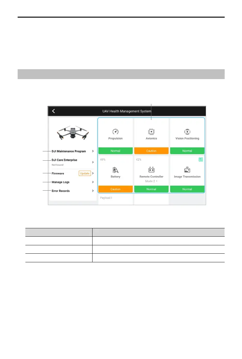
Health Management System (HMS)
The HMS system includes: DJI Maintenance Program, DJI Care Enterprise, Firmware Update,
Manage Logs, Error Records, and Error Diagnosis.
1
2
3
4
5
6
1. Error Diagnosis: for checking the current status of each aircraft module. Users can solve
issues by following the corresponding prompted instructions.
Color Status
Green Normal
Orange Caution
Red Warning
2. DJI Maintenance Program: users can view historical flight data and refer to the
maintenance manual to determine if maintenance is required.
3. DJI Care: relevant information can be viewed if the device is bound to DJI Care.
4. Firmware Update: tap to enter the Firmware Update page.
5. Manage Logs: displays the remote controller and aircraft log data of recent flights. Users
can assist by exporting and saving the relevant logs locally or uploading them directly to
the DJI Support cloud to help DJI Support solve issues.
6. Error Records: records aircraft issues to determine if any serious problem has occurred
during usage. This helps users evaluate the stability of the aircraft and assist DJI Support
in conducting aftersales analysis.