Do you have a question about the Garmin DriveLuxe 50 and is the answer not in the manual?
Access Garmin services like software and map updates, and product registration.
Guide to using Garmin Express for device updates.
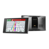
Identifies key hardware components of the DriveLuxe 50 device.
Instructions for powering the device using the vehicle power cable.
Steps to power the device on, off, or enter power saving mode.
Process of the device obtaining satellite data for location services.
Explains the meaning of various icons displayed in the device's status bar.
Describes how to interact with the device using its on-screen controls.
How to control the audio volume for different device outputs.
Setting the device to adjust volume based on ambient noise levels.
Customizing volume levels for specific audio types like prompts or calls.
How to change the display brightness for optimal viewing.
Control over audible warnings for driving events and alerts.
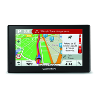
Information on device alerts for traffic enforcement cameras.
Understanding how the device calculates and displays routes.
Step-by-step guide to initiating navigation to a chosen destination.
Method to select a destination directly from the map interface.
Setting up and navigating to your predefined home location.
Procedures for updating the saved home address on the device.
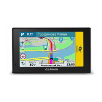
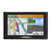
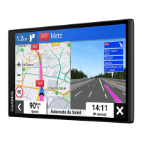
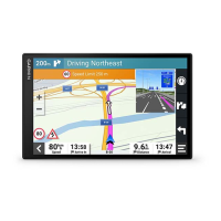
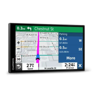
Explains the map display elements during active navigation.
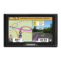
Visual prompts indicating the correct lane for upcoming maneuvers.
Accessing detailed turn-by-turn instructions for the route.
Displaying the complete planned route on the device's map.
Incorporating intermediate destinations into an active route.
Manually adjusting the route path to favor specific roads or areas.
Re-routing the device to bypass current road conditions or obstacles.
Procedures for ending an active navigation session.
Selecting preferences for route calculation, e.g., fastest time or shortest distance.
Tools for creating, saving, and managing multi-stop trips.
Step-by-step guide to creating a new trip with multiple destinations.
How to start navigation for a previously saved trip.
Automatically reordering trip destinations for route efficiency.
Modifying saved trip destinations and their sequence.
How to modify and save the current route as a trip for later use.
Adjusting route calculation settings specific to a saved trip.
Adding desired arrival times and stop durations to trip locations.
How the device predicts and offers potential routes based on history.
Setting preferences to avoid specific road features or conditions.
Utilizing traffic information to find routes that bypass congestion.
Setting the device to exclude toll roads from route calculations.
How to avoid areas identified with toll sticker requirements.
Excluding specific road characteristics like highways or ferries from routes.
Preventing routes through areas with environmental restrictions.
Defining personal preferences for roads or areas to avoid.
Configuring the device for direct point-to-point navigation without roads.
Using keywords to search for addresses, businesses, or points of interest.
Displaying search findings directly on the device's map interface.
Adjusting the geographical scope for location searches.
Information on locating useful places like restaurants or fuel stations.
Browsing and selecting locations based on predefined categories.
Utilizing quick search lists for faster location selection within categories.
Finding specific locations inside larger venues like shopping malls.
Viewing all available points of interest within a selected venue.
Overview of Foursquare integration for social location services.
How to find Foursquare locations using the device's search.
Linking the device to a personal Foursquare account.
Accessing comprehensive information for Foursquare locations.
Automatically saving the last known parking location.
Displaying detailed data about the device's current GPS position.
Locating essential services like hospitals, police, and fuel stations.
Generating directions for others to reach your current position.
Creating quick access icons for frequently used menu items.
Deleting previously created shortcuts from the menu.
Methods for saving frequently visited or important locations.
Step-by-step guide to saving a specific searched location.
How to save the device's present GPS coordinates.
Modifying the details of saved favorite locations.
Organizing saved locations using custom category assignments.
Removing saved favorite locations from the device.
Quick access functions available directly from the map view.
How to display and interact with specific map tools.
Customizing the selection of tools available in the map tools menu.
Displaying points of interest, exits, or cities along the current route.
Selecting which types of locations appear in the Up Ahead display.
Finding and viewing details about traffic events on the map.
Adjusting the overall appearance and content of the map display.
Selecting specific map elements like POIs or road conditions to display.
Modifying the information shown in data fields on the map screen.
Switching between 2D (Track Up, North Up) and 3D map views.
How the device obtains traffic information via its built-in receiver.
Obtaining traffic information through the Smartphone Link mobile application.
Details on purchasing and managing subscriptions for traffic services.
Checking the status and details of active traffic data subscriptions.
Steps to purchase or renew a traffic data subscription.
Activating or deactivating the display of traffic information on the device.
Configuring a custom phrase to activate the voice command system.
Initiating the voice command interface by speaking the wake-up phrase.
Recommendations for improving the accuracy and effectiveness of voice commands.
Navigating to destinations by using voice commands.
Disabling voice prompts for voice command features.
An alternative voice interaction method for specific regions or devices.
Setting up Voice Control by recording user-specific voice commands.
Operating the device using previously configured voice control commands.
Additional tips for optimizing the performance of voice control features.
Explaining the icons that indicate the status of Bluetooth connections.
Configuring Bluetooth connectivity and features on Apple devices.
Steps for establishing a connection between the device and Smartphone Link on Apple.
Turning off the hands-free calling feature while maintaining other connections.
Turning off data and notification services from Smartphone Link on Apple devices.
Filtering which types of notifications are displayed from an Apple device.
Configuring Bluetooth connectivity and features on Android devices.
Steps for establishing a connection between the device and Smartphone Link on Android.
Turning off specific Bluetooth features on Android devices.
Filtering which types of notifications are displayed from an Android device.
Instructions on how to obtain and install the Smartphone Link application.
Transferring destination information from a smartphone to the navigation device.
Overview of subscription-based real-time data services provided by Garmin.
Steps to sign up for and activate Garmin Live Services.
How to view incoming smartphone notifications on the navigation device.
Configuration and process for receiving smartphone notifications on the device.
How to access and view a list of all received smartphone notifications.
Functionality for making and receiving phone calls via Bluetooth.
Detailed steps for initiating a phone call from the device.
Method for manually entering and dialing a phone number.
How to call contacts stored in the device's phone book.
Option to call a point of interest directly from the device.
How to handle incoming calls, including answering or ignoring them.
Accessing and reviewing the history of recent phone calls.
Features available during an active call, such as mute or dial pad.
Setting a specific phone number as "Home" for quick dialing.
Initiating a call to the previously saved home phone number.
Accessing the comprehensive owner's manual and help resources.
Using the search function within the help files to find specific information.
Checking current weather conditions and future forecasts for a location.
Retrieving weather information for locations other than the current one.
Displaying animated radar maps to track weather patterns.
Receiving and viewing notifications for severe weather events.
Accessing information about current road conditions and potential hazards.
Viewing live images from traffic cameras to monitor road conditions.
Marking specific traffic cameras for quick access later.
Accessing saved traffic cameras to check live conditions.
Reviewing past routes and locations visited by the device.
Adjusting map display options and the appearance of the vehicle icon on the map.
Activating or deactivating installed map products on the device.
Configuring preferences for route calculation, avoidances, and alerts.
Selecting the method for calculating routes, such as fastest time or shortest distance.
Manually setting a GPS location, useful for testing or indoor use.
Managing paired backup cameras and their operational settings.
Configuring paired Garmin babyCam cameras and their features.
Managing Bluetooth connections, pairing, and device visibility.
Turning off the device's Bluetooth wireless technology.
Adjusting screen brightness, timeout duration, and color modes.
Enabling traffic data and configuring traffic alert preferences.
Setting units of measurement and time format for the device.
Manually or automatically setting the device's current time.
Configuring language options for on-screen text, voice prompts, and keyboard input.
Setting up alerts for custom points of interest based on proximity.
Accessing device information and managing privacy-related features like position reporting.
Resetting device settings to their original factory defaults.
Technical details including operating and charging temperature ranges.
Information regarding the power sources the device can utilize.
Specifies the type of battery used in the device.
Lists the various types of power cables compatible with the device.
Instructions and methods for charging the device's internal battery.
General guidelines for maintaining the device and preventing damage.
Procedures for cleaning the exterior of the device safely.
Proper methods for cleaning the device's touch-sensitive display.
Recommendations for preventing the device from being stolen.
How to perform a hard reset if the device becomes unresponsive.
Step-by-step instructions for detaching the device and its accessories.
Procedure for separating the device from its magnetic mount.
Procedure for detaching the mount from the suction cup base.
Instructions for safely removing the suction cup from the windshield.
Guide for replacing the fuse in the vehicle power adapter.
Solutions for issues with the suction cup's adhesion to the windscreen.
Troubleshooting steps to resolve problems with GPS signal reception.
Solutions for the device failing to charge while connected to vehicle power.
Tips and settings adjustments to improve battery life and performance.
Troubleshooting common computer detection issues when connected via USB.
Resolving problems where the device is not recognized as a portable device by the computer.
Comprehensive steps for when the computer fails to detect the device at all.
Solutions for Bluetooth pairing and connection failures between the phone and device.
How to temporarily disable a paired Bluetooth device without removing it.
Procedure for removing a paired phone from the device's Bluetooth list.
Instructions for inserting and using a microSD card for additional storage.
Information on storing, organizing, and managing files on the device.
Details on purchasing and the capabilities of memory cards for the device.
Steps for establishing a USB connection between the device and a computer.
Guidance on moving files between a computer and the navigation device.
Proper procedures for safely detaching the device from a computer.
How to check the current strength and status of the GPS signal.
Information on acquiring new map products for the device.
Where to find and purchase optional accessories for the device.
| Display Resolution | 480 x 272 pixels |
|---|---|
| Battery Type | Rechargeable lithium-ion |
| Battery Life | Up to 1 hour |
| Lifetime Map Updates | Yes |
| Voice Command | Yes |
| Voice-activated Navigation | Yes |
| Bluetooth | Yes |
| Bluetooth Calling | Yes |
| Wi-Fi | No |
| Preloaded Maps | Yes |
| Display Size | 5.0 inches |
| Traffic Information | Yes |
| Smart Notifications | Yes |
| Dimensions | 5.5"W x 3.4"H x 0.6"D (13.9 x 8.6 x 1.5 cm) |