Do you have a question about the Garmin DRIVECAM 76 and is the answer not in the manual?
Provides a visual guide to the device's components and ports for initial setup.
Instructions for inserting the essential memory card and securely attaching the device.
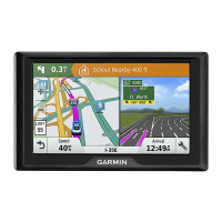
Covers turning the device on/off, acquiring GPS signals, and basic settings.
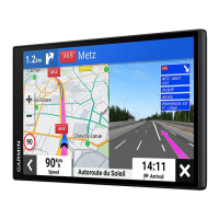
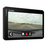
How to record, save, view, and manage dash cam video footage.
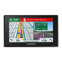
Explains driver alerts, collision warnings, and lane departure warnings.
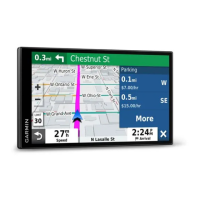
Methods for searching, saving, and navigating to addresses, POIs, and parking spots.
How to start, manage, and customize routes for optimal travel.
Using voice for navigation, calls, and connecting to a smartphone for live services.
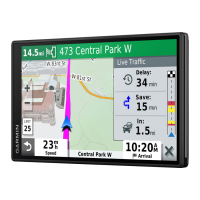
Customizing map views, traffic information, and display preferences.
Procedures for updating software, cleaning the device, and managing storage.
Solutions for video, connectivity, battery, and GPS signal problems.
| Auto | Yes |
|---|---|
| Marine (chartplotters, sounders) | No |
| Languages support | - |
| Map view options | 2D/3D |
| Lifetime map updates | Roads change, but with Lifetime Map Updates your map will always be up to date. Start fresh every few months by downloading a new edition of the industry's most accurate map. New editions are issued four times per year. |
| Display diagonal | 6.95 \ |
| Display resolution | 1024 x 600 pixels |
| Storage media type | Flash, Memory card |
| Compatible memory cards | MicroSD (TransFlash) |
| Included memory card size | 16 GB |
| Internal storage capacity | 32 GB |
| Hands-free calling | Keep your hands on wheel with Bluetooth™ Hands-free calling. After pairing your compatible Bluetooth mobile phone to your TomTom GPS, you’ll be able to see incoming call information, make and answer calls, and talk hands-free through your device. You’ll e |
| Form factor | Handheld/Fixed |
| Product color | Black |
| Power source type | AC, Battery |
| Battery life (max) | 0.3 h |
| Depth | 35 mm |
|---|---|
| Width | 177 mm |
| Height | 106 mm |
| Weight | 271 g |