Do you have a question about the Garmin GPS 76 and is the answer not in the manual?
Guide to registering your GPS 76 for product updates and support.
Important safety warnings and cautions for using the GPS 76 in a vehicle.
Statement regarding FCC compliance for the GPS 76 device.
Detailed overview of the GPS 76's hardware and software features.
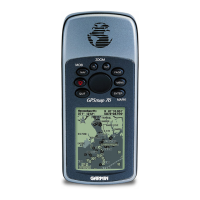
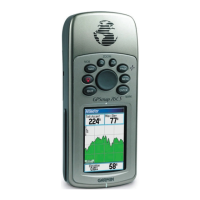
Highlights key physical features and components of the GPS 76 unit.
Instructions on how to properly install and replace batteries in the GPS 76.
Steps to attach the lanyard for secure carrying of the GPS 76 unit.
Explanation of the function and operation of each interface key.
Introduction to the five main display pages of the GPS 76.
Guide to using the simulator mode for practicing GPS functions.
Instructions on how to enter data, such as naming waypoints.
Fundamental steps and concepts for navigating with the GPS 76.
Process for initializing the GPS receiver for accurate positioning.
Steps to initialize the GPS receiver, essential for accurate positioning.
Details on the data displayed on the GPS Information Page.
Customizing the Map Page display, including zoom and data fields.
Explanation of the Pointer Page for straight-line course navigation.
Guide to using the Highway Page for road navigation.
Information on the Trip Computer functions and data fields.
Managing track logs, saving, clearing, and viewing saved tracks.
Finding, creating, editing, and managing points of interest and waypoints.
Creating, managing, and navigating routes using waypoints.
Setting up proximity alarms to alert when approaching specific areas.
Viewing Tides, Sun and Moon, and Hunt and Fish information.
Information on optimal hunting and fishing times based on location.
Configuring unit settings via tabs: General, Time, Units, Location, Alarms, Interface.
Detailed physical and performance specifications of the GPS 76.
Information on connecting power, data, and external devices.
Chart of UTC time offsets for various longitudinal zones.
List of available map datums for geographic positioning.
Glossary of terms used in GPS navigation and the manual.
Explanation of common messages displayed on the GPS 76 unit.
Explanation of the Loran TD system and its use with the GPS 76.
List and description of standard and optional accessories for the GPS 76.
Alphabetical index to help locate information within the manual.
Details of the limited warranty for the GARMIN GPS 76 product.
| Sport (fitness, running) | No |
|---|---|
| Marine (chartplotters, sounders) | Yes |
| Routes quantity | 50 |
| Tracks quantity | 10 |
| Number of waypoints | 500 |
| Form factor | Fixed |
| Product color | Gray |
| Interface | RS232, NMEA 0183, RTCM 104 |
| Channels quantity | 12 channels |
| GPS accuracy - position | 15 m |
| GPS accuracy - velocity | 0.05 m/s |
| Grayscale levels | 4 |
| Display resolution | 180 x 240 pixels |
| Battery type | AA |
| Battery life (max) | 16 h |
| Number of batteries supported | 2 |
| Sustainability certificates | RoHS |
| Operating temperature (T-T) | -15 - 70 °C |
| Depth | 30 mm |
|---|---|
| Width | 69 mm |
| Height | 157 mm |
| Weight | 218 g |