Do you have a question about the Garmin GPS 72H and is the answer not in the manual?
Explains how to interpret instructions and symbols used in the manual.
Provides useful tips and quick methods for operating the GPS device.
Encourages users to register their product for better support and updates.
Instructions for inserting and securing batteries in the GPS device.
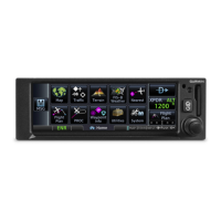
Explains buttons, rocker, and power functions for operating the device.
Covers attaching strap, acquiring signals, and adjusting backlight for initial use.
Guides on how to record, store, and navigate to waypoints.
Step-by-step instructions to save the device's current geographical position.
Provides recommendations for storing the device when not in use for extended periods.
Explains the specific actions and outcomes for each button press on the device.
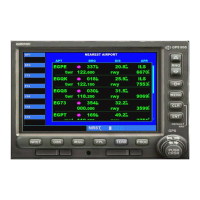
How to quickly find and navigate to a waypoint.
Explains the track log feature for recording travel paths.
Configuration options for setting up the track log recording.
Instructions for saving entire or partial recorded track logs.
Steps to display a saved track on the map screen.
How to use the TracBack feature to retrace a saved track.
Guide on creating a sequence of waypoints to form a route.
Instructions for following a pre-defined route.
How to modify existing routes, including changing names.
Displays speed, elevation, accuracy, and satellite status.
Visual representation of the user's location and surroundings.
Provides directional guidance with a compass display.
Aids navigation on straight courses by following road indicators.
Shows route progress, ETA, and leg information during navigation.
Steps to remove the current track log data from the device.
How to calculate distances between points on the map.
Customizing the information displayed on the map screen.
Hides data fields to maximize map display area.
Tool to measure distances between points on the map.
Allows customization of data field rows and text size.
Selects the type of data to display in the map's data fields.
Settings for map detail, orientation, and zoom level.
Settings for grids, labels, and MapSource customization.
Controls settings for waypoints, POIs, Navaids, and Exit options.
Zoom settings for track logs and text/zoom for city sizes.
On/Off settings for accuracy circle and heading line.
Provides directional guidance with a compass display.
Settings for data fields and changing data on the compass page.
Aids navigation on straight courses by following road indicators.
Settings for page layout and highway display features.
Shows route progress, ETA, and leg information during navigation.
Options for managing waypoints and planning routes.
Displays speed, elevation, accuracy, and satellite status.
Settings for simulator, orientation, elevation, and location.
Information on data fields related to trip calculations.
Options for resetting trip data, max speed, and odometer.
Options for managing track logs, including saving and deleting.
Information about creating and finding waypoints.
Search methods for waypoints like Find By Name or Nearest.
Options for managing routes, including copying and deleting.
Setting up proximity waypoints and alarms.
How to add waypoints to the proximity list and set alarm radii.
Options to view Sun and Moon or Hunt and Fish predictions.
Provides predicted best times for hunting and fishing.
Displays software version and unit ID number.
Settings for receiver mode, WAAS, backlight, beeper, and language.
Optimizes battery life at the cost of screen update speed.
Turns off the GPS receiver and simulates satellite reception.
Enables Wide Area Augmentation System for improved GPS accuracy.
Sets the duration the backlight remains active.
Configures beeper alerts for buttons and messages.
Settings related to time format, time zone, and daylight saving.
Allows customization of units for various data fields.
Settings for location format, map datum, north reference, and magnetic variation.
Selects the reference used for calculating heading information.
Displays and allows input for magnetic variation at the current location.
Alerts for boat drift and deviation from course.
Alerts for turns, destinations, and shallow depths.
Alerts when water depth exceeds a set threshold.
Communication settings between the GPS and other devices.
Communication with Garmin software and DGPS devices.
Data transmission and reception formats.
Shows GPS signal accuracy and direction to destination.
Shows direction from start to destination and water depth.
Shows distance and estimated time to destinations/waypoints.
Displays speed, average speed, trip timers, and off-course distance.
Current time and data for following routes.
Displays boat speed relative to water and water temperature.
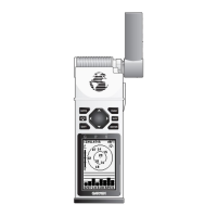
Lists installation hardware and steps for fixed mounting.
Instructions for mounting the device with a swivel base.
How to tilt and adjust the mounted GPS unit's angle.
Steps to secure the GPS unit into its mounted cradle.
How the device receives water speed and temperature data.
Guide for connecting the power and data cable to the device.
Supported data formats for connecting external devices.
Diagram and instructions for connecting to NMEA 0183 devices.
Instructions for connecting the GPS device to a computer via USB.
How to transfer data between the GPS and MapSource software.
Warnings, guidelines for battery usage, and tips to optimize life.
Instructions for safely cleaning the device's screen.
Procedure to reset the device by removing and reinstalling batteries.
Dimensions, weight, display, case, and temperature range.
Battery life, receiver details, acquisition times, update rate, accuracy.
Details on batteries, source voltage, and fuse.
GPS and DGPS accuracy ratings and conditions.
Supported interfaces and data storage life information.
Terms and conditions for using the device's embedded software.
Statement of compliance with relevant EU directives.
| Sport (fitness, running) | No |
|---|---|
| Marine (chartplotters, sounders) | Yes |
| Routes quantity | 50 |
| Tracks quantity | 10 |
| Map view options | 2D |
| Form factor | Fixed |
| Product color | Black |
| Display resolution | 120 x 160 pixels |
| Display size (HxV) (imperial) | 1.6 x 2.2 \ |
| USB 2.0 ports quantity | 1 |
| Battery type | AA |
| Battery life (max) | 18 h |
| Number of batteries supported | 2 |
| Sustainability certificates | RoHS |
| Depth | 30 mm |
|---|---|
| Width | 69 mm |
| Height | 157 mm |
| Weight | 218 g |