Do you have a question about the Garmin GPSMAP 76 and is the answer not in the manual?
Explains the manual's organization and purpose.
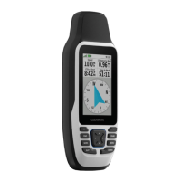
Overview of the GPSMAP 76 physical features and components.
Explains the functions of the device's interface buttons.
Step-by-step guide to powering the GPSMAP 76 on and off.
Steps to set up the GPS for initial use and satellite acquisition.
Methods to mark and save a location as a waypoint.
How to begin navigation to a waypoint or destination.
Details displayed on the GPS Information screen.
Describes basemap, MapSource data, and map display options.
Overview of Pointer and Highway pages for navigation guidance.
Accessing trip data and managing track logs.
Managing waypoints, routes, and proximity alerts.
Configuring unit settings like time, units, and alarms.
Technical specs, power connection, and device interfacing.
Explains satellite info, WAAS/DGPS, map datums, and navigation terms.
Covers accessories, FCC compliance, warranty, and safety.
| Sport (fitness, running) | No |
|---|---|
| Marine (chartplotters, sounders) | Yes |
| Routes quantity | 50 |
| Number of waypoints | 1000 |
| Form factor | Handheld |
| Product color | Silver |
| Grayscale levels | 4 |
| Display resolution | 180 x 240 pixels |
| RS-232 ports | 1 |
| Internal memory | 8 MB |
| Number of tracklog points | 10000 |
| Battery type | AA |
| Battery life (max) | 16 h |
| Number of batteries supported | 2 |
| Sustainability certificates | RoHS |
| Depth | 30 mm |
|---|---|
| Width | 69 mm |
| Height | 157 mm |
| Weight | 218 g |