Do you have a question about the Garmin GPSMAP 7400 and is the answer not in the manual?
Details device components, touchscreen use, buttons, shortcuts, and manual access.
Information on support, memory cards, GPS signals, and source selection.
Customizing home screen, favorites, and pages for user preference.
Creating, deleting, and customizing data overlays for combination pages.
Resetting station layouts, managing presets, vessel type, backlight, and color mode.
Customizing startup screen and managing automatic power on/off.
Connecting and using the app for device management, notifications, and updates.
Setting up Wi-Fi, connecting devices, managing channels and host.
Pairing and managing the wireless remote control with the chartplotter.
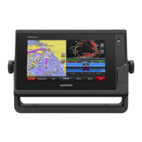
Overview of chart views including Navigation, 3D, Fishing, and Radar overlay.
Connecting wireless wind sensors and wearable devices for data integration.
Details on premium chart features like 3D views, satellite imagery, and fishing charts.
Navigating to points, measuring distance, and viewing chart information and symbols.
Understanding AIS, targeting symbols, and navigation aids for situational awareness.
Managing AIS/MARPA targets, collision alarms, and distress signals for safety.
Accessing chart menus for layers, Quickdraw, settings, and data overlays.
Customizing chart appearance by adjusting layers like vessel, user data, water, and range rings.
Configuring chart settings, Fish Eye 3D, and supported maps.
Features for creating, labeling, and mapping bodies of water with depth contours.
Accessing and sharing user-created contour maps via ActiveCaptain and Garmin Connect.
Fundamentals of navigation using Auto Guidance, Go To, Route To, and destination search.
Creating, editing, moving, and viewing waypoints, including SOS locations.
Procedures for stopping active navigation sessions on the chartplotter.
Creating, saving, editing, and navigating routes, including Auto Guidance paths.
Configuring Auto Guidance parameters like depth, clearance, and shoreline distance.
Recording, saving, editing, viewing, and navigating tracks on the chartplotter.
Creating, editing, linking, and setting alarms for boundaries.
Configuring sail settings, starting line guidance, and race timer for sailing.
Using autopilot for wind hold, tacking, gybing, and setting delays for sailing.
Setting and displaying heading lines and angle markers for navigation.
Introduction to sonar features, stopping transmission, and changing sonar views.
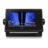
Overview of Traditional, ClearVü, SideVü, and Panoptix sonar views for underwater imaging.
Details on SideVü, Panoptix, LiveVü, and RealVü 3D sonar views for underwater imaging.
Exploring RealVü 3D Down/Historical and FrontVü sonar views for detailed imaging.
Configuring zoom, scroll speed, noise rejection, appearance, and alarms.
Configuring sonar alarms, advanced settings, transducer installation, and frequencies.
Adjusting Panoptix and LiveVü/FrontVü views, sweep speed, and depth alarms.
Understanding radar display, overlays, and alignment for situational awareness.
Managing radar transmission, timed transmit, no-transmit zones, and range settings.
Using guard zones, MARPA, and MotionScope for collision avoidance and target tracking.
Adjusting radar gain, clutter, echo trails, and display for optimal performance.
Manually adjusting gain, sea clutter, rain clutter, crosstalk, and accessing radar options.
Setting up and engaging the autopilot, including step increments, power saver, and shadow drive.
Using autopilot steering patterns like U-Turn, Circles, Zigzag, and Williamson Turn.
Managing DSC calls, contacts, distress calls, and man-overboard functions.
Viewing and customizing engine, fuel, and other gauges and graphs.
Setting up and making individual routine calls via VHF radio.
Configuring vessel settings like fuel capacity, speed sources, and vessel type.
Managing battery status and viewing tide, current, and celestial information.
Controlling media playback, selecting sources, and understanding icons.
Viewing, sorting, filtering, saving, and clearing warning messages.
Configuring VHF radio, DAB stations, and SiriusXM satellite radio and parental controls.
Requirements for SiriusXM weather, data broadcasts, and weather warnings.
Displaying and viewing various weather charts including precipitation, forecasts, and fronts.
Viewing sea conditions, fishing forecasts, visibility, buoy reports, and local weather.
Viewing video feeds from connected sources and alternating between multiple video inputs.
Configuring video appearance, camera controls, and PC display settings.
Configuring system settings, GPS, station information, power management, and simulator.
Setting user preferences like units, language, navigation, keyboard, and data sharing.
Configuring navigation settings, route labels, turn transitions, and auto guidance parameters.
Setting alarms for navigation, sonar, weather, fuel, and managing vessel settings.
Configuring vessel offset, other vessel settings, and synced network settings.
Sharing and managing user data, including copying, backing up, and restoring data.
Device registration, software updates, loading new software, and digital switching.
Troubleshooting common device issues like GPS acquisition and power problems.
Details on device physical dimensions, weight, power, and temperature ratings.
Details on NMEA 0183 and J1939 PGN information for data communication.
| Touchscreen | Yes |
|---|---|
| Water Rating | IPX7 |
| Waterproof | Yes |
| GPS Receiver | Yes |
| GPS | Yes |
| GLONASS | Yes |
| Chartplotter | Yes |
| Wi-Fi Connectivity | Yes |
| Bluetooth Connectivity | Yes |
| NMEA 2000 | Yes |
| Radar Support | Yes |
| Autopilot Support | Yes |
| Display Size | 7" |
| Display Resolution | 800 x 480 pixels |
| Mounting Options | flush |
| CHIRP Sonar | Yes (with compatible transducer) |
| CHIRP Scanning Sonar | Yes (with compatible transducer) |