Do you have a question about the Garmin GPSMAP 76Cx and is the answer not in the manual?
Explains the manual's organization, sections, and conventions for clarity.
Defines key terms like 'Warning' and 'Caution' for user safety and understanding.
Details potentially hazardous situations that could lead to injury or death, and property damage.
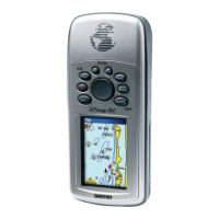
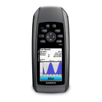
Identifies and describes the external components and features of the GPSMAP 76Cx unit.
Step-by-step guide for installing batteries, MicroSD card, and lanyard.
Explains the function of each keypad button and how to power the unit on/off.
Process for the GPS receiver to acquire satellite signals and establish current location.
How to create, edit, delete, and use waypoints for navigation and location marking.
Creating, saving, and navigating using track logs to record travel paths.
How to create, edit, and navigate multi-point routes for destinations.
Overview of the Find Menu for searching waypoints, cities, points of interest, and more.
Displays GPS satellite status, signal strength, and receiver location for optimal performance.
Shows travel statistics including speed, distance, time, and odometer readings.
Displays the map with cartographic data, navigation information, and customizable data fields.
Provides compass guidance, bearing pointers, and navigation data for destination tracking.
Access point for customizing device preferences and functionalities via the Setup Menu.
Configuring core device settings like GPS mode, battery type, language, and power options.
Customizing screen appearance, including brightness, timeout, and color schemes for day/night viewing.
Customizing how the unit calculates and guides routes, including road following and avoidance.
Setting the device's time, date, time zone, and measurement units for navigation.
Technical details, physical dimensions, weight, and environmental ratings of the GPSMAP 76Cx.
Instructions for connecting the GPSMAP 76Cx to a computer for data transfer.
Explanation of map datums and coordinate systems for accurate location referencing.
Explanations of all available data fields that can be displayed on the unit's pages.
Details of the product's warranty coverage, terms, and conditions for service.
| Auto | No |
|---|---|
| Marine (chartplotters, sounders) | Yes |
| Routes quantity | 50 |
| Tracks quantity | 20 |
| Number of waypoints | 10000 |
| Form factor | Handheld |
| Certification | RoHS |
| Interface | USB |
| GPS receiver | SiRFstarIII |
| RS-232 ports | 1 |
| Supported protocols | NMEA 0183 |
| Display resolution | 160 x 240 pixels |
| Display number of colors | 256 colors |
| Display size (HxV) (imperial) | 1.6 x 2.2 \ |
| Battery type | AA |
| Battery life (max) | 18 h |
| Number of batteries supported | 2 |
| GPS accuracy - position | 10 m |
| GPS accuracy - velocity | 0.05 m/s |
| Operating temperature (T-T) | -15 - 70 °C |
| Depth | 30 mm |
|---|---|
| Width | 69 mm |
| Height | 157 mm |
| Weight | 218 g |
