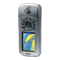
Do you have a question about the Garmin GPSMAP 76CSx and is the answer not in the manual?
Explains the structure and organization of the manual.
Defines terms and symbols used for warnings and cautions.
Outlines the terms and conditions for using the device software.
Instructions for registering the product online and recording the serial number.
Instructions for cleaning the case and screen of the GPSMAP 76CSx.
Guidance on storing the unit and its waterproof capabilities.
Guidance on adjusting the screen brightness for better visibility.
Defines key terms and conventions used throughout the manual.
Defines terms like Field, On-screen button, Scroll bar, and Default.
Explains how to use optional MapSource CD-ROMs and databases.
Introduces waypoints and methods for creating and managing them.
Describes creating waypoints from map points or coordinates.
Overview of the Find Menu for searching waypoints, cities, and points of interest.
Details how to view and use information for items found via the Find Menu.
How to find items near another item or by using the Find Menu.
How to locate saved waypoints from the Waypoints Page.
Information on creating custom points of interest using the Garmin POI Loader utility.
Covers clearing and setting up track logs for recording.
Screens for GPS signal status and travel data.
Screens for map display, compass guidance, and altitude data.
Access to device settings and features.
Options to control GPS receiver, display, and location settings.
How to add and configure data fields on the map screen.
Procedures for changing displayed data fields on the map.
Using optional map data and reviewing installed map information.
Adjusting map zoom level and orientation (North Up/Track Up).
Menu for customizing map display, including data fields and guidance text.
How to customize map display items using Setup Map.
Settings for general map display and track log visibility.
Settings for point visibility scale and text size.
Settings for downloaded maps and marine chart display.
Tool to measure distance between two map items.
Option to remove map clutter for better readability.
Explains compass operation, declutter, and restoring defaults.
How to turn on/off and use the electronic compass feature.
Configuring automatic compass activation based on speed and time.
Steps for calibrating the compass for accurate readings.
Menu for customizing compass display and navigation features.
Feature to set a course to a distant object using visual alignment.
Explains the function of course and bearing pointers for navigation.
How to show three or four data fields on the compass page.
How to customize the data displayed on the Altimeter Page.
Menu for customizing profile plots, zoom ranges, and calibration.
How to plot elevation or pressure changes over time or distance.
How to adjust zoom ranges for elevation, distance, or time plots.
Scrolling through elevation/pressure data for specific points on a profile.
Displaying the location of profile points on the map page.
Resets elevation and max elevation data fields.
Manually calibrating the altimeter using known elevation or pressure.
How to select and display various data fields on the Trip Computer page.
Options for resetting trip data, changing display, and restoring defaults.
Manages track logs, including setup, saving, and TracBack activation.
Creating and managing routes with waypoints.
How to use the Highway Page for navigation and access its options menu.
Options to restore defaults and view software version.
Customizes sound tones for unit alerts and beeps.
Find and record hidden items at geographic locations.
Defines marine alarm settings like anchor drag and water depth alarms.
Customizes measurement units for position, speed, distance, etc.
Settings for map datums and heading display.
Enters wind speeds and directions for jump calculations.
Fine-tunes aspects of a planned jump, like percentage max.
Allows margin of error for jumps, used in HAHO jump types.
Technical details of the GPSMAP 76CSx, including physical, performance, and accuracy data.
Instructions for setting up Loran TD from the Setup Menu.
Contact details for Garmin support and warranty service.
| Auto | No |
|---|---|
| Marine (chartplotters, sounders) | Yes |
| Routes quantity | 50 |
| Tracks quantity | 20 |
| Number of waypoints | 10000 |
| Interface | USB |
| GPS receiver | SiRFstarIII |
| RS-232 ports | 1 |
| Supported protocols | NMEA 0183 |
| GPS accuracy - position | 10 m |
| GPS accuracy - velocity | 0.05 m/s |
| Form factor | Handheld |
| Certification | RoHS |
| Display resolution | 160 x 240 pixels |
| Display number of colors | 256 colors |
| Display size (HxV) (imperial) | 1.6 x 2.2 \ |
| Battery type | AA |
| Battery life (max) | 10 h |
| Number of batteries supported | 2 |
| Operating temperature (T-T) | -15 - 70 °C |
| Depth | 30 mm |
|---|---|
| Width | 69 mm |
| Height | 157 mm |
| Weight | 218 g |
