Do you have a question about the Garmin GPSMAP 76S and is the answer not in the manual?
Provides critical safety warnings regarding product usage in vehicles and general operation.
Explains the process of initializing the GPS receiver for navigation and satellite acquisition.
Explains receiver status indicators like 'Acquiring Satellites', '2D/3D GPS Location', and 'GPS Off'.
Introduces the Map Page, its built-in basemap, and how to change the zoom scale for navigation.
Describes the Compass Page, its display elements, and how it uses the electronic compass or GPS for navigation.
Introduces the Highway Page for straight-line navigation, its data fields, and how to follow highway guidance.
Shows currently navigated waypoints and distance information for routes or 'Go To' navigation.
Explains the Trip Computer page with Horizontal and Vertical tabs showing trip data like odometer, speed, and ascent/descent.
Allows selection of Waypoints, Points of Interest, Cities, Exits, Addresses, and Intersections.
Explains methods for creating waypoints using ENTER/MARK, Map Page, or manual coordinate entry.
Details how to create waypoints on the Map Page or manually, and edit saved waypoints.
Details how to search for and view information about Points of Interest using MapSource data.
Describes how to find cities and select exit options, including services and rest areas.
Explains how to find and view address information and save addresses as waypoints.
Introduces routes as a series of waypoints for navigation and the unit's capacity for storing them.
Explains methods for creating new routes using the map or manually entering waypoints.
Explains how to plan a route by entering speed, fuel flow, departure time, and date.
Describes proximity waypoints used to alert users when approaching a predetermined area.
Introduces the Celestial menu for viewing Tides, Sun and Moon, and Hunt and Fish information.
Configures settings for receiver mode, WAAS, backlight timeout, beeper, and language.
Adjusts settings for Altimeter Auto Calibration, Pressure Units, and Barometer Mode.
Outlines the limited warranty terms, coverage, exclusions, and service procedures for the product.
| Sport (fitness, running) | No |
|---|---|
| Marine (chartplotters, sounders) | Yes |
| Routes quantity | 50 |
| Number of waypoints | 1000 |
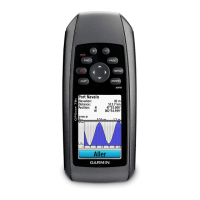
| Form factor | Handheld |
| Product color | Silver |
| Display resolution | 180 x 240 pixels |
| RS-232 ports | 1 |
| Internal memory | 24 MB |
| Number of tracklog points | 10000 |
| Battery type | AA |
| Battery life (max) | 16 h |
| Number of batteries supported | 2 |
| Sustainability certificates | RoHS |
| Depth | 30 mm |
|---|---|
| Width | 69 mm |
| Height | 157 mm |
| Weight | 218 g |
