Do you have a question about the Garmin GPSMAP 7600 Series and is the answer not in the manual?
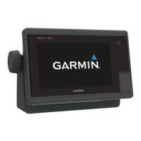
Details the location of various components and controls on the chartplotter.
Explains how to interact with the touchscreen for navigation and selection.
Describes the functions of various on-screen buttons available on the chartplotter.
Provides helpful tips and shortcuts for efficient chartplotter operation.
Instructions on how to lock the touchscreen to prevent accidental touches.
Guide on how to access the owner's manual directly from the chartplotter.
Instructions for downloading the latest owner's manual and translations from the web.
Details on where to find additional support, FAQs, and software updates.
Guide on how to insert and use memory cards for map data and storage.
Instructions on updating the device software via memory card or network.
Explanation of how the device acquires GPS signals and indicator status.
How to choose a preferred GPS data source if multiple are available.
How to customize the home screen layout and add items to favorites.
Guide to customizing page layouts, data overlays, and SmartMode layouts.
Instructions on how to customize the data shown in overlay boxes and bars.
How to restore factory default layouts for all stations on the chartplotter.
How to save, manage, and edit screen presets for different activities.
Explains Navigation Chart, Perspective 3D, Mariner's Eye 3D, Fish Eye 3D, and Fishing Chart.
How to zoom, pan, select maps, and measure distance on chart views.
Details common chart symbols and how to view object information.
Instructions for creating waypoints directly on a chart or 3D view.
How to navigate to a selected location or navaid on the chart.
Information on premium charts like BlueChart g2 Vision, Mariner's Eye 3D, and Fish Eye 3D.
How to instantly create maps with depth contours for any body of water.
Instructions for adding labels to mark hazards or points of interest on Quickdraw maps.
Configuration options for recording offset, display offset, and survey coloring.
Explanation of the various symbols used to represent AIS targets on the chart.
How to configure the display of AIS and MARPA vessels on charts.
Steps for activating, viewing information, and deactivating AIS targets.
How to set up a collision alarm for AIS and MARPA targets.
Guidance on navigating to a distress signal transmission received by the chartplotter.
Description of symbols indicating AIS distress signal transmissions.
How to enable or ignore test alerts from AIS emergency devices.
Instructions for disabling AIS functionality on the chartplotter.
Options for displaying and managing waypoints and tracks on charts.
How to configure the display of AIS and MARPA vessels on charts.
Settings for chart appearance, orientation, and detail levels.
Answers to common questions about navigation methods like Go To and Auto Guidance.
How to search for and select destinations by name or marine services.
Creating, editing, moving, and deleting waypoints, including SOS locations.
Steps for creating routes from the present location or saving them.
How to view, edit, browse, and delete saved routes.
Guide to plotting and following an Auto Guidance path to a destination.
Steps for creating and saving an Auto Guidance path.
How to adjust saved Auto Guidance paths and cancel calculations.
Settings for Preferred Depth, Vertical Clearance, and Shoreline Distance.
How to show, color, save, view, edit, and delete tracks.
Steps for browsing, following, and retracing recorded tracks.
Managing track log memory and configuring recording intervals.
How to create new boundaries or convert routes and tracks.
How to edit boundary appearance, set alarms, and delete boundaries.
Configuring vessel type for sailing and using sail racing features.
Using start line guidance and race timer for optimal race starts.
How to configure and display laylines for sailing races.
How to set the keel offset to compensate for depth measurements.
How to set up and engage wind hold for autopilot steering.
How to perform tacking and gybing maneuvers using the autopilot.
Using autopilot patterns like U-Turn, Circles, Zigzag, and Search.
Describes various sonar views like Traditional, SideVü, DownVü, and Panoptix.
Adjusting sonar view, transducer type, gain, color, and zoom settings.
Configuration for sonar settings, noise rejection, appearance, and alarms.
How to change radar modes, transmit signals, and stop transmission.
Adjusting radar range, setting up guard zones, and MotionScope technology.
Using radar overlay, echo trails, and adjusting gain, clutter, and appearance.
Explanation of symbols used for MARPA target acquisition and status.
How to assign, remove, and view information about MARPA-tagged objects.
How to view and customize a list of AIS and MARPA threats.
Using VRM and EBL to measure range and bearing to target objects.
Overview of the autopilot screen, engaging autopilot, and adjusting heading.
Using various autopilot steering patterns for maneuvers.
Connecting VHF radio for GPS position transfer and DSC calls.
Viewing, adding, editing, and deleting DSC contacts and position reports.
Setting up and making individual routine calls via VHF radio.
How to view, change data, customize layout, and set engine/fuel gauge limits.
Synchronizing fuel data and configuring sailing wind gauge settings.
Viewing trip gauges, graphs, and battery management details.
How to view tide, current, and celestial information for specific dates and stations.
Accessing almanac data like sunrise, sunset, and moon phases from charts.
How to open, select media sources, and play music.
Scanning channels, adjusting squelch, and tuning radio stations.
Tuning DAB stations and managing SiriusXM radio features and presets.
Overview of weather data broadcasts, charts, and subscription requirements.
How to view precipitation, storm cells, hurricanes, and forecasts.
Viewing sea conditions, wind data, and fishing location forecasts.
Checking visibility forecasts and viewing buoy station reports.
Instructions for enabling and configuring the weather overlay on charts.
Customizing overlay settings for precipitation, cloud cover, and visibility.
How to select and alternate between multiple video sources.
Using on-screen controls and gestures to control cameras.
Adjusting video aspect ratio, brightness, color, and contrast.
Settings for VIRB camera name, recording, photo, and video modes.
How to add VIRB action camera controls to other chartplotter screens.
Viewing and controlling VIRB action camera video playback on the chartplotter.
Adjusting display, GPS, system information, and station settings.
Customizing units, language, navigation, and screenshot capture.
Configuring route labels, turn transitions, and Auto Guidance parameters.
Setting parameters like Preferred Depth, Vertical Clearance, and Shoreline Distance.
Configuring NMEA ports, output sentences, and device connections.
Sharing data between compatible Garmin devices on the network.
Configuring navigation, system, sonar, weather, and fuel alarms.
Setting vessel type, depth/anchoring, temperature offset, and fuel capacity.
Setting up and connecting to a Wi-Fi network for wireless device communication.
Pairing and connecting devices like quatix watches and Nautix devices.
Pairing, using, and managing the wireless remote control.
Transferring waypoints, routes, tracks, and maps to/from memory cards.
Steps for backing up system information and restoring data.
Information on how to register your device for support.
Instructions for safely cleaning the chartplotter screen.
How to view image files stored on a memory card.
How to capture screen images and transfer them to a computer.
Steps to resolve problems with the device not acquiring GPS signals.
Troubleshooting steps for when the device will not turn on or keeps turning off.
Guidance on resolving issues with waypoints not being created in the correct location.
Reference for NMEA 2000 PGNs and NMEA 0183 sentences.
