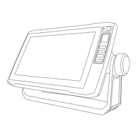
Do you have a question about the Garmin ECHOMAP UHD2 73cv and is the answer not in the manual?
Provides a step-by-step guide to connect a mobile device to the ECHOMAP UHD2 and set up the ActiveCaptain app.
Explains how to download and install software and chart updates for the chartplotter using the ActiveCaptain mobile application.
Guides users through setting up the chartplotter's Wi-Fi network, managing hosts, and changing channels for optimal connectivity.
Explains how to wirelessly connect two ECHOMAP UHD2 devices to share user data and sonar information between them.
Provides steps to diagnose and resolve common problems encountered when trying to establish a wireless connection between devices.
Guides users on viewing information about map features, navaids, and setting up navigation to points on the chart.
Guides users on creating custom depth contour maps and adding labels to mark points of interest or hazards.
Covers accessing the Quickdraw Community via ActiveCaptain or Garmin Connect, downloading, and sharing contour maps.
Details sharing and downloading Quickdraw maps using the Garmin Connect website for devices without Wi-Fi.
Covers searching for destinations, using the Navigation chart, finding marine services, and initiating/stopping navigation.
Details waypoint creation, editing, listing, marking MOB, and projecting waypoints for various navigation needs.
Explains how to move, navigate to, and delete individual or all waypoints from the chartplotter.
Covers route creation, navigation, editing, and viewing lists of routes and Auto Guidance paths.
Details finding, navigating, and deleting saved routes, including parallel navigation and search patterns.
Introduces Auto Guidance and provides instructions for setting and following calculated navigation paths.
Explains creating, saving, adjusting, canceling Auto Guidance paths, and setting timed arrivals for specific points.
Explains how to configure parameters like Preferred Depth, Vertical Clearance, and Shoreline Distance for Auto Guidance path calculations.
Details saving, editing, viewing, navigating, and deleting saved tracks, including saving tracks as routes.
Describes the Garmin ClearVü sonar view for detailed structure imaging and the Flasher view for target strength indication.
Covers selecting transducers, sonar sources, renaming sources, creating waypoints on sonar screens, and pausing the display.
Covers sonar alarms, advanced settings like bottom search limit, and transducer installation configurations.

