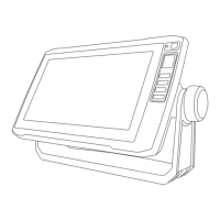
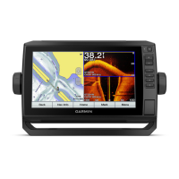
Do you have a question about the Garmin ECHOMAP Ultra 126sv and is the answer not in the manual?
Setting up collision avoidance alarms using AIS.
Handling distress signals and AIS aids to navigation.
Navigating using Go To, searching destinations, and marine services.
Creating, editing, moving, and navigating to waypoints.
Planning, saving, and following routes.
Calculating and following automated navigation paths.
Showing, saving, editing, and navigating recorded tracks.
Defining areas, alarms, and converting tracks/routes.
Overview of Traditional, ClearVü, SideVü, and Panoptix sonar views.
Specific views and settings for Panoptix transducers.
Overview, step increment, power saver, and heading source.
Activating autopilot and using steering patterns.
Using device for race starts, line guidance, and race timer.
Setting laylines, keel offset, and sailboat autopilot operation.
Wireless connection and screen controls for the trolling motor.
Adding contacts, viewing distress calls, and navigating to vessels.
Setting fuel level and safe-zone collision alarms.
Loading software onto a memory card and updating the device.
Resolving GPS, power, sonar, and waypoint problems.
| Display Size | 12" |
|---|---|
| Display Resolution | 1280 x 800 pixels |
| GPS Receiver | Yes |
| Routes | 100 |
| Wireless Connectivity | Yes |
| Water Rating | IPX7 |
| NMEA 0183 Input Ports | 1 |
| NMEA 0183 Output Ports | 1 |
| NMEA 2000 Compatible | Yes |
| Garmin Marine Network Ports | 2 |
| Sonar Recording | Yes |
| Track Log | 50, 000 points; 50 saved tracks |
| Power Input | 10-32 Vdc |
| Preloaded Maps | Yes, includes BlueChart g3 and LakeVü g3 maps |
| Waypoints | 5, 000 |
| Memory Card Slots | 2 microSD |
| Mounting Options | Bail or flush |
| Transmitter Power | 500 W (RMS) |
| Sonar Frequencies | Traditional: 50/77/83/200 kHz |
| BlueChart g3 Charts | Yes |
| LakeVü g3 Charts | Yes |
| Connectivity | Wi-Fi |
| Sonar | Yes |
