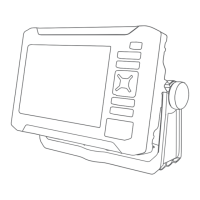
Do you have a question about the Garmin ECHOMAP UHD2 52cv and is the answer not in the manual?
Guides on creating and modifying multi-data display pages.
Step-by-step process for building custom chart pages.
Provides initial setup steps for connecting the mobile app to the device.
Details how to perform device software updates using the mobile app.
Explains how to download and transfer updated charts via the app.
Guides on configuring the device's wireless network for sharing.
Explains how to wirelessly connect two devices for data and sonar sharing.
Specifics on how sonar data is shared between connected devices.
Provides steps to resolve common wireless connection issues.
Step-by-step guide for setting a course to a destination on the chart.
Instructions for recording and saving depth contour data.
Introduces the core navigation functions of the chartplotter.
Guides on setting a direct course and how to stop navigation.
Instructions for repositioning waypoints and navigating to them.
Guides on creating, saving, editing, and navigating routes.
Instructions for finding and following saved routes.
Introduces the Auto Guidance feature for automated route planning.
Step-by-step guide to create and navigate an Auto Guidance path.
Guides on creating and saving custom Auto Guidance paths.
Sets parameters like preferred depth and vertical clearance for Auto Guidance.
Covers viewing, editing, saving tracks as routes, and navigating recorded tracks.
Details the ClearVü sonar view for a high-frequency, detailed image.
Guides on selecting transducer types, sources, and renaming them.
Overview of the sonar setup options for customization.
Reduces interference and clutter from noise sources on the sonar screen.
Sets alarms for shallow water, deep water, temperature, and fish detection.
Manages viewing, sorting, saving, and clearing device messages/alarms.
Configures system-wide settings, including sounds and display.
Covers GPS settings, software version, event log, and regulatory information.
Sets parameters like preferred depth and vertical clearance for Auto Guidance.
Covers alarm settings for navigation, system, and sonar.
Covers system alarms (clock, voltage, GPS accuracy) and sonar alarms.
Resets device settings to original factory defaults.
Covers importing/exporting waypoints, routes, and managing user data.
Guides on updating device maps using a memory card and computer.
Introduces ActiveCaptain and Garmin Express apps for device management.
Guides on installing the Garmin Express application on a computer.
Steps for registering the device using the Garmin Express app.
Guides on updating charts using the Garmin Express app.
Information on when and how to update device software.
Instructions for loading software updates onto a memory card.
Guides on installing software updates from a memory card.
Addresses common problems like GPS signal acquisition and device power.
Resolves issues with device power and waypoint location accuracy.
Provides contact information for customer support and assistance.
| Display Size | 5" |
|---|---|
| Display Resolution | 800 x 480 pixels |
| GPS | Yes |
| GPS Accuracy | Within 3 meters |
| Storage | MicroSD card slot |
| Water Rating | IPX7 |
| Weight | 1.2 lbs (0.54 kg) |
| Transmit Power | 500 W (RMS) |
| Waypoints | 5, 000 |
| Routes | 100 |
| Garmin Sonar Compatible | Yes |
| Supports AIS | No |
| Supports DSC | Yes |
| Display Type | Color |
| Sonar | CHIRP traditional |
| Mapping | Preloaded maps |
| Connectivity | Wi-Fi, NMEA 2000 |
| Sonar Frequencies Supported | 50/200 kHz |
| Mounting Options | Flush mount |
| Power Input | 10-32 V DC |
| Track Log | 50, 000 points |