Do you have a question about the Garmin ECHOMAP Ultra Series and is the answer not in the manual?
Initial setup and connection process for the ActiveCaptain app.
Configuring a collision alarm with a defined safe zone.
Step-by-step guide to creating custom contour maps.
Overview of the Auto Guidance feature for path planning.
Features designed to enhance sailboat racing performance.
General operation and safety guidelines for sailboat autopilot.
Overview of autopilot steering patterns for fishing and maneuvers.
Steps to wirelessly connect a remote control to the chartplotter.
Wireless connection setup for a Force trolling motor.
Overview of controlling the Power-Pole anchor system.
Overview of DSC functionality with VHF radio.
Resetting the device to factory default configurations.
Importing, exporting, and managing user data.
Common issues and their solutions.
| Wi-Fi | Yes |
|---|---|
| Bluetooth | Yes |
| Touchscreen | Yes |
| Water Rating | IPX7 |
| Power Input | 10-32 Vdc |
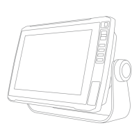
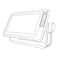
| Display Size | 10" or 12" |
| Display Resolution | 1280 x 800 pixels |
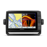
| Sonar | CHIRP traditional and ClearVü/SideVü |
| Preloaded Maps | BlueChart g3 and LakeVü g3 |
| Connectivity | NMEA 2000, NMEA 0183 |
| Mounting Options | Bail mount or flush mount |
| Memory Card Slot | microSD card slot |
| Dimensions | Varies by model |
| Weight | Varies by model |
| Transducer | Compatible with GT series transducers (included or optional depending on model) |