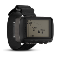
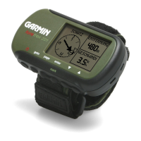
Do you have a question about the Garmin Foretrex 401 and is the answer not in the manual?
Explains button usage and text conventions for navigation.
Prompts users to register their product online for better support.
Provides contact details for product support in the USA and UK/Europe.
Directs users to the Garmin website for a list of available accessories and maps.
Details the functions of the power, page/goto, enter/mark, and up/down buttons.
Provides step-by-step instructions for installing batteries into the device.
Instructs users on how to turn the Foretrex device on for the first time.
Explains the process and conditions required to acquire GPS signals for location finding.
Details how to use and adjust the device's backlight for visibility.
Explains how to view the map, clear track logs, and measure distances on the map page.
Describes how the compass page guides navigation with a bearing pointer and how to calibrate it.
Explains the elevation page, its zoom function, and how to calibrate the barometric altimeter.
Describes the trip computer's display of speed, odometer, and other statistics, and how to customize data fields.
Explains how the main menu provides access to setup screens, waypoints, tracks, and routes.
Defines waypoints as recorded locations and explains how to mark and navigate to them.
Details how to edit waypoint names, symbols, and coordinates from the waypoint page.
Describes the hunting and fishing almanac feature for finding best dates and times.
Details the Sun and Moon page, showing sunrise, sunset, and moon phase information.
Explains how the Foretrex records track logs while moving and how to save them.
Guides users on creating new routes by selecting waypoints and navigating them.
Explains options within the map menu for panning, clearing track logs, and measuring distances.
Details options within the compass menu, specifically calibration.
Outlines options for the elevation page, including plotting, zooming, and viewing data points.
Covers changing data fields and resetting trip data in the trip computer settings.
Lists options available from the main menu, such as creating waypoints and managing tracks/routes.
Lists and describes available data fields for the Foretrex device.
Details options for configuring the timer, including alerts and expiration behavior.
Guides users on setting the GPS mode, including options for indoor use.
Describes how the satellite page shows location, accuracy, and signal strength.
Explains the Sky View feature, which shows the location of satellites providing a signal.
Details how to pair the Foretrex 401 with wireless sensors like heart rate or cadence monitors.
Describes how to send and receive waypoints, routes, and tracks wirelessly with other Garmin devices.
Guides users on connecting the Foretrex to a computer via USB for data access.
Explains how to add waypoints, tracks, and routes to the device by pasting .gpx files from a computer.
Introduces the Jumpmaster accessory for skydivers and provides information on its use.
Advises on proper storage of the Foretrex to prevent damage from extreme temperatures.
Provides essential information about battery types (AAA) and handling precautions.
Offers suggestions to maximize battery performance and life, such as adjusting backlight and tones.
Describes how to perform a soft reset if the device becomes unresponsive, without losing data.
Explains how to clear all user history and entered information from the device.
Provides instructions for replacing the device's wristband.
Offers guidance on cleaning the device and its wristband using mild solutions.
Details the physical, performance, and accuracy specifications of the Foretrex device.
Outlines the terms and conditions of the software license agreement for using the device.
States the device's compliance with EU directives and directs users to the website for full details.
Explains the FCC compliance rules and conditions under which the device operates.
| Outdoor (hiking, trekking) | Yes |
|---|---|
| Marine (chartplotters, sounders) | No |
| Routes quantity | 20 |
| Tracks quantity | 10 |
| Number of waypoints | 500 |
| Form factor | Handheld |
| Display resolution | 100 x 64 pixels |
| Display number of colors | Monochrome |
| USB 2.0 ports quantity | 1 |
| Battery type | AAA |
| Battery life (max) | 17 h |
| Number of batteries supported | 2 |
| Sustainability certificates | RoHS |
| Depth | 23 mm |
|---|---|
| Width | 75 mm |
| Height | 43 mm |
| Weight | 87.3 g |

