Do you have a question about the Garmin GDU 37X and is the answer not in the manual?
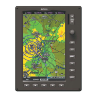
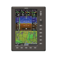
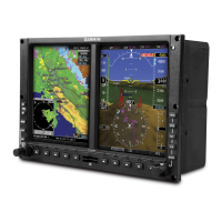
Details the physical controls and their functions on the GDU 37X unit.
Introduction to GPS navigation principles and map display features on the GDU 37X.
Explains how to use various map display options for situational awareness and navigation.
Overview of flight planning functions, including creating, storing, and activating flight plans.
Step-by-step guide on how to create active or stored flight plans using the GDU 37X.
Instructions on activating stored flight plans or individual flight plan legs.
Details on SiriusXM Weather and FIS-B weather information sources and their display.
Explains traffic sources (TIS-A, ADS-B) and how traffic data is displayed and managed.
Information on terrain and obstacle display, color codes, and alert settings for hazard avoidance.
Provides detailed taxiway, runway, and ramp information for airports, enhancing ground operations.
Steps for updating GDU 37X databases via the flyGarmin website and an SD card.
| Touchscreen | Yes |
|---|---|
| Operating Temperature | -20°C to +55°C |
| Display Resolution | 800 x 480 pixels |
| Interfaces | RS-232 |
| Connectivity | Bluetooth |
| Certification | TSO Certified |