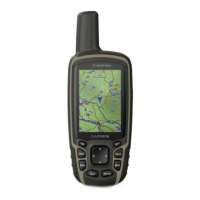
Do you have a question about the Garmin GPSMAP 65 and is the answer not in the manual?
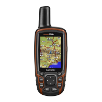
Details the physical components of the GPS device.
Provides important warnings and notices regarding battery usage and temperature.
Offers tips to extend the device's battery operational time, including battery save mode.
Instructions for storing the device when not in use for extended periods.
Step-by-step guide for installing AA batteries into the device.
Instructions for installing the optional NiMH battery pack.
Instructions on how to power on the GPS device.
Description of the function of each button on the device.
Steps to acquire satellite signals for accurate positioning.
Overview of the primary navigation pages like menu, map, compass, and elevation plot.
How to access the main menu from any page.
Information about the map display, orientation settings, and measuring distance.
Options for customizing map display and behavior, including auto zoom.
Covers compass use, calibration, course pointer, and Sight 'N Go navigation.
Customizing compass display, north reference, and pointer behavior.
Overview and settings for tracking trip data like speed and distance.
Information on elevation plots, settings, and altimeter calibration.
Restores settings for the current page to factory defaults.
Covers creating, projecting, navigating, editing, and deleting waypoints.
Covers creating, editing, viewing, deleting, and navigating routes.
Covers track settings, recording methods, and intervals.
Instructions for viewing, saving, clearing, deleting, and navigating tracks.
How to purchase maps and find addresses.
Information on geocaching, downloading caches, logging, and chirp features.
How to share waypoints, routes, tracks, and geocaches wirelessly.
How to set alarms for proximity to specific locations.
How to change device settings by selecting a profile.
How to calculate the size of an area by walking its perimeter.
Information on viewing satellite status and configuring GPS satellite settings.
How to group and manage adventure-related data using BaseCamp.
How to control a VIRB camera using the GPS device.
How to refine waypoint accuracy by averaging multiple readings.
How to customize the data fields displayed on each main page.
Steps to pair a compatible smartphone with the device via Bluetooth.
Explanation of features available when connected to a smartphone.
How to view and manage smartphone notifications on the device.
Overview of planning trips, cloud storage, and offline map access.
Using the device's alarm clock and calculator functions.
Utilizing features for predicting hunting times, timing laps, and tracking celestial events.
Accessing and configuring core system settings like satellite and language.
Configuring satellite systems (GPS, GLONASS, GALILEO, QZSS) and multi-band usage.
Configuring serial interface for data exchange with computers and NMEA devices.
Adjusting backlight timeout, battery save mode, colors, and menu style.
Managing Bluetooth connections, status, and notifications.
How to adjust screen backlighting to conserve battery life.
Customizing tones for messages, keys, turn warnings, and alarms.
Configuring marine chart modes, appearance, and alarm setups.
Options to reset trip data, waypoints, tracks, and restore default values.
Customizing the order of pages displayed on the device.
How to add or remove pages from the device's page sequence.
Modifying the main menu by moving, adding, or deleting items.
Customizing units for distance, speed, elevation, depth, and pressure.
Setting the time format and time zone for the device.
Configuring position format, map datum, and map spheroid.
Configuring auto calibration, barometer mode, pressure trending, and plot type.
Optimizing routes based on activity type and setting road lock.
Creating, editing, and deleting custom device profiles.
Installing Garmin Express for software/map updates and product registration.
Viewing electronic labels for regulatory and compliance information.
Instructions for attaching the carabiner clip and wrist strap.
Guidelines for maintaining and cleaning the device to prevent damage.
Information on storing files on the device and memory card.
List of supported file types for data storage on the device.
Instructions for installing a microSD memory card for additional storage.
Steps for connecting the device to a computer via USB for data transfer.
How to copy files from a computer to the device or memory card.
Instructions on how to safely delete files from the device's memory.
Procedure for safely disconnecting the device from a computer.
Technical specifications including battery type, water rating, and operating ranges.
Information on how to access support resources and product manuals.
How to turn on the device's backlight and its automatic activation.
Information on available optional accessories for the device.
Details on the ANT+ wireless temperature sensor and pairing.
Steps for pairing ANT+ wireless sensors like heart rate monitors.
Guidance for resolving common device issues, including restarting.
How to view unit ID, software version, and regulatory information.
How to reset all device settings back to factory defaults.
| Basemap | Yes |
|---|---|
| Purpose | Personal |
| Product color | Black |
| Pre-installed maps | TopoActive Europe; routable |
| Protection features | Waterproof |
| International Protection (IP) code | IPX7 |
| Display diagonal | 2.6 \ |
| Display resolution | 160 x 240 pixels |
| Display size (HxV) | 36 x 55 mm |
| Display technology | TFT |
| Display number of colors | 65536 colors |
| Routes quantity | 250 |
| Tracks quantity | 200 |
| Number of waypoints | 5000 |
| Compatible memory cards | MicroSD (TransFlash) |
| Built-in memory capacity | 16 GB |
| USB connector type | Mini-USB A |
| Battery life (max) | 16 h |
| Battery technology | Nickel-Metal Hydride (NiMH) |
| Number of batteries supported | 2 |
| Depth | 36 mm |
|---|---|
| Width | 61 mm |
| Height | 160 mm |
| Weight | 217 g |
