EasyManua.ls Logo

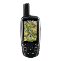
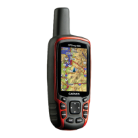
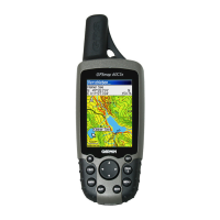
Garmin GPSMAP 62sc User Manual

Garmin GPSMAP 62sc
60 pages
To Next Page IconTo Next Page
Page #1 background imageLoading...
Page #1 background image
GPSMAP
®
62 series
owners manual
For use with the GPSMAP 62,
62s, 62st, 62sc, and 62stc

Table of Contents

Other manuals for Garmin GPSMAP 62sc

Questions and Answers:

Garmin GPSMAP 62sc Specifications

General IconGeneral
Outdoor (hiking, trekking)Yes
Marine (chartplotters, sounders)No
Routes quantity200
Number of waypoints2000
Form factorHandheld
Product colorBlack
InterfaceUSB, NMEA 0183
Internal memory3584 MB
Display diagonal2.6 \
Display resolution160 x 240 pixels
Display number of colors65536 colors
Display size (HxV) (imperial)2.15 x 1.43 \
USB 2.0 ports quantity1
Battery typeAA
Battery life (max)16 h
Battery technologyNickel-Metal Hydride (NiMH)
Number of batteries supported2
Megapixel5 MP
Weight and Dimensions IconWeight and Dimensions
Depth36 mm
Width61 mm
Height160 mm
Weight262.1 g

Summary

Getting Started

Initial Setup

Covers manual conventions, device overview, battery installation, power on/off, and satellite acquisition.

Device Buttons

Details the function of each physical button on the GPS device.

Navigating with Waypoints and Routes

Waypoints and Routes

How to create, edit, navigate, and delete waypoints and routes.

Additional Maps

Information on purchasing and using additional map data.

Tracks

Track Management

Covers track log recording, viewing, saving, clearing, deleting, and navigation.

Using the Main Pages

Map and Measurement

Explains map display, orientation, measuring distance, and map setup options.

Compass and Altimeter

Details compass usage, calibration, Sight 'N Go, and elevation plot features.

Page and Menu Settings

Covers customizing data fields, restoring defaults, and opening the main menu.

Trip Computer

Overview and setup options for the trip computer.

Main Menu Features

Geocaching and Sharing

How to download and navigate geocaches, and share data wirelessly.

Alarms, Profiles, and Satellite

Setting alarms, managing profiles, and viewing satellite status.

Menu Tools and Utilities

Using tools like Calendar, Calculator, Stopwatch, and Hunt/Fish features.

Camera and Photos

Photo Operations

Taking, viewing, sorting, deleting, navigating, and transferring photos.

Customizing Your Device

Data Fields and System

Customizing data fields, system settings, display, and tones.

Navigation and Units

Configuring units, time, position formats, altimeter, routing, and profiles.

Appendix

Device Information

Registering device, updating software, viewing information, and contacting support.

Specifications and Operation

Technical specifications, battery life, backlight, and accessory usage.

Data Management and Troubleshooting

microSD card, USB connection, file transfer, cleaning, and troubleshooting.

Related product manuals