Do you have a question about the Garmin GPSMAP 60CSx and is the answer not in the manual?
Explains the manual's organization and purpose, guiding users on how to get the most out of the navigation system.
Defines terms like Warning and Caution used throughout the manual to indicate potential hazards.
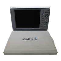
Identifies the key components, ports, and features of the GPSMAP 60CSx unit.
Provides a step-by-step guide for installing AA batteries into the GPSMAP 60CSx.
Explains the function of each button on the GPSMAP 60CSx keypad for user interaction.
Details the procedures for powering the GPSMAP 60CSx unit on and off.
Instructions on how to adjust the screen brightness for optimal visibility.
Steps required for the GPS receiver to acquire satellite signals and establish current location.
Explains basic interaction with the unit's interface, including terms and default settings.
Procedures for selecting menu options and inputting data using the unit's interface.
Explains the icons and information displayed in the status bar for unit features.
Describes how the unit displays important operational messages and provides remedies.
How to use and transfer map data from MapSource disks for enhanced GPS functionality.
Steps for installing, removing, and transferring data to/from a microSD card.
How to record, store, and manage location points (waypoints) for later return.
Method to create a new waypoint at the current GPS position.
How to create waypoints by selecting points directly on the map display.
Method to create waypoints by manually entering location coordinates.
How to modify existing waypoint details like name, location, and elevation.
Procedures for removing waypoints from the unit's memory.
Technique to improve waypoint location accuracy by averaging multiple readings.
Creating a new waypoint by specifying distance and bearing from a known point.
Setting up alarms to notify when approaching stored waypoint locations.
Creating a waypoint to quickly mark a location for immediate return.
How to search for waypoints, cities, and other points of interest.
Searching for specific locations by entering their names using an on-screen keypad.
Accessing a list of recently searched or visited locations.
Details and options available for an item selected from a Find list.
Searching for items relative to another selected item on the map.
Finding items by referencing a location on the map using the pointer.
How to locate saved waypoints from the Waypoints Page.
How to find and record geocache locations created or downloaded.
How to search for cities within the unit's mapping database.
How to find interstate exits and associated services nearby.
How to search for specific street addresses by entering number and name.
How to search for street intersections by entering street names.
How to find various Points of Interest (POI) like restaurants and landmarks.
Creating user-defined categories for points of interest using POI Loader utility.
How to create and use track logs for recording paths and navigation.
Configuring track log recording settings such as record method and interval.
Saving only a selected segment of the track log for later use.
Enabling the unit to save track logs directly to the microSD card.
How to measure the area enclosed by a recorded track.
Viewing elevation and path data for saved tracks.
Using the TracBack feature to retrace a saved track log.
How to create, save, and navigate custom routes to a destination.
Step-by-step guide to building a new route by adding waypoints.
Explains different navigation approaches to reach a destination.
How to initiate navigation for a saved route with turn-by-turn guidance.
Viewing upcoming turns and guidance information for an active route.
How to modify existing routes, including names and route points.
Procedures for removing saved routes from the unit.
Setting how the unit transitions between route points when off-road.
Various settings and actions for managing saved routes.
Shows GPS receiver status, satellite locations, and signal strength.
Displays travel data like current speed, average speed, and trip odometer.
Shows the geographical map, operating modes, and allows data field configuration.
How to add and configure data fields on the Map Page for navigation information.
Provides directional guidance and navigation data with a compass display.
Indicates the direction to your destination from your current location.
Indicates your course of travel and distance you drift off course.
Displays current elevation, rate of ascent/descent, and pressure data.
Access point to system settings, games, and other unit features.
How to configure settings for the Satellite Page, such as GPS On/Off.
Customizing which data fields are shown on the Map Page.
How optional MapSource data enhances map versatility and information.
Adjusting map zoom levels for greater detail or a wider overview.
Setting map display to North Up or Track Up.
Customizing the Map Page display and available functions.
Displaying navigation prompts and messages for destinations.
Customizing map display settings like orientation, detail, and zoom.
Settings related to saving and displaying track logs on the map.
Settings for controlling the display of map points, labels, and land cover.
Adjusting text size for map item descriptions.
Viewing details about downloaded maps and their availability.
Customizing settings for marine charts, colors, and symbols.
How to measure the distance between two points on the map.
Removing map items to improve clarity when zoomed out.
Resetting map settings to their factory default configuration.
How to use and manage the unit's electronic compass for accurate headings.
Procedures to enable or disable the electronic compass to conserve battery.
Steps to calibrate the compass for accurate directional readings.
Customizing the Compass Page display and available features.
Navigating to a visible object by pointing the unit at it.
Step-by-step guide for using the Sight 'N Go navigation feature.
Procedures to end an active navigation session.
Explains the function of course and bearing pointers for navigation guidance.
How to display data fields on the Compass Page.
Steps to configure the number of data fields displayed on the Compass Page.
Customizing the type of data displayed in the fields on the Compass Page.
Resetting Compass Page data fields to their factory default settings.
Displays current elevation, rate of ascent/descent, and pressure data.
Customizing settings and views for the Altimeter Page.
Plotting elevation or pressure changes over time or distance.
Displaying graphical plots of elevation or pressure data.
Adjusting zoom levels for plots displayed on the Altimeter Page.
Scrolling through profiles to view data for specific points.
Displaying profile points on the map interface.
Resetting elevation and other data fields on the Altimeter Page.
Steps to manually calibrate the altimeter for improved accuracy.
Customizing the data fields displayed on the Altimeter Page.
Displays detailed travel statistics useful for navigation.
Options for customizing the Trip Computer Page display.
Managing track logs, setup, and the TracBack feature.
Settings for track log recording methods, intervals, and appearance.
Creating, saving, and managing routes.
Displays route guidance with highway graphics and data fields.
Using the Highway Page for route guidance during navigation.
Access point to customize various unit settings and preferences.
Configuring GPS, WAAS, battery type, language, and alarms.
Options for restoring defaults and checking software version.
Customizing screen colors, backlight timeout, and brightness.
Configuring data formats for connecting to external devices.
Enabling the unit for use as a USB storage device for file transfer.
Steps to connect the unit to a computer for mass storage access.
How to copy files to the microSD card from a computer.
Customizing sound tones for various unit features.
Changing the order of main pages or adding new ones.
Customizing how the unit calculates and displays routes.
Settings for route calculation methods and avoidance preferences.
Finding and recording geocache locations.
Defining alarm settings for marine use.
Setting time format, zone, and daylight saving.
Customizing measurement units for various parameters.
Specifying heading display and North reference type.
Calibrating compass and altimeter for improved accuracy.
Configuring the altimeter for self-calibration, barometer, or manual calibration.
Adding a custom message that appears upon unit startup.
Setup for the Jumpmaster accessory for skydivers.
Entering wind speed and direction data for Jumpmaster calculations.
Fine-tuning parameters for planned jumps in Jumpmaster.
Setting aircraft direction and magnitude for jumps.
Viewing sunrise/sunset, moon phases, and hunt/fish probabilities.
Using the unit as a standard or scientific calculator.
Using the unit as a stopwatch with lap timing capabilities.
Displaying sun and moon positions and times for a given date and location.
Viewing predicted best times for hunting and fishing.
Access to built-in games like Memory Race and Virtua Maze.
Description and gameplay of the Virtua Maze GPS game.
Description and gameplay of the GekoSmak GPS game.
Description of the Beast Hunt game requiring navigation skills.
Instructions on how to play the Beast Hunt game.
Detailed physical, performance, and power specifications of the unit.
Supported connection formats and sentences for external devices.
Brief definitions of various data fields available on the unit.
List and description of optional accessories for the GPSMAP 60CSx.
Instructions for connecting the unit to a computer via USB or serial port.
Explanation of the Wide Area Augmentation System and its function for GPS accuracy.
How to configure Loran TD settings within the unit.
Explains map datums and coordinate system formats for accurate navigation.
Compliance information regarding FCC regulations for Class B digital devices.
Details of the product's warranty terms and conditions.
Company contact and support information for Garmin.
Policies regarding warranty and support for online auction purchases.
Warranty and service policies for international purchases.
| Outdoor (hiking, trekking) | Yes |
|---|---|
| Marine (chartplotters, sounders) | No |
| Routes quantity | 50 |
| Number of waypoints | 1000 |
| Interface | USB |
| Display resolution | 160 x 240 pixels |
| Display number of colors | 262144 colors |
| Display size (HxV) (imperial) | 1.5 x 2.2 \ |
| Battery type | AA |
| Battery life (max) | 18 h |
| Weight | 213 g |
|---|