EasyManua.ls Logo

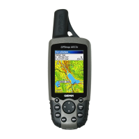
Garmin GPSMAP 60C User Manual

Garmin GPSMAP 60C
92 pages
To Next Page IconTo Next Page
Page #1 background imageLoading...
Page #1 background image
color map navigator
owner’s manual
GPSMAP
®
60C
GPSmap 60C Front Cover.Indd 1 12/19/2003, 9:45:54 AM
Question and Answer IconNeed help?

Do you have a question about the Garmin GPSMAP 60C and is the answer not in the manual?

Garmin GPSMAP 60C Specifications

General IconGeneral
BrandGarmin
ModelGPSMAP 60C
CategoryGPS
LanguageEnglish

Summary

Preface and Introduction

GPS Navigation Functions

Explains core navigation features and how to use them.

Installing the Batteries

Key Functions of the Device

Device Navigation and Control Keys

Describes POWER, ROCKER, PAGE, MENU, ENTER, FIND, MARK, IN/OUT keys for operation.

Unit Features and Components

Initialization and Satellite Acquisition

Starting Up the GPS Receiver

Explains the initialization process and satellite acquisition.

GPS Initialization Procedure

Step-by-step guide for unit initialization.

Navigating with GPSmap 60C

Navigation Methods Explained

Describes Go To, Track, and Route navigation methods.

Main Page Sequence and Access

The Map Page

Using the Map Page

Primary navigation feature displaying map, location, and routes.

Map Page Features and Controls

Map Zoom and Pan Functionality

Explains zoom, pan, accuracy circle, and map scale.

Map Data Display Elements

Discusses data fields, map items, and guidance text.

Map Page Options and Customization

Map Page Options Menu Overview

Lists options for customizing map display and navigation.

Map Page Option Functionality

Brief descriptions of menu options like Stop Navigation, Data Fields.

Map Page Data and Setup Options

Managing Map Data Fields

How to select and modify data fields displayed on the map.

Configuring Map Display Settings

Accessing map setup options for customization.

Map Page Guidance and Setup

Guidance Text Display Options

Options for showing navigation guidance messages on the map.

Map Page Utilities

Measuring Distance and Decluttering Map

Features for measuring distance and managing map clutter.

The Compass Page

Using the Compass Page for Navigation

Explains compass display, bearing pointers, and navigation guidance.

Compass Page Options and Settings

Compass Page Navigation Options

Details options like Stop Navigation, Course Pointer, and Data Fields.

The Trip Computer Page

Trip Computer Data and Usage

Displays travel data like speed, distance, and time.

Trip Data Reset and Options

How to reset trip data and other management options.

Using Waypoints

Marking Current Location as Waypoint

How to mark and record current or other locations as waypoints.

Waypoint Creation Methods

Creating Waypoints from Map Items

Marking map items as waypoints.

Man Overboard (MOB) Waypoint Creation

Using the Man Overboard feature for marking locations.

Waypoint Management

Editing and Deleting Waypoints

Modifying or removing saved waypoints.

Averaging Waypoint Location for Accuracy

Improving position accuracy by averaging waypoint locations.

Waypoint Manipulation

Moving Waypoints on the Map

Repositioning waypoints directly on the map display.

Projecting New Waypoints

Creating a new waypoint based on bearing and distance.

Using the Find Feature

Find Menu Overview and Categories

Introduction to searching for waypoints, cities, exits, and geocaches.

Searching by Name and Recent Finds

Methods for searching locations by name and recent history.

Find Feature Search Methods

Searching for Locations by Name

Detailed steps for using the 'Find By Name' search.

Find Item Information Page

Find Information Page Options

Additional Find Feature Options

Finding and Managing Waypoints

Searching and Viewing Waypoints

How to find and view saved waypoints.

Finding Geocaches

Finding Cities

Finding Interstate Exits

Finding Addresses

Finding Intersections

Finding Points of Interest

The Main Menu

Using Tracks

Creating a Track Log

Steps to record movement trails and save them.

Saving and Managing Tracks

Track Navigation with TracBack

Using Routes

Creating and Using Routes

Step-by-step guide for route creation and management.

Route Navigation Methods

Navigating Routes via Go To and Roadways

Describes Go To, point-to-point, and roadway navigation.

Navigating a Created Route

Previewing Route Turns

How to follow a created route and view turn information.

Route Options and Settings

Route Detail Page Management

The Highway Page

Navigating with the Highway Page

Visual guidance for route navigation.

The Setup Menu

Display Setup

Interface Setup

Tones and Page Sequence Setup

Map Setup and Configuration

General Map Setup Settings

Map orientation, zoom, detail, and display mode settings.

Map Setup Details

Map Setup Text, Information, and Marine

Routing Setup

Routing Setup Options

Customizing guidance methods and route calculation.
Geocache Setup

Marine Setup

Time and Units Setup

Heading and Welcome Page Setup

Proximity Waypoints

Calendar Features

Alarm Clock and Calculator

Stopwatch Operations

Connecting to a Computer

Downloading MapSource Map Data

Related product manuals