EasyManua.ls Logo

Garmin GPSMAP 620 User Manual

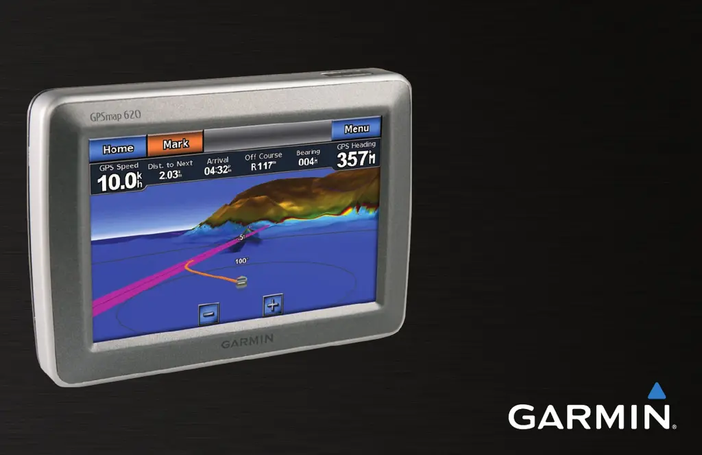
Garmin GPSMAP 620
72 pages
To Next Page IconTo Next Page
Page #1 background imageLoading...
Page #1 background image
GPSMAP
®
620
owners manual

Table of Contents

Other manuals for Garmin GPSMAP 620

Questions and Answers:

Garmin GPSMAP 620 Specifications

General IconGeneral
Sport (fitness, running)No
Marine (chartplotters, sounders)Yes
Maps included-
Map view options3D
Routes quantity50
Tracks quantity1000
Number of waypoints1500
Spoken street namesKeep your eyes on the road while your GPS announces turn-by-turn directions, including street and place names.
Form factorHandheld/Fixed
Product colorGray
Display diagonal5.2 \
Display resolution800 x 480 pixels
Display size (HxV) (imperial)4.5 x 2.7 \
Storage media typeSSD
Compatible memory cardsSD
Headphone outputs1
Power source typeBattery
Battery life (max)9 h
Supported radio bandsNot supported
Weight and Dimensions IconWeight and Dimensions
Depth48 mm
Width150 mm
Height102 mm
Weight490.4 g

Summary

Introduction to GPSMAP 620

Product Registration

Register your GPSMAP 620 online to receive better support and updates.

Contact Garmin Support

Find contact information for Garmin Product Support in the USA and UK.

Manual Conventions Explained

Understand how to interpret instructions and symbols used in the manual.

Getting Started with GPSMAP 620

Identifying GPSMAP 620 Features

Learn about the physical buttons and connectors on the GPSMAP 620 unit.

GPSMAP 620 Mounting Bracket Features

Identify the components of the marine and automotive mounting brackets.

Using the Mounting Bracket

Instructions on how to install and place the GPSMAP 620 in its mounts.

Powering the GPSMAP 620 On and Off

Guide on how to turn the GPSMAP 620 device on and off.

Battery Pack Management

Instructions for removing and inserting the rechargeable battery pack.

SD Card Installation and Removal

Steps for inserting and removing an SD card, preserving water resistance.

Marine Mode: Initial Setup

Mounting the GPSMAP 620 in Marine Mode

Install the marine mount and place the GPSMAP 620 in the bracket.

Configuring GPSMAP 620 for Marine Use

Initial setup prompts for marine mode operation.

Acquiring Satellite Signals

Steps to ensure the device can receive GPS satellite signals.

Using the Marine Mode Home Screen

Overview of the Home screen interface in marine mode.

Marine Mode: Navigation Basics

Navigating Directly to a Destination

How to select and navigate to a chosen destination on the chart.

Saving Your Current Location as a Waypoint

Mark your current position as a waypoint for future reference.

Marine Mode: Navigation Controls

Navigating to a Saved Location

Procedure to navigate to a previously saved waypoint.

Stopping Active Navigation

How to end a navigation session.

Adjusting Volume and Backlight

Control audio volume and screen brightness levels.

Marine Mode: Using Charts

Navigation Chart Overview

Using the main chart view for planning and navigation.

Zooming and Panning Charts

How to adjust the map scale and move around the chart view.

Interacting with Chart Objects

Accessing information about points of interest on the chart.

Advanced Chart Features

Accessing Additional Chart Information

View tide, current, celestial, and local service data.

Viewing Aerial Photos on Charts

Display aerial photos of marinas and landmarks with BlueChart g2 Vision.

BlueChart g2 Vision Features

Using Mariner's Eye 3D View

Experience a 3D perspective of the seabed and shore for navigation.

Using Fish Eye 3D View

View underwater depth contours and sea floor details.

Using Fishing Charts

Display detailed bottom contours and soundings for fishing.

Enabling High-Resolution Satellite Imagery

Overlaying Satellite Images on Charts

Configure satellite imagery for land, sea, or blended views.

Marine Mode: Navigating Your Course

Choosing a Destination with Where To?

Search for destinations using various categories and menus.

Setting and Following a Course

Options for setting a direct course or a multi-point route.

Direct Course Navigation

Setting a Direct Course (Go To)

Steps to set a direct path from current location to destination.

Following a Direct Course on Charts

Visualizing direct courses on Navigation, Mariner's Eye, or 3D screens.

Route Creation and Navigation

Creating a Route (Route To)

Build and save custom routes with multiple waypoints.

Following a Saved Route

Navigate using pre-saved routes on various chart views.

Automatic Course Guidance

Setting an Automatic Course (Guide To)

Use chart data to automatically suggest a passage.

Following an Automatic Course

Visualizing the suggested passage on different chart views.

Marine Mode: Destination Search

Searching for Marine Services

Find nearby fuel, repairs, and other marine facilities.

Searching for Waypoints and Saved Routes

Locate saved destinations and navigation paths.

Finding Places by Name or Track

Searching for Saved Tracks

Find and navigate saved recorded paths.

Searching for Destinations by Name

Use the search function to find specific locations by name.

Marine Mode: Waypoints and Tracks

Using Man Overboard (MOB) Waypoints

Mark an emergency MOB waypoint and navigate to it.

Marking Waypoints at Current Location

Create waypoints for your current position.

Managing Waypoints

Editing Waypoint Details

Modify names, symbols, and other attributes of waypoints.

Changing Waypoint Position

Move existing waypoints on the chart.

Deleting Waypoints

Remove waypoints and MOB markers from the device.

Managing Tracks

Saving the Active Track

Save your current recorded path.

Following and Navigating Saved Tracks

View and navigate along previously saved tracks.

Marine Mode: Using the Dashboard

Using the Compass Screen

Displaying heading, course, and speed information.

Following Courses on the Compass Screen

Use the compass display for navigation guidance.

Dashboard Data Screens

Using the Numbers Screen

View key navigation data numerically.

Using the Trip Screen

Monitor trip statistics like speed, distance, and time.

Resetting Trip Screen Information

Clear trip data to start a new log.

Marine Mode: Viewing Almanac Data

Viewing Tide Station Information

Access and interpret tide level data for stations.

Viewing Current Information

Access and interpret marine current data.

Viewing Celestial Information

Accessing Sunrise, Sunset, Moon Data

View almanac data for sun and moon rise/set times.

Marine Mode: Managing User Data

Transferring Data to/from SD Card

Move waypoints, routes, and tracks using an SD card.

Backing Up Data to a PC

Create a backup of your user data on a computer.

Data Management with MapSource

Copying or Merging MapSource Data

Transfer data between MapSource and GPSMAP 620 via SD card.

Connecting GPSMAP 620 Directly to PC

Transfer data using a USB cable connection.

Managing Information from Other Vessels

Viewing AIS Information

Display data for nearby AIS-equipped vessels.

Viewing DSC Information

View received DSC distress calls and position reports.

DSC Information Management

Interacting with DSC Information

Edit, navigate to, or create waypoints from DSC reports.

Deleting All Received DSC Information

Clear the list of all received DSC distress calls and reports.

Marine Mode: Advanced Configuration

Configuring System Settings

Adjust general unit settings like simulator and language.

Beeper and Display Options

Set audible alerts and adjust screen display parameters.

Units of Measure and Time Settings

Changing Units of Measure

Customize units for depth, temperature, distance, speed, etc.

Time Settings Configuration

Set time format, time zone, and current time.

Configuring Communications Settings

Manage NMEA data port types and output sentences.

Alarms and Boat Configuration

Configuring Alarm Settings

Set navigation, system, and sonar alarms.

Configuring My Boat Settings

Set parameters for Auto Guidance, Keel Offset, and Turn Transition.

Vessel and Chart Settings

Configuring Other Vessels (AIS/DSC)

Manage AIS and DSC display settings for other boats.

Configuring Navigation Chart Setup

Customize chart appearance, photos, tides, and service points.

Chart Appearance Customization

Map Orientation and Detail Settings

Adjust map perspective (North Up, Head Up) and detail level.

Heading Line and World Map Settings

Configure heading lines and world map display options.

Chart Symbol and View Settings

Spot Depths and Symbol Customization

Control spot depth display and map symbol appearance.

Mariner's Eye and 3D View Options

Configure specific settings for Mariner's Eye views.

Fishing Chart and Track Options

Fishing Chart Setup and Appearance

Customize the display and appearance of fishing charts.

Configuring Active Track Options

Set record mode, interval, and color for active tracks.

Configuring the Numbers Screen

Customize the data fields displayed on the Numbers screen.

Automotive Mode: Getting Started

Mounting Your GPSMAP 620 in a Vehicle

Install the automotive dash mount and bracket.

Configuring Your GPSMAP 620 for Automotive

Initial setup and power-on procedures for automotive mode.

Acquiring Satellite Signals

Ensure optimal conditions for GPS signal reception.

Using the Automotive Mode Menu Page

Overview of the main menu and its features in automotive mode.

Finding Destinations in Automotive Mode

Finding Your Destination Overview

Search for addresses, cities, and points of interest.

Adding Stops and Taking Detours

Modify routes by adding via points or taking detours.

Stopping an Active Route

Procedure to end a current navigation route.

Automotive Mode: Destination Search

Finding an Address

Search for specific street addresses.

Setting Your Home Location

Define and navigate to your home address.

Finding Places by Name or Location

Go! Page Options

Options available on the Go! page for destinations.

Finding Places by Spelling Name

Search for destinations by typing their names.

Searching Near Another Location

Find points of interest relative to current location or destination.

Managing Favorites and Recent Places

Deleting Recently Found Places

Clear the history of recently found locations.

Saving and Managing Favorites

Save locations for quick access and route creation.

Finding Places Using the Map

Browse the map to discover and select locations.

Custom Route Management

Using Custom Routes

Select and navigate pre-created custom routes.

Creating a Custom Route

Steps to create and save new custom routes.

Editing Existing Custom Routes

Modify names, points, or preferences of custom routes.

Entering Coordinates and Off-Road Navigation

Entering Coordinates for Navigation

Navigate to a destination using geographic coordinates.

Navigating Off Road

Enable off-road route preference for non-road navigation.

Automotive Mode: Using the Map

Understanding the Map Display

Route marking, voice prompts, and arrival indicators.

Next Turn and Turn List

View upcoming turns and turn-by-turn instructions.

Trip Computer Functionality

Using the Trip Computer

View current speed and trip statistics.

Resetting the Trip Computer

Clear trip data before starting a new trip.

Automotive Mode: Managing Files

Loading Files onto GPSMAP 620

Transfer JPEG images and MapSource files via USB.

Deleting Files from GPSMAP 620

Remove unwanted files from the device's memory.

Automotive Mode: Using the Tools Menu

Accessing Settings and Tools

Navigate to settings and access various tool functions.

Using 'Where Am I?' Feature

View current location details and emergency information.

Using the Picture Viewer

View images stored on the GPSMAP 620 or SD card.

Automotive Mode: Advanced Configuration

Changing System Settings

Configure GPS simulator, units, keyboard, and About info.

Changing Navigation Settings

Set route preferences, avoidances, and restore settings.

Adjusting Display Settings

Configure color mode, brightness, and screen shots.

Display and Time Settings

Adjusting Brightness and Volume

Control screen brightness and audio volume levels.

Updating Time Settings

Set time format, time zone, and current time.

Language and Map Settings

Setting the Languages

Change voice prompt and on-screen text languages.

Changing Map Settings

Adjust map detail, perspective, and world map view.

Security and System Reset

Changing Security Settings

Configure safe mode for driving.

Restoring All Settings

Reset the device to factory default settings.

Appendix: Device Maintenance and Updates

Calibrating the Screen

Adjust the touchscreen for accurate input.

Resetting Your GPSMAP 620

Troubleshoot and reset the device if it stops responding.

Updating the Software

Download and install the latest software updates.

User Data and Battery Information

Clearing User Data

Delete all user-entered information and restore defaults.

Battery Information and Care

Maximize battery life and understand battery status.

Charging and Fuse Replacement

Charging Your GPSMAP 620

Instructions for charging the device's battery.

Changing the Fuse on the Automotive Mount

Replace the fuse in the vehicle power adapter.

Device Care and Cleaning

Caring for Your GPSMAP 620

Protect the device from shock, vibration, and environmental factors.

Cleaning the Unit and Touch Screen

Proper methods for cleaning the device casing and touchscreen.

Protecting Your Device

Protecting GPSMAP 620 from Damage

Avoid extreme temperatures and improper touchscreen use.

Water Immersion and Theft Avoidance

Understand waterproofing limits and security measures.

Maps and GPS Signals

Additional Maps and MapSource

Purchase and load additional maps for enhanced navigation.

About GPS Satellite Signals

Ensure clear sky view for reliable GPS signal acquisition.

GPSMAP 620 Specifications

Technical Specifications Overview

Details on physical size, weight, display, and power.

Troubleshooting Common Issues

Resolving Satellite Signal Problems

Solutions for GPSMAP 620 not receiving satellite signals.

Troubleshooting Charging and Touchscreen Issues

Fixes for charging errors and unresponsive touchscreen.

Compliance and Licensing

Declaration of Conformity

Product compliance with European regulatory requirements.

Software License Agreement

Legal terms and conditions for using the device software.

Related product manuals