Do you have a question about the Garmin nuvi 42 series and is the answer not in the manual?
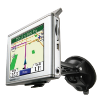
Steps for securely attaching the navigation device to a vehicle's windshield or dashboard.
Instructions for connecting the device to a computer and installing Garmin Express.
How to perform a hard reset on the device if it becomes unresponsive.
Adjusting the display brightness for optimal viewing and battery conservation.
Steps to modify audio volume levels for voice prompts and system sounds.
Guide to interacting with the virtual keyboard for text input.
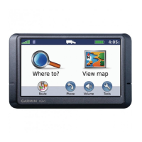
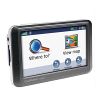
Locating destinations by selecting from predefined categories like restaurants or gas stations.
Finding points of interest close to a different city or specific location.
Setting a primary location, typically home, for quick return routes.
Overview of different methods to search for destinations using the device.
Entering street addresses to find specific destinations on the map.
Navigating the map visually to discover and select locations.
Locating destinations by inputting latitude and longitude coordinates.
Using the GPS simulator to set a location when satellite signals are unavailable.
Adding current or found locations to the Favorites list.
Accessing and selecting previously saved locations from the Favorites menu.
Modifying details of saved locations, such as name or category.
Creating custom categories to organize saved locations within Favorites.
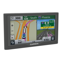
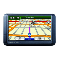
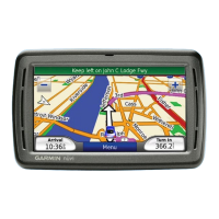
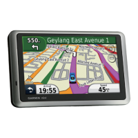
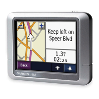
Understanding how the device guides you along a planned driving route.
Instructions for rerouting around obstacles or road closures.
Procedure to end the current navigation route.
Creating straight-line routes that bypass standard road networks.
Customizing the information displayed on the map screen.
Clearing trip computer data such as distance, speed, and time.
Displaying all upcoming turns and distances for the current route.
Displaying the complete planned route on the map screen.
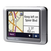
Previewing the upcoming turn, lane changes, or maneuvers on the route.
Seeing a visual representation of upcoming junctions on major roadways.
Information on supported file formats for maps, waypoints, and custom POIs.
Details on using memory cards for additional storage and data.
Steps for inserting a microSD or microSDHC card into the device.
Connecting the device to a computer to copy or move files.
Removing unwanted files from the device's storage.
Configuring core system functions like GPS simulator and units of measure.
Adjusting screen appearance including color mode, brightness, and screenshots.
Setting the device's time format and automatic time synchronization.
Selecting languages for voice prompts, on-screen text, and keyboard.
Configuring map details, view perspective, vehicle icon, and trip log.
Configuring alerts for approaching custom safety cameras or points of interest.
Returning device settings to their original factory defaults.
Guidelines for maintaining the device, avoiding damage, and proper handling.
Instructions for cleaning the external surfaces of the device.
Proper methods for cleaning the device's touch-sensitive display.
Recommendations to prevent device theft when not in use.
Procedure for replacing the fuse in the car charger cable if charging fails.
Steps for detaching the suction cup mount from the windshield.
| Screen Size | 4.3 inches |
|---|---|
| Resolution | 480 x 272 pixels |
| Battery Life | Up to 2 hours |
| Waypoints | 1000 |
| Display Type | WQVGA color TFT with white backlight |
| Battery | Rechargeable lithium-ion |
| Receiver | High-sensitivity |
| Accepts Data Cards | microSD card (not included) |
| Custom POIs | Yes |
| Trip Planner | Yes |
| Lane Assist | Yes |
| Speed Limit Indicator | Yes |
| Bluetooth | No |
| Voice-activated Navigation | No |
| Preloaded Maps | Yes |