Do you have a question about the Garmin nuvi 55 and is the answer not in the manual?
Connect the device to the vehicle's power cable for charging and operation.
Access services like product registration, software updates, and map updates via Garmin Express.
Install and set up Garmin Express software on your computer for device management.
Information on free map updates within 90 days of acquiring satellite signals.
Details on subscription models including lifetime traffic and map updates.
Instructions for activating lifetime map subscriptions through Garmin Express.
Guide to downloading and installing the latest map and software updates for your device.
How to view the device's GPS signal strength by holding a button.
Explains how the device charges when connected to power.
Instructions for setting the device's time automatically or manually.
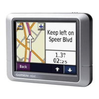
Explains the function of various on-screen navigation buttons.
How to use the on-screen keyboard for text input and character changes.
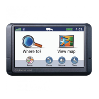
How to search for locations by selecting categories and subcategories.
Using quick search lists to find previously selected destinations within a category.
Searching for locations by category, brand name, address, or city name.
How to modify the geographic area for location searches.
Using the map interface to visually find and select locations.
Step-by-step guide to entering and finding a specific address.
Accessing a list of the last 50 destinations found by the device.
How to locate parking facilities using the device's categories.
Retrieving the location where the device was last parked.
Utilizing tools to search for specific location types via on-screen prompts.
How to search for a location by specifying two street names.
Locating a city by entering its name into the search function.
Using latitude and longitude coordinates to find a specific location.
Steps to save a found location to the device's memory.
Saving the device's current position as a named location.
Setting a primary location, such as home, for quick navigation.
Modifying the details of the saved home location.
Updating the name, category, or map symbol of a saved location.
Organizing saved locations by assigning custom categories.
Removing saved locations from the device's memory.
Setting a temporary GPS location, useful when indoors or without a signal.
Creating shortcuts to frequently accessed menus or locations.
Deleting existing shortcuts from the device's menus.
Information on using custom points of interest for alerts and navigation.
Guide to installing custom POI lists using Garmin's POI Loader software.
Accessing help documentation for the POI Loader software.
Locating custom points of interest that have been loaded onto the device.
Initiating navigation to a chosen destination.
Viewing and selecting from different route options before starting navigation.
Adjusting how the device calculates routes (e.g., fastest time, shortest distance).
Using the device for navigation in areas without defined roads.
Navigating to a location that has been previously saved.
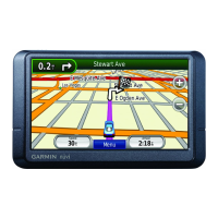
Understanding how the calculated route is displayed on the device's map.
Basic map interaction, including zooming, panning, and selecting features.
Modifying an active route by adding intermediate destinations.
Creating a temporary diversion from the current route to avoid obstacles.
How to end the current navigation session.
Accessing information about the current route, such as turns and distances.
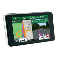
Displaying a detailed list of upcoming turns and maneuvers.
Visualizing the complete planned route on the device's map.
Previewing the immediate upcoming turn or maneuver.
Displaying visual aids for complex road junctions and intersections.
Finding upcoming services and points of interest along the route.
Searching for specific types of services or points of interest ahead.
Modifying the categories displayed in the "Up Ahead" feature.
Displaying trip data fields directly on the map view.
Selecting which data fields appear on the trip information display.
Accessing a dedicated page with detailed trip statistics and current speed.
Reviewing the device's record of past routes and travel history.
Clearing trip data, including trip computer, max speed, and odometer.
Displaying details about the device's current geographical position.
Locating essential services like fuel, food, or hospitals near the current position.
Providing directions for others to reach your current location.
Configuring the device to avoid specific road types or features.
Creating and managing personalized avoidance settings for routes.
Defining specific geographic areas to be excluded from route calculations.
Marking specific road segments to be avoided in route planning.
Temporarily deactivating a previously set custom avoidance.
Removing custom avoidance settings from the device.
Selecting which shortcuts appear in the map tools menu for quick access.
Choosing which data elements (POIs, conditions) are displayed on the map.
Selecting the type of data to display in map data fields.
Adjusting the map view between 2D (Track Up, North Up) and 3D.
Changing the icon that represents the vehicle's position on the map.
Information about safety camera alerts and subscription services.
How the device receives traffic data, including necessary hardware and conditions.
Displaying information about traffic incidents occurring ahead on the route.
Visualizing traffic flow and delays using color-coded map indicators.
Finding specific traffic incidents by searching through a list.
How the device handles traffic delays by recalculating routes.
Manually selecting an alternative route to avoid traffic delays.
Information on purchasing or renewing traffic subscription services.
How traffic subscriptions are automatically activated.
Checking the status and details of active traffic subscriptions.
Steps to purchase and add a new traffic subscription for different regions.
Accessing the device's help system to find answers to questions.
Introduction to the ecoRoute feature for fuel efficiency tracking.
Entering vehicle information for accurate ecoRoute calculations.
Updating the current fuel price for ecoRoute calculations.
Adjusting the fuel economy settings for personalized vehicle data.
Understanding the ecoChallenge feature for scoring driving habits.
Accessing scores for acceleration, braking, speed, and overall driving efficiency.
Details on how acceleration, braking, speed, and overall scores are calculated.
Clearing existing ecoChallenge scores to start fresh.
Reviewing historical fuel economy data and trends.
Information about reports that track distance, time, and fuel cost for trips.
Accessing saved mileage reports for past journeys.
Resetting vehicle profile and ecoRoute settings.
Recommendations for efficient and safe driving to improve fuel economy.
Steps to create a new trip with multiple destinations.
Setting departure times, arrival times, or durations for trip legs.
Starting navigation for a previously planned and saved trip.
Modifying existing saved trips, including renaming or changing destinations.
Reviewing past routes and locations visited.
Information about the different types of files supported by the device.
Details on using memory cards for expanding storage and data.
Steps for inserting a microSD or microSDHC memory card.
How to connect the device to a computer using a USB cable.
Moving files between your computer and the device.
Safely removing the device from a computer after data transfer.
Adjusting map display, vehicle icons, and map detail levels.
Activating installed map products on the device.
Configuring route calculation, avoidances, and safety features.
Setting preferences for route calculation (e.g., faster time, shorter distance).
Adjusting screen orientation, color mode, brightness, and timeout.
Configuring traffic alerts, providers, and route optimization.
Setting units of measurement, time format, and position format.
Changing voice and text languages, and keyboard layouts.
Managing device options, software versions, and privacy preferences.
Returning device settings to their factory default values.
Methods for charging the device's internal battery.
Replacing the fuse in the vehicle power cable if charging issues occur.
Warning against dropping the device to prevent damage.
How to clean the external plastic parts of the device.
Proper methods for cleaning the device's touchscreen display.
Tips to prevent the device and mount from being stolen.
Instructions for securely mounting the device on a car dashboard.
Procedures for detaching the device, mount, and suction cup.
How to detach the suction cup from the windshield.
Information on acquiring new map data for the device.
Where to buy additional accessories for the device.
Steps to resolve issues with the suction cup adhering to the windshield.
Troubleshooting steps for problems with GPS signal acquisition.
Solutions for issues preventing the device from charging in a vehicle.
Tips to improve battery life and address rapid battery drain.
| Auto | Yes |
|---|---|
| Marine (chartplotters, sounders) | No |
| Live service | - |
| Address input | Street |
| Number of waypoints | 1000 |
| Spoken street names | Keep your eyes on the road while your GPS announces turn-by-turn directions, including street and place names. |
| Map coverage | USA |
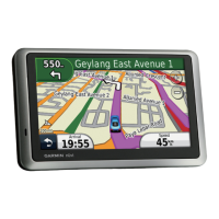
| Display diagonal | 5 \ |
| Display resolution | 480 x 272 pixels |
| Storage media type | SSD |
| Compatible memory cards | MicroSD (TransFlash) |
| Form factor | Fixed |
| Product color | Black |
| Power source type | Battery |
| Battery life (max) | 2 h |
| Mac operating systems supported | Mac OS X 10.4 Tiger, Mac OS X 10.5 Leopard, Mac OS X 10.6 Snow Leopard, Mac OS X 10.7 Lion, Mac OS X 10.8 Mountain Lion, Mac OS X 10.9 Mavericks |
| Windows operating systems supported | Windows XP Home, Windows XP Home x64, Windows XP Professional, Windows XP Professional x64 |
| Depth | 86 mm |
|---|---|
| Width | 139 mm |
| Height | 20 mm |
| Weight | 180.1 g |