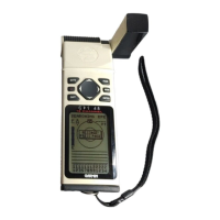
Do you have a question about the Garmin Personal Navigator GPS 45XL and is the answer not in the manual?
| Display Type | LCD |
|---|---|
| Battery | 4 AA batteries |
| Waypoints | 500 |
| Channels | 12 |
| Update rate | 1 second |
| Velocity accuracy | 0.1 knot RMS steady state |
| Antenna | Built-in patch |
| Operating temperature | 5°F to 158°F (-15°C to 70°C) |
| Routes | 20 |
| Position Format | Lat/Lon |
| Accuracy | 15 meters |
| DGPS accuracy | 3-5 meters (10-16 feet) |
| Power supply | 4 AA batteries |
| Waterproof | IPX7 |
| Navigation Features | Track log, trip computer, sunrise/sunset times, hunt/fish calendar |
Initial setup procedures for the GPS 45XL and how to attach the lanyard.
Step-by-step guide to setting up the GPS receiver for initial use.
Instructions on how to get a clear sky view for the GPS receiver to acquire satellite signals.
Procedure for powering on the GPS 45XL unit.
Details on powering on the unit and selecting initialization methods.
Steps to initialize the GPS receiver by selecting country or using AutoLocate.
Information on initialization options, external antennas, and DGPS receivers.
How to power on the unit and interpret the satellite status page for signal acquisition.
How to mark the current GPS position as a waypoint for future reference.
Step-by-step guide to capturing and naming a waypoint.
Navigating to a waypoint using GOTO and understanding the highway page display.
Procedure for selecting a destination and initiating a GOTO function.
How the highway and compass pages provide steering guidance.
Managing the track log and procedures for turning the unit off.
Procedure for powering down the GPS 45XL.
Accessing the EZinit prompt for reinitialization from the status page.
Procedures for marking, saving, and naming waypoints.
Managing waypoints through submenus: nearest, list, and definition pages.
Method for manually creating a new waypoint using coordinate data.
Creating waypoints using bearing and distance from an existing waypoint.
Navigating to destinations using GOTO and Man Overboard functions.
Choosing any stored waypoint as a destination for navigation.
Activating MOB mode to quickly mark and set a course to a position.
Retracing your path using the track log to create a route back to the start.
Procedure for activating the TracBack feature to navigate your recorded path.
Advice for optimizing the use of the TracBack feature.
Planning and navigating courses using user-defined routes.
How to plan and follow a course from one place to another using waypoints.
Creating, copying, and editing routes using the route definition page.
Accessing the route definition page from the menu.
Step-by-step guide to creating a new route.
Activating routes in their defined or inverted sequence for navigation.
Procedure to activate a stored route for navigation.
Selecting and using highway and compass pages for navigation guidance.
Detailed explanation of the highway page's graphics and steering indicators.
How to interpret the highway page for efficient course correction.
Activating the TracBack feature to navigate your recorded path.