Do you have a question about the Garmin RINO 530HCx and is the answer not in the manual?
Critical safety warnings regarding RF exposure, medical devices, and environmental conditions.
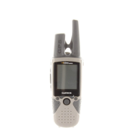
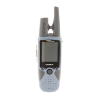
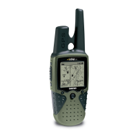
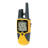
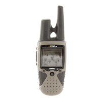
Explanation of the Rino's buttons, their functions, and how to navigate menus.
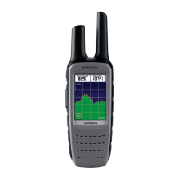
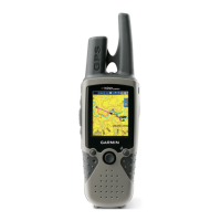
Overview of the different screens available on the Rino, including Radio, Map, and Compass.
Instructions on how to operate the Rino, including using the rocker and page menus.
How to utilize detailed maps with the Rino, including microSD card usage.
User interface for FRS/GMRS radio operations and weather radio access.
Guide to selecting FRS/GMRS channels and privacy codes for communication.
Configuring radio settings like Send Location, GMRS Power, and Headset Type.
Accessing and using the NOAA Weather Radio for weather updates and alerts.
Utilizing peer-to-peer positioning, new contact management, and sending locations.
Displaying current position, movement trail, and map details.
Tailoring map display settings like orientation, detail, and road locking.
Guidance on using the compass page for navigation and direction.
Procedure to calibrate the electronic compass for accurate readings.
Viewing elevation, ascent/descent rates, and pressure profiles.
Steps to manually calibrate the altimeter for accurate elevation data.
Understanding satellite signal strength and page options for tracking.
Recording current location as a waypoint and managing waypoint data.
Searching for locations, cities, exits, and points of interest on the map.
Creating routes and navigating to destinations using map and compass guidance.
Recording and viewing your travel path as a track log.
Navigating back to your starting point by following the saved track log.
Viewing track profiles and creating/managing routes with directions.
Following a created route and receiving navigation guidance.
Accessing and configuring various device settings like GPS, display, and radio.
Requirements and procedures for obtaining a GMRS license for radio operation.
| Sport (fitness, running) | Yes |
|---|---|
| Marine (chartplotters, sounders) | No |
| Routes quantity | 50 |
| Tracks quantity | 20 |
| Number of waypoints | 500 |
| Form factor | Handheld |
| Interface | USB |
| Channels quantity | 22 channels |
| Display resolution | 176 x 220 pixels |
| Display size (HxV) (imperial) | 1.3 x 1.7 \ |
| Battery life (max) | 14 h |
| Depth | 46 mm |
|---|---|
| Width | 58 mm |
| Height | 130 mm |
| Weight | 292 g |