Do you have a question about the Garmin RINO 700 and is the answer not in the manual?
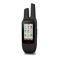
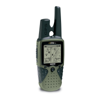
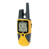
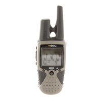
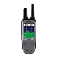
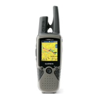
Provides a visual overview of the device's physical components and ports.
Instructions on how to charge the device's internal battery using a USB connection.
Explains the procedure to power the device on and off.
Details the function of each physical button and control on the device.
Guides users on how to get a GPS lock for accurate positioning.
Introduces the radio communication capabilities of the device.
Instructions on how to send voice and position data over the radio.
Overview of the application used to manage radio functions and settings.
Steps to access the radio application from the home screen.
How to control the audio volume for radio transmissions and reception.
Adjusting sensitivity to filter background noise for clearer reception.
Explains how to select radio channels and squelch codes for communication.
Process to choose a specific radio channel for communication.
How to select squelch codes to filter incoming radio signals.
Switching between CTCSS and DCS squelch modes for better filtering.
How to listen for signals on a specific radio channel.
How to scan multiple radio channels for activity.
Information on using repeater channels for extended radio range.
Sending and receiving location data between Rino devices.
Requesting location updates from saved contacts.
Modifying transmitted name and symbol for peer-to-peer positioning.
Managing saved contact information for other Rino users.
How to add a new Rino user to the contacts list.
Displaying saved contacts' locations on the device map.
Getting directions to a saved contact's location.
Sending and managing short text messages between Rino devices.
Steps to compose, store, and transmit notes.
Functionality for sending and receiving emergency notifications.
Procedure to initiate an emergency alert to nearby users.
How to react to and navigate towards an emergency alert sender.
Accessing and modifying radio application specific configurations.
Configuring core radio transmission and reception parameters.
Steps to initiate navigation to a chosen point or address.
Searching for points of interest close to a specific area.
Procedure to cancel an active navigation session.
Using the on-screen map to guide movement towards a destination.
Utilizing the compass display to orient direction towards a destination.
Feature to help maintain a desired bearing or course line.
Returning to the start of a recorded track or journey.
Functionality for marking, saving, and managing locations.
Saving the device's present coordinates as a waypoint.
Locating and selecting saved waypoints from the manager.
Modifying the details of a saved waypoint.
Removing saved waypoints from the device.
Transmitting saved waypoint data to other Rino devices.
Averaging multiple GPS readings for a more precise waypoint.
Creating a new waypoint based on bearing and distance from an existing one.
Building a route by selecting points sequentially via the planner.
Constructing a route by selecting points directly on the map interface.
Changing the identifier for a saved route.
Modifying existing routes by adding, removing, or reordering points.
Displaying a saved route on the device's map interface.
Removing saved routes from the device's memory.
Accessing the tool for managing recorded tracks.
Displaying details about a recorded track, such as path and points.
Storing the currently recorded track for later use.
Erasing the active track log data.
Permanently removing a saved track from the device.
Transferring geocache data from a computer to the device.
Guidance on using the device to find a geocache location.
Utilizing provided hints to locate hidden geocaches.
Recording the outcome of a geocache search (found, not found, etc.).
Narrowing down the list of geocaches based on criteria.
Creating and storing personalized filters for geocache lists.
Modifying existing custom filters for geocaches.
Implementing a saved filter to view specific geocaches.
Creating alerts for when approaching a specific location.
Measuring the area enclosed by a walked perimeter.
Accessing calendar and astronomical data like sunrise/sunset.
Accessing the device's stopwatch functionality.
Displaying GPS signal status and satellite information.
Adjusting how satellite data is presented on the screen.
Using a dummy GPS location for testing or saving battery.
Adding frequently used apps to the main home screen.
Managing and organizing different screens or pages on the device.
Creating a new screen for custom arrangement of applications.
Deleting a custom screen from the device.
Reordering the sequence of available pages on the device.
Creating and managing sets of settings for different activities.
Steps to create a new custom profile.
Activating a previously created profile.
Modifying existing user profiles.
Configuring on-screen data displays and information groups.
Activating data fields or dashboards on map and compass pages.
Personalizing the specific data shown in fields.
Controlling screen brightness to conserve battery life.
Configuring screen timeout, contrast, and other visual options.
Adjusting map orientation, data display, and color schemes.
Fine-tuning map behavior like auto-zoom and waypoint display.
Configuring core device parameters like satellite systems and language.
Information on using GPS and GLONASS for positioning.
Customizing audible alerts and feedback sounds.
Configuring how the device calculates and navigates routes.
Adjusting compass display and north reference options.
Setting the display format for coordinates and map datum.
Customizing units for distance, speed, elevation, etc.
Configuring time format and time zone.
Customizing geocache list display and filter options.
Procedures for clearing data or restoring factory defaults.
Resetting settings within specific categories to their defaults.
Resetting settings for individual pages like Map or Compass.
Performing a full factory reset of all device settings.
Viewing unit ID, software version, and regulatory details.
Instructions on how to attach the included carabiner clip.
Information on connecting and using audio accessories.
How to get software updates and register the device.
Guidelines for maintaining the device's condition and preventing damage.
Instructions for safely cleaning the device's exterior.
Information on the device's water resistance rating and limitations.
How the device handles data files and compatibility.
Overview of supported file formats for transfer.
Steps to establish a connection between the device and a computer.
Process for copying files from a computer to the device.
Instructions for safely removing files from the device.
Proper procedure for safely removing the device from a computer.
Technical details such as battery life, dimensions, and operating conditions.
Frequencies and channel descriptions for GMRS communication in North America.
Frequencies and channel descriptions for CBRS/PRS communication in Australia/New Zealand.
Digital-Coded Squelch codes for radio communication.
Continuous Tone-Controlled Squelch System frequencies.
Details on licensing requirements for using GMRS frequencies.
Steps to resolve inaccurate battery level readings.
Troubleshooting tips for GPS signal acquisition problems.
Solutions for issues with automatic mass storage connection.
Instructions for performing a complete factory reset.
Additional reference material and technical details.
Explanations of various data fields displayed on the device.
| Outdoor (hiking, trekking) | Yes |
|---|---|
| Marine (chartplotters, sounders) | No |
| Display diagonal | 2.2 \ |
| Display resolution | 128 x 160 pixels |
| Display size (HxV) | 36 x 43 mm |
| Display number of colors | Monochrome |
| Power source type | Battery |
| Battery life (max) | 13 h |
| International Protection (IP) code | IPX7 |
| Purpose | Personal |
| Product color | Black |
| Channels quantity | 22 channels |
| Electronic compass | - |
| Protection features | Water resistant |
| Transmission distance (max) | 32 km |
| Routes quantity | 50 |
| Tracks quantity | 10000 |
| Number of waypoints | 1000 |
| USB connector type | Mini-USB |
| Operating temperature (T-T) | -20 - 55 °C |
| Cables included | USB |
| Depth | 178 mm |
|---|---|
| Width | 60 mm |
| Height | 44 mm |
| Weight | 268 g |