Do you have a question about the Garmin STRIKER PLUS 5 and is the answer not in the manual?
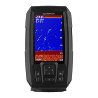
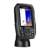
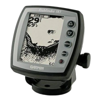
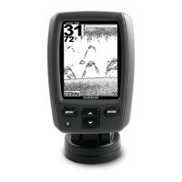
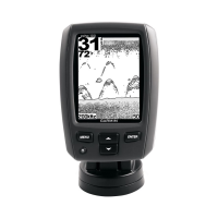
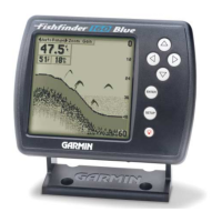
Describes the function of each physical button on the device.
Provides access to all device features and can be customized.
Explains how the device acquires satellite data for location.
Allows adding, rearranging, or removing items on the Home screen.
Explains how to create custom screen layouts combining multiple functions.
Step-by-step guide to creating a custom combination page for specific models.
Steps to create a custom combination page for a specific model.
Defines user roles (Owner, Guest) and their access levels within the app.
Guide to connecting the mobile device to the STRIKER Plus via Wi-Fi.
Explains how to display mobile notifications (calls, texts) on the device.
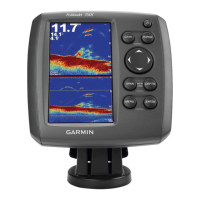
Displays a large image of sonar readings from a transducer.
Provides detailed scanning sonar images of the fishing environment.
Shows a picture of what lies to the sides of the boat for searching.
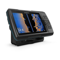
Allows viewing two frequencies simultaneously for deeper and detailed sonar readings.
Shows sonar information on a circular depth scale indicating what's beneath the boat.
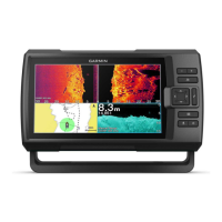
Displays a full view and a magnified portion of the sonar graph.
Choose frequencies for sonar screen for optimal viewing.
Mark a location as a waypoint directly from the sonar screen.
Temporarily stops the sonar display for closer examination.
Manually or automatically adjusts the zoom level of the sonar display.
Locks the sonar screen to the water bottom for consistent depth reference.
Configures display elements like color, A-Scope, and symbols.
Reduces interference and surface noise for a clearer sonar image.
Customizes the data displayed on the sonar screen.
Automatically adjusts sonar gain based on conditions.
Manually adjusts sonar gain for optimal target visibility.
Adjusts distance between sonar depth and contour recording depth.
Compensates contour depths for water level changes.
Specifies depth ranges and colors for fishing maps.
Search for saved waypoints, routes, or marine services by name.
Mark a location on the map as a waypoint.
Set course and travel to a waypoint.
Create and follow a multi-point route on the map.
How to end an active navigation session.
Locations recorded and stored on the device.
Saves the current location as a waypoint with a single button press.
Manually creates a waypoint by entering coordinates or selecting on chart.
Quickly mark and navigate back to a man overboard position.
Measures the distance between two points on the map.
Displays all saved waypoints for management.
Modifies the name, symbol, or location of a saved waypoint.
Removes individual waypoints or man overboard markers.
Clears all saved waypoints from the device.
Creates and saves a route including all its waypoints.
Displays all saved routes for management.
Modifies the name or turns of a saved route.
Selects and follows a saved route, either forward or backward.
Navigates parallel to a saved route, offset by a specified distance.
Displays a trailing line on the chart indicating your track.
Clears the track memory; active track recording continues.
Saves the currently recorded active track.
Displays all saved tracks for management.
Modifies the name or color of a saved track.
Converts a saved track into a navigable route.
Selects and follows a previously recorded track.
Removes a specific saved track from the device.
Clears all saved tracks from the device memory.
Follows the currently recorded active track.
Assigns a color to the active track display.
Configures how track log memory is managed during recording.
Sets the frequency at which track plot points are recorded.
Adjusts display settings like backlight and color scheme.
Provides information about the device and software version.
Configures vessel-specific settings like transducer type and keel offset.
Compensates water depth reading for the transducer installation location.
Compensates temperature reading from a temperature-capable transducer.
Configures navigation, system, and sonar alarms.
Sets the unit format for the device.
Sets magnetic declination for navigation reference.
Sets direction references for heading information.
Sets the position format in which location readings appear.
Sets the coordinate system on which the map is structured.
Sets the time format to 12-hour, 24-hour, or UTC.
Sets the device's time zone.
Enables or disables daylight savings time adjustments.
Sets the type of labels shown with route turns on the map.
Sets turn transition calculation based on time or distance.
Sets minutes before turn for transition when time is selected.
Sets distance before turn for transition when distance is selected.
Selects a starting point for route navigation.
Connects STRIKER Plus to compatible Garmin devices to share data.
Removes saved user data like waypoints, routes, and tracks from memory.
Addresses power issues, checking fuses and voltage.
Troubleshoots issues with acquiring satellite signals.
Checks transducer connection and sonar enablement.
Addresses map datum and position format mismatches for waypoints.
Checks GPS fix and time zone settings for correct time display.
| Display Size | 5 inches |
|---|---|
| Display Resolution | 800 x 480 pixels |
| Display Type | WVGA color |
| Transmit Power | 500 W (RMS) |
| GPS | Yes |
| Waypoints | 5, 000 |
| Routes | 100 |
| Waterproof Rating | IPX7 |
| Mark Waypoints | Yes |
| Track Recording | Yes |
| Water Temperature Log and Graph | Yes |
| Sonar Type | CHIRP |
| Sonar Frequencies Supported | 77/200 kHz |
| Mounting Type | Flush mount, tilt/swivel bracket |
| Maximum Depth | 2, 300 ft (fresh water); 1, 100 ft (salt water) |
| Battery Life | Not applicable (depends on external power source) |