Do you have a question about the Hema HN7 and is the answer not in the manual?
General information and recommendations for using the Hema HN7 NAVIGATOR.
Details external influences and conditions affecting device operation, including GPS and temperature.
Critical guidelines to prevent hazardous situations and ensure safe operation while driving.
Advice on using the NAVIGATOR as an aid, not a replacement, for traditional maps in remote areas.
Information on the rechargeable lithium-polymer battery, charging, and care.
Instructions for cleaning the Hema HN7 NAVIGATOR casing and touch screen.
Tips to prevent theft of the NAVIGATOR and mount when not in use.
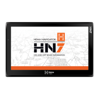
Welcome message and introduction to the Hema HN7 NAVIGATOR and its features.
Explains what the NAVIGATOR is and its key differences from other GPS devices.
Details the key features and specifications of the Hema HN7 NAVIGATOR.
Identifies and describes the physical buttons and ports of the Hema HN7 device.
Diagram and description of the rear view of the Hema HN7, including power button, speaker, and vents.
Diagram and description of the side view of the Hema HN7, detailing ports and buttons.
Diagram and description of the bottom view of the Hema HN7, showing mounting cradle slots.
Instructions on how to safely insert and remove the MicroSD card from the HN7.
Explanation of how to use the included MicroSD card adapter with a PC.
Instructions on how to connect the Hema HN7 to a power source for charging.
Steps for powering the device on and off, including sleep mode.
How to completely power off the unit and terminate running applications.
How to put the device into Sleep Mode and its implications for battery life.
How to cancel the shutdown screen action and return to the previous state.
Details the methods for charging the internal lithium-polymer battery.
Instructions on how to perform a system reset to return the HN7 to a stable state.
Describes finger and stylus interaction techniques used with the navigation applications.
Explains how and where user data is stored and how to create a backup copy.
Information on finding product manuals, support, and registering the device on the Hema website.
Details how to connect the HN7 to a PC for software installation and data transfer.
Overview of the Main Menu screen elements, including battery and settings indicators.
Describes the speaker status indicator and when it might be muted.
Explains the Bluetooth indicator and how to access the Bluetooth screen.
Details the GPS indicator and how to access GPS information.
Introduces the two navigation applications: iGO Primo 2.4 (Street) and OziExplorer (4WD).
Shows the system date and time displayed on the orange strip at the bottom of the screen.
Overview of the Settings menu, including Volume, Backlight, Language, Date Time, Calibration, USB, Sys Info, and Tools.
Instructions on how to adjust the master volume level and enable sound for taps.
How to adjust screen brightness and set auto-off for the backlight.
How to select the system menu language for the NAVIGATOR.
How to set the date, time, time zone, and daylight saving options.
Procedure for calibrating the touch screen to ensure accurate tap registration.
Options for connecting the HN7 to a PC or USB flash drive for data transfer.
Details the Mass Storage connection mode for PC connectivity.
Details the Windows Sync connection mode for PC connectivity.
Displays system information useful for support staff.
Access to various tools like Bluetooth, Calculator, Factory Reset, GPS Info, Music, Photo, Video.
Description of Bluetooth technology and its use for hands-free calling.
Information about the built-in scientific calculator application.
How to reset system settings to factory defaults, noting it doesn't affect app data.
Displays GPS status and information, with an option to reset the GPS receiver.
Details the Music Player for playing audio files from SD card or USB.
Details the Photo Viewer for viewing image files from SD card or USB.
Details the Video Player for playing video files from SD card or USB.
How to pair the HN7 with a Bluetooth phone for making/receiving calls.
Displays call lists: outgoing, incoming, and rejected calls.
How to redial the last accessed phone number.
Procedure for pairing the NAVIGATOR with a Bluetooth phone.
Configuration options for Bluetooth, including PIN, background operation, and auto-answer.
Lists previously paired devices and allows connection or deletion.
Tool to search for, connect, and pair nearby Bluetooth devices (currently not functional).
Allows transfer of phonebook entries from a mobile phone to the NAVIGATOR.
How to answer an incoming call on the NAVIGATOR.
Using the numeric keypad to dial a phone number.
Process for making an outgoing call using Bluetooth connectivity.
Viewing call logs (inbound, outbound, rejected) and managing entries.
How to redial the last phone number and modify it before calling.
Entering Bluetooth pairing mode to connect the phone with the NAVIGATOR.
Configuring Bluetooth settings like PIN code, background operation, and auto-answer.
Procedure to change the default PIN code for Bluetooth pairing.
Managing paired Bluetooth devices: connect, delete, or disconnect.
Searching for nearby Bluetooth devices and initiating pairing.
Process of finding and pairing Bluetooth devices.
Transferring phonebook entries from a mobile phone to the NAVIGATOR.
Details the comprehensive calculator feature for simple and advanced calculations.
How to play music files using the built-in Music Player.
Customizing sound profiles with pre-set or user-defined equalizer settings.
Managing playlists by adding and removing audio files.
Viewing image files, including slideshow and browse functions.
Playing video files, with controls for playback and playlist creation.
Navigating video files on SD card or USB stick.
Introduction to iGO Primo 2.4 for street navigation, its features and capabilities.
Guide to updating maps and content using NaviExtras Toolbox.
Overview of the iGO Primo 2.4 Navigation Menu and its display modes.
How to exit the iGO application and return to the NAVIGATOR Main Menu.
Description of the main iGO menu buttons like Show Map, Destination, Route Options, and More.
Selecting a destination by address, POI, or map location.
Displaying route parameters and performing route-related actions.
Accessing additional iGO settings and features.
Accessing iGO settings for route planning, map appearance, and warnings.
Shortcut to the Bluetooth system settings menu within iGO.
Navigating back to the previous screen.
Features of the Map screen, including direction indicators and quick menu access.
Display of current speed and modification of data fields.
Shows the name of the current street.
Jumps back to the Main Menu.
Displays information like speed limits, school zones, and cancels audible alerts.
Accessing the Quick Menu for handy navigation functions and volume controls.
Indicators displayed during navigation and how to access Menu/Back options.
Information about upcoming maneuvers, distance, and secondary maneuvers.
Lower-right info panels showing speed, distance, arrival time; customisable.
Entering the Find Menu to search for destinations.
Performing a combined search within a radius or defined area.
Searching by address, place of interest (POI), or on the map.
Choosing a destination from a list of saved favorite locations.
Navigating to a previously used destination via the #1 or #2 buttons.
Accessing a list of previously used destinations.
Navigating to a coordinate or a location saved in a photo.
Entering address details to specify a destination.
Choosing a street, including intersecting streets or specific numbers.
Calculating and starting a route to the selected destination.
Accessing additional route options like alternatives, itinerary, and settings.
Searching for Points of Interest (POIs) like Petrol Stations or Camps.
Finding POIs located along the current route.
Indicators showing how far off route a POI is, helping to decide on stops.
Convenient buttons for quick searches like Petrol Stations or Camps.
Customizing search aspects for POIs, with different views for routing or not.
Searching for specific POIs within a specified town.
Searching for POIs around the current location.
Searching for POIs along the current route.
Searching for POIs around the destination of the current route.
Displaying all POIs for the current selection.
Narrowing search results by entering a name.
Guidance on using the NAVIGATOR with CAMPS 8 and Caravan Parks Australia Wide POI data.
Details the comprehensive POI data provided for Camps and Caravan Parks, including facility symbols and descriptions.
Explanation of icons used to identify types of POIs for Camps 8 and Caravan Parks Australia Wide.
Information displayed for POIs, including site number, contact, classification, and GPS coordinates.
How to search for POIs like Camps 8 and Caravan Parks using various methods.
Icons related to cassette toilet use, holding tank, and water facilities.
Access to iGO settings and useful tools like Updates, Phone, Picture Viewer, Unit Converter.
Displays a world map showing areas of night and day.
Recording journeys, including saving track logs.
Useful information for countries, like speed limits and emergency numbers.
Information about iGO software, map versions, and simulated navigation.
Changing iGO settings for route planning, map appearance, and warnings.
Adjusting audio output, voice guidance, and setting up warnings.
Customizing the 8 buttons available in the Quick Menu.
Enabling collection and use of Historical Traffic data.
Configuring vehicle type, road types, and route planning methods.
Creating multiple profiles for different drivers with personalized settings.
Adjusting map-related settings like color schemes, zoom, and Vehimarker.
Changing data fields, displaying junction views, and route progress bars.
Settings for menu animations, application skin, and backlight.
Settings for program language, time format, and units of measure.
Managing trip data, including automatic saving and track logs.
Enabling/disabling collection of usage information and GPS logs.
Performing initial setup or resetting program to default settings.
Deleting saved data and resetting program settings to factory defaults.
Introduction to OziExplorer for 4WD navigation on the Hema HN7.
Overview of the OziExplorer EziOzi-3 interface and its displays.
Shows GPS status, page name, latitude, and longitude.
Buttons for common functions like Select Page, Add Waypoint, Dim, Settings, GPS ON/OFF, Exit.
Contains buttons specific to the current page being viewed.
Details map display elements like GPS status, position, speed, heading, and map selection buttons.
Elements of the OziExplorer Standard Toolbar.
Steps to acquire a GPS fix, including optimal conditions and time required.
Shows internal GPS status and satellite visibility.
Number of satellites currently visible.
Horizontal Dilution of Precision, indicating positioning accuracy.
Shows total/free space on NAVIGATOR internal storage.
Shows total/free space on NAVIGATOR SD card.
Numbered satellites and relative signal strengths.
Shows raw NMEA GPS data.
Shows sky map with visible satellites.
Accessing different pages/screens within OziExplorer using the Select Page window.
Available OziExplorer pages: Map View, Maps, Waypoints, Tracks, Routes, Altitude, Meters.
Additional parameters for Time, Speed, and Acceleration.
Graphs showing Speed and Altitude over time.
Current GPS status and storage usage.
Buttons for customising OziExplorer settings.
Instructions for switching off GPS reception and opening map files.
Navigating directory structure to find and open map files.
Adding a waypoint at the current cursor position on the map.
Setting waypoint properties like name, color, position, and proximity alarm.
Using the keyboard to enter waypoint data and saving the waypoint.
Exiting OziExplorer and returning to the NAVIGATOR Main Menu.
Steps to install the Hema Navigator Explorer PC application and maps.
Initial setup procedure for Hema Navigator Explorer, requiring device connection.
Where to find tutorials and detailed help for the Explorer application.
Terms and conditions for using the embedded software and supplied maps.
Information on navigation data integrity and reporting incorrect data to HERE.
Information regarding the completeness and accuracy of Hema Maps data.
Product compliance with essential requirements and FCC limits.
Details the one-year warranty for defects in materials or workmanship.
Warranty details for units purchased outside Australia.
Policies regarding products sold through online auctions for rebates and warranty.
Legal agreement for the use of the iGO software product.
Identifies the Licensor (NNG Software) and the User for the agreement.
How the agreement is concluded and User acceptance of terms.
Governing laws and jurisdiction for disputes related to the agreement.
Defines the software product and database, and conditions for termination.
Licensor's ownership of copyrights in the software product and its parts.
User's entitlements, including installation on one device and making one backup copy.
Restrictions on duplicating, reselling, sublicensing, or modifying the software.
Disclaimers for software quality, accuracy, and liability for damages.
Consequences of breaching copyright and related rights.
Terms for third-party content and services, including community services and Google Local Search.
| Screen Size | 7 inches |
|---|---|
| Resolution | 800 x 480 pixels |
| Connectivity | Bluetooth, USB |
| Maps | Preloaded Hema Maps |
| Operating System | Windows CE 6.0 |
| RAM | 128 MB |
| Waterproof | No |
| Expandable Storage | MicroSD card slot |
| Battery | Lithium-ion |
| GPS | Built-in GPS receiver |