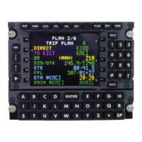
Mark V and Mark VII EGPWS Pilot’s Guide
System Description 060-4241-000
36 Rev H, August 2011
When the aircraft is greater than 500 feet (250 with gear
down) above the terrain in view, additional (green) color
bands are presented. These added bands are computed and
displayed as a function of the highest and lowest elevations in
view.
The following table indicates the TAD colors and elevations
(Non-Peaks and Peaks).
Terrain/Obstacle Threat Area – Warning.
Terrain/Obstacle Threat Area – Caution.
Terrain/Obstacle that is more than 2000 feet above aircraft
altitude.
Terrain/Obstacle that is between 1000 and 2000 feet above
aircraft altitude.
Terrain/Obstacle that is 500 (250 with gear down) feet
below to 1000 feet above aircraft altitude.
Highest terrain not within 500 (250 with gear down) feet of
aircraft altitude. May appear with dotted yellow terrain
when the aircraft altitude is within 500 feet (250 feet with
gear down) of terrain. Top 5% of Range.
Terrain/Obstacle that is 500 (250 with gear down) feet
below to 1000 below aircraft altitude.
Terrain/Obstacle that is the middle elevation band. 1000 ft
Below A/C Top 35% of Range, or Top 5 Percentile
Terrain/Obstacle that is 1000 to 2000 feet below aircraft
altitude.
Terrain/Obstacle that is the lower elevation band. 2000 ft
Below A/C Top Half of Range, Top 15
No significant Terrain/Obstacle.
Water at sea level elevation (0 feet MSL).
Unknown terrain. No terrain data in the database for the
magenta area shown.
Magenta may be displayed at or near the South and North
Poles dependent upon the airplane flight path and location.
 Loading...