Do you have a question about the Humminbird 581i Combo and is the answer not in the manual?
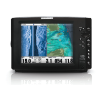
Explains the 200/83 kHz DualBeam sonar system with wide and narrow beam coverage.
Explains the significance of display data, representing sonar returns as vertical bands over time.
Describes the RTS Window updating at the fastest rate, showing bottom, structure, and fish returns.
Details how to freeze the display and use an active cursor to identify sonar returns and depths.
Explains how the unit charts bottom changes and identifies bottom types like hard or soft.
Presents a historical log of sonar returns, with recent information charted on the right side.
Provides a magnified view of the bottom and structure to see close-together sonar returns.
Displays digital data in a large, easy-to-see format with depth, temperature, and speed readouts.
Shows a 3D perspective view of tracks and chart contours from above and behind the boat.
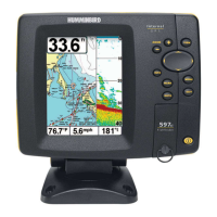
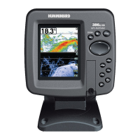
Displays cartography from built-in maps or optional cards, showing position history and routes.
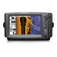
Splits the screen with Chart View on the left and Sonar View on the right for simultaneous data display.
Allows choosing between North-Up or Course-Up orientation for Chart and Combo Views.
Explains how to pan, zoom, and get information on chart objects using various keys.
Explains how to mark areas of interest, create paths, and save movement history.
Details methods to save, modify, and remove waypoint positions from the unit's memory.
Guides users on setting a destination and initiating navigation to a specific waypoint.
Describes applying visual targets or grid patterns to waypoints for enhanced navigation.
Covers creating, modifying, and removing saved routes for trip planning and navigation.
Explains how to save the current path or clear it from the display.
Details managing saved tracks, including renaming, visibility, and deletion.
Instructions on how to install and use optional MMC/SD cards for additional chart data.
Explains how to transfer saved navigation data (tracks, waypoints, routes) to an external card.
Covers powering the unit on/off and adjusting backlight and contrast settings.
Describes how to cycle through different display views for optimal system use.
Explains how to get information on chart objects near an active cursor.
Details how to access the Start-Up Options, X-Press™, and Main Menus.
Explains cursor movement, menu selection, and interaction in various views.
Describes how to mark a waypoint at the cursor or boat location.
Guides on initiating navigation to a waypoint or creating a waypoint.
Explains how to adjust the scale of views for closer or farther inspection.
Covers exiting menus, canceling alarms, and cycling through views in reverse.
Describes the mode for on-the-water operation with a connected transducer.
Allows users to learn operation and practice settings before going on the water.
Provides options to view system connections and conduct self-tests.
Allows simplifying or expanding menu options based on user preference for basic or advanced settings.
Controls display detail by adjusting the sensitivity of all sonar frequencies.
Sets the shallowest depth range displayed on Sonar and Big Digits Views.
Sets the deepest depth range displayed on the unit, with Auto or Manual settings.
Determines how fast sonar information moves across the display, affecting detail shown.
Selects how bottom and structure are represented on the display (e.g., Inverse, Structure ID).
Discards the current route and exits Navigation Mode when navigating.
Allows viewing the Waypoint submenu for a waypoint under the cursor.
Quickly moves the cursor to any saved waypoint for location or editing.
Saves the current track on the display and starts a new one.
Clears the current track from the display and starts a new one.
Saves the current route being displayed while navigating.
Removes the next waypoint from the current route during navigation.
Discards the current route and exits Navigation Mode.
Removes a waypoint target from the display.
Removes a waypoint grid from the display.
Sets the size of the Sonar Window in the Combo View.
Allows viewing the waypoint submenu for the most recently created waypoint.
Sounds when the depth becomes equal to or less than the set menu value.
Sounds when fish detections meet alarm settings, only if Fish ID+ is on.
Sounds when the input battery voltage drops to or below the set menu level.
Sounds when the water temperature reaches the set alarm value.
Alerts when the boat moves too far off the intended course during navigation.
Sounds when the boat nears a destination waypoint or enters an arrival circle.
Alerts if an anchored boat drifts outside a set perimeter.
Adjusts a filter to remove surface clutter noise caused by algae and aeration.
Adjusts sonar returns to show less clutter and improve fish size accuracy.
Uses advanced processing to interpret sonar returns and display fish symbols and depths.
Adjusts the threshold for Fish ID detection algorithms to display weaker returns as fish.
Sets the RTS Window to Wide, Narrow, or Off to display real-time returns.
Adjusts the width of the zoomed view in the Sonar Zoom View.
Divides the display into four sections separated by three horizontal depth lines.
Limits display interference from sources like engine noise, turbulence, or other devices.
Controls the maximum depth of operation, allowing auto adjustment or manual setting.
Configures the unit for fresh or salt water, affecting deep water depth reading accuracy.
Allows viewing the Current Track submenu to save, clear, or change appearance.
Allows viewing the Saved Tracks submenu to edit, delete, or set default appearances.
Allows viewing the Waypoints submenu for creating, editing, deleting, or navigating to waypoints.
Allows viewing the Routes submenu for creating, editing, deleting, or traveling routes.
Selects whether Chart and Combo Views are drawn North-Up or Course-Up.
Selects how much chart detail is displayed on Navigation Views.
Allows displaying or hiding map borders, indicating different map areas.
Allows displaying or hiding a grid showing latitude and longitude lines.
Allows displaying or hiding depth measurements shown on the chart.
Chooses which chart to use, with an Auto option for automatic selection.
Sets the display of bearings with True North or Magnetic North orientation.
Controls decluttering of waypoints for better readability on crowded charts.
Sets the orientation of a trolling grid in degrees.
Selects the time period between saving trackpoints to define the path.
Sets a minimum distance before a trackpoint is added to the track.
Changes the map coordinate system to match a paper map.
Sets the boat's position for use in the Simulator mode.
Adjusts the map offset to correct map positioning.
Exports all saved tracks, waypoints, and routes to an MMC/SD card.
Deletes all saved tracks, waypoints, and routes from the unit.
Selects units of measure for depth-related readouts (Feet, Fathoms, Meters).
Selects units of measure for temperature-related readouts (Celsius, Fahrenheit).
Selects units of measure for distance-related readouts (Miles, Nautical Miles, Kilometers).
Selects units of measure for speed-related readouts (mph, kts, kph).
Sets the menu system to Normal or Advanced for simplified or expanded options.
Selects the display language for menus.
Resets the Triplog data (elapsed time, distance, average speed).
Resets all menu settings to their factory defaults.
Sets information to display in fixed-position data windows on the Sonar View screen.
Adjusts the digital depth readout to indicate depth from the waterline or boat's keel.
Adjusts the temperature readout by a specified amount.
Adjusts the speed readout by a percentage.
Selects the unit's time zone reference for GPS time display.
Adjusts the time display for local Daylight Saving Time.
Selects the format for the latitude and longitude position display.
Changes the time format used by the unit (12 or 24 hour).
Selects the format for the date display.
Turns NMEA output on or off for data communication with other devices.
Sets whether Sonar views are shown in the view rotation.
Controls the visibility of the Demonstration Mode.
Provides steps to resolve issues where the fishfinder fails to power on.
Offers solutions for when the unit defaults to Simulator mode despite a connected transducer.
Addresses common display issues, interference, and causes like power or transducer problems.
Helps identify sources of electrical noise or interference affecting sonar reception.
| Brand | Humminbird |
|---|---|
| Model | 581i Combo |
| Category | Fish Finder |
| Language | English |