114
Chart Overview
CHART OVERVIEW
T
o enable the chart and navigation features, the control head must have a GPS Fix from an internal or external GPS receiver (see
G
etting Started to check the sensor reception). Some of these features also require a compass/heading sensor to be connected
t
o the control head.
The selected map source also influences the menu system. When you change the map source, the menu options for the chart views
change, allowing you to add navigation data, shading, or alarms. See Select a Map Source for details.
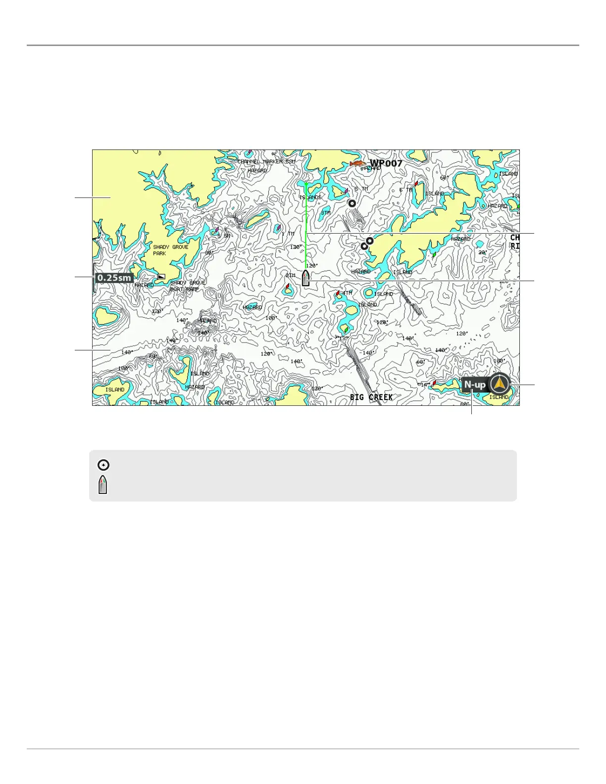
When the boat is stationary, it is drawn as a circle.
When the boat is in motion, it changes to a boat shape, pointed in the direction of motion.
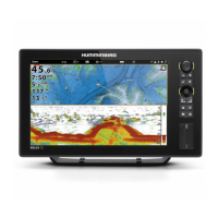
Chart View
map scale
course
projection
line
boat icon
land
water
chart
orientation
north up
indicator
 Loading...