26 IKE 4 User Manual
Photo Measure
Used to aim and capture an image of
an object in the eld. The image would
capture records such as; azimuth,
bearing and vertical angle between the
IKE device and laser target.
This information will be utilized to
calibrate the image and ultimately for
height measurements when uploaded
into IKE Ofce
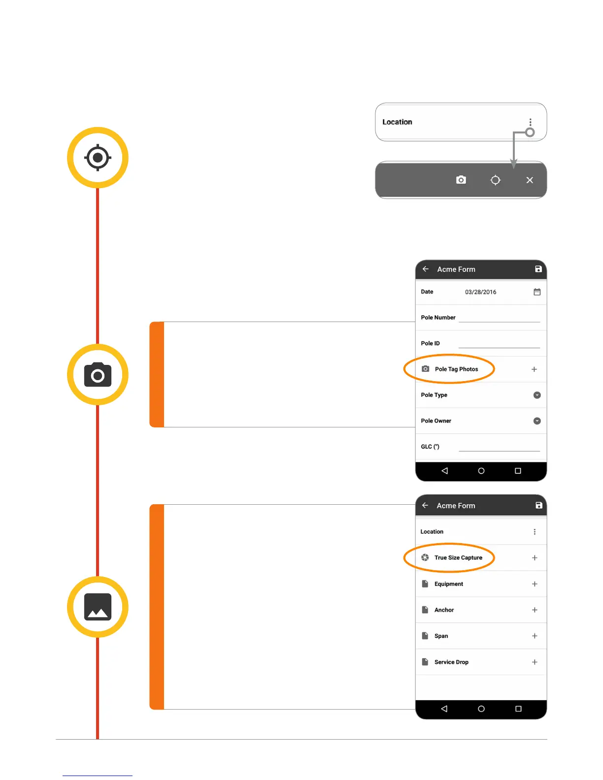
IKE Capture Tools
Location
Used to create a GPS location of the
target, in WGS84, Longitude and
Latitude. There are two options; GPS
location only which is 30 seconds of
GPS xes at the target, or GPS position,
image and laser measurement at an
offset position.
When viewed on IKE Field, you will be presented with two options to
capture the location of an object:
a. Remote Location
b. Local Location
Image
This is a “photo only” tool and is
exclusively for capturing images
of objects in the eld.
IKE Field screen: