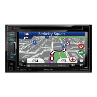
Do you have a question about the Kenwood DNX7230DAB and is the answer not in the manual?
Access help topics and information for using the navigation device.
Information on how the navigation system acquires and displays GPS satellite signal status.
Search for destinations by browsing through predefined categories and subcategories.
Locate places by entering keywords like category, brand, address, or city name.
Set your home location for quick access when navigating home.
Guide on how to begin navigating to a selected destination.
Explanation of how the device guides users along a route with prompts and map displays.
Instructions on how to reroute to avoid obstacles like construction zones.
Adjust map display settings, including points of interest and road conditions.
Select map viewing modes such as 2D (Track Up/North Up) or 3D.
Display a list of all upcoming turns and maneuvers for the current route.
Overview of the Smartphone Link app for live data and services integration.
Explains the ecoRoute feature for calculating fuel economy and carbon footprint.
Create and save multi-destination trips using the trip planner.
How the system receives and uses traffic information via built-in receiver or subscription.
How the system optimizes routes based on current traffic conditions and delays.
Information on traffic cameras and how to save or view them.
Access and change various navigation system settings like calculation mode and avoidances.
Adjust map details, themes, layers, and buttons to personalize the map display.
Modify time settings, including automatic updates, time format, and units.
Steps to update the navigation system software using a USB drive and internet.
Information on how to purchase and update map data for the navigation system.
| Auto | Yes |
|---|---|
| Marine (chartplotters, sounders) | No |
| Live service | - |
| Languages support | Multi |
| GPS accuracy - position | 2.5 m |
| GPS accuracy - velocity | 0.1 m/s |
| Map coverage | All Europe |
| Map view options | 2D |
| Display diagonal | 7 \ |
| Display resolution | 800 x 480 pixels |
| Placement supported | Horizontal |
| Storage media type | Flash |
| Compatible memory cards | SD, SDHC |
| Maximum memory card size | 32 GB |
| Audio formats supported | AAC, MP3, WAV, WMA |
| Image formats supported | JPG |
| Video formats supported | DIVX, H.264, MPEG1, MPEG2, MPEG4, MPG, WMV |
| Bluetooth version | 2.1+EDR |
| DIN size | 2 DIN |
| Form factor | Fixed |
| Product color | Black |
| USB 2.0 ports quantity | 1 |
| FM band range | 87.5 - 108 MHz |
| Supported radio bands | AM, DAB+, FM, LW, MW |
| Preset stations quantity | 24 |
| Power source type | DC |
| Depth | 163 mm |
|---|---|
| Width | 182 mm |
| Height | 112 mm |
| Weight | 2600 g |

