Do you have a question about the Kenwood DNX7340BT and is the answer not in the manual?
Precautions to prevent injury or fire, including avoiding short circuits and distraction.
Precautions to avoid injury or property damage, including route suggestion limitations.
Tips for preserving vehicle battery life during system use.
Details on map data sources, accuracy, and potential limitations.
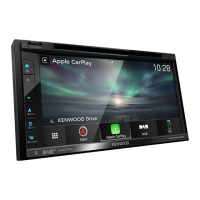
Initial steps to use the navigation system and access its features.
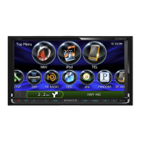
Guide on how to find information and assistance within the navigation system.
Steps to search for and select a restaurant using the navigation system.
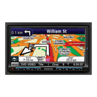
Understanding route guidance, voice prompts, and map indicators.
How to add intermediate stops to your planned route.
Procedure for navigating around road closures or obstacles on your route.
Instructions on how to terminate an active navigation route.
Methods to find places close to your current, a different city, or destination.
Understanding the options available on the Go! page for a selected location.
Steps to search for a specific street address using the navigation system.
How to locate a place by typing its name using the on-screen keyboard.
Guide to operating the virtual keyboard for text input.
Searching for locations in areas other than your current vicinity.
Techniques to refine search results by partially spelling location names.
How to save frequently visited or important locations to your Favorites.
Steps to save your vehicle's present location as a favorite.
Configuring your home address for easy navigation.
How to access and view locations saved in your Favorites.
Modifying details of saved locations, such as name, symbol, or category.
Instructions on how to remove a saved location from your Favorites.
Understanding the map display, navigation indicators, and zoom functions.
Accessing and viewing trip statistics like speed, distance, and arrival time.
Viewing detailed turn-by-turn instructions for your entire route.
Displaying upcoming turn information, distance, and time.
Checking GPS satellite status, accuracy, and location data.
Step-by-step guide to building a new route with start and end points.
Modifying existing custom routes, including name, points, and order.
How to save and adjust the currently active route, adding or removing points.
Instructions for starting navigation on a previously saved route.
Procedure to remove all stored custom routes from the system.
How to end the current navigation session.
How to reroute when encountering unexpected road closures or delays.
Overview of how to adjust system preferences and settings.
Adjusting units, keyboard layout, and viewing system information.
Modifying map detail, view perspective, vehicle icon, and map data.
Setting route preferences and defining avoidances for navigation.
Customizing color mode and other visual preferences for the display.
Configuring time format and automatic time updates.
Changing system language, voice personality, and keyboard layout.
Enabling or disabling safe mode for enhanced driving safety.
Guide to updating the navigation system software via the internet.
Information on how to update map data using an SD card or from a dealer.
Loading and managing custom points of interest like safety cameras.
| Resolution | 800 x 480 pixels |
|---|---|
| Bluetooth | Yes |
| GPS Navigation | Yes |
| USB Ports | 1 |
| Touchscreen | Yes |
| Navigation | Yes |
| DVD Player | Yes |
| USB Input | Yes |
| SD Card Slot | Yes |
| Display Resolution | 800 x 480 pixels |
| AM/FM Tuner | Yes |
| Voice Control | Yes |
| Steering Wheel Control | Yes |
| Audio Formats Supported | MP3, WMA, AAC |