REMARK
When the “Navigate to the point” is performed, one of the left end, center, and right end of blade edge is used as
a reference point which has been set in “Point of interest :” of “Steer Indication” screen or in the Steerpoint of
the Pop-up menu.
To set or change the reference point for Navigation, see “STEER INDICATION OPTIONS” or “OPERATION US-
ING POP-UP MENU”.
TOPO SHOT FOR TOPOGRAPHIC SURVEY
PERFORM TOPOGRAPHIC SURVEYS
The coordinate of the blade position can be measured and recorded continuously in certain interval or in pref-
erable timing.
TAKE A TOPO SHOT OF BLADE ELEVATION FOR TOPOGRAPHIC SURVEY IN
CERTAIN INTERVAL
1.
Press the power ON/OFF and menu switch to display the
main menu.
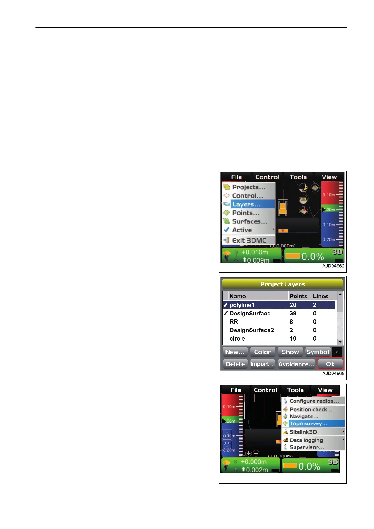
2.
On “File” menu, press “Layers...” and select.
3.
On “Project Layers” screen, make a new layer for record-
ing topographic survey.
4.
Press “Ok”.
5.
Press the power ON/OFF and menu switch to display the
main menu.
6.
On “Tools” menu, press “Topo survey...” and select.
HANDLE CONTROL BOX TOOLS MENU
4-51
 Loading...