Do you have a question about the Leica TS30 Series and is the answer not in the manual?
Explanation of inverse calculations between points, lines, and arcs in COGO.
Explanation of COGO traverse calculations for single and multiple points.
Methods for dividing areas by defined lines, percentage, or area in COGO.
Explains the need for coordinate systems and transformation methods for GPS points.
Setting default parameters for normal coordinate system determination method.
Steps to define or update a coordinate system transformation type and parameters.
Procedure for selecting or editing pairs of matching WGS84 and local control points.
Viewing shift, rotation, scale, and accuracy results of coordinate system transformations.
Steps to access the coordinate system determination for one point localisation.
Procedure to determine a coordinate system using onestep or twostep transformation.
Introduction to the GPS Survey application for measurements with SmartStation.
Information on predefined, additional, and default antennas with correction models.
Guide to defining new antennas or editing existing ones, including offset characteristics.
Explanation of measuring hidden points using a hidden point rod and reflector setup.
Settings for configuring hidden point measurements, including display mask and tolerances.
Step-by-step process for measuring hidden points using reflector configurations.
Introduction to using reference lines or arcs for measuring or staking points.
Settings for reference direction, stake mode, visual guides, and chainages.
Introduction to staking points relative to polylines using CAD data.
Procedure for setting up the instrument using GPS measurements with SmartStation.
Procedure for setting up the instrument using GPS measurements with SmartPole.
Information on creating and computing offset points relative to auto points.
Procedure to access the cross section template management interface.
Procedure to access the traverse adjustment calculation interface.
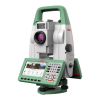
| Brand | Leica |
|---|---|
| Model | TS30 Series |
| Category | Measuring Instruments |
| Language | English |