Do you have a question about the Leica TS03 and is the answer not in the manual?
Information regarding the acquisition of the Leica TS03/TS07 instrument.
Details on locating the model and serial number of the instrument.
Lists registered trademarks and other proprietary marks.
Specifies the applicability of the manual to different instruments and applications.
Provides contact information for Leica Geosystems headquarters and regional support.
General directions to anticipate and avoid operational hazards for product users.
Explains the purpose and types of warning messages used in the manual.
Details the intended purposes and foreseeable misuse of the product.
Specifies operational constraints and environmental limitations for the instrument.
Warnings and precautions against improper handling, misuse, or modification.
Highlights the danger of electrocution near electrical installations.
Advises on increased risk of lightning strike when using accessories.
Warns about potential accidents due to lack of attention to surroundings.
Emphasizes securing the working site, especially in traffic or industrial areas.
Caution against pointing the product directly at the sun to avoid eye injury.
Warns about risks associated with improperly secured accessories.
Highlights fire hazard risks from mechanical influences during battery transport.
Warns about leakage, fire, or explosion from battery stress or fluids.
Warns about fire and injury risks from short-circuited battery terminals.
Details hazards of improper product disposal, including health and environmental risks.
Warns about injuries and destruction from unauthorized repairs.
Provides information on laser safety standards and operational hazards.
Safety information for EDM module using a visible laser beam.
Safety information for the Electronic Guide Light (EGL) feature.
Safety precautions for the laser plummet, classified as Class 2.
Safety information for the AutoHeight laser plummet feature.
Defines EMC and its capability to function smoothly in electromagnetic environments.
Caution regarding intense electromagnetic radiation near transmitters.
Caution regarding radiation from improper cable connections.
Warning about electromagnetic fields from phones affecting equipment and people.
Information regarding FCC compliance for digital devices and laser products.
Details product and battery labelling information.
Compliance statement for digital apparatus according to Canadian ICES-003.
Details labelling information for the GEB361 battery.
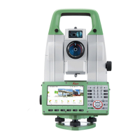
Overview of the instrument, computer, and data transfer system components.
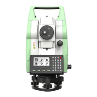
Lists the items included in the first part of the instrument container.
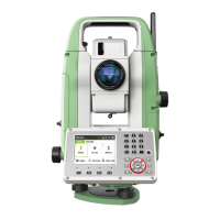
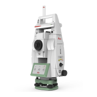
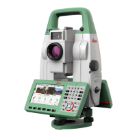
Details the components of the TS03 instrument, part one.
Describes the keyboard layout and the function of each key.
Details the purpose and action of various instrument keys.
Explains the screen layout and the meaning of status icons.
Provides a detailed description of various instrument icons.
Explains how to access and view information in icon pop-up bubbles.
Describes the functionality of common and specialized softkeys.
Details how to turn the instrument on/off and access power options.
Explains language selection and alphanumeric keypad usage.
Describes how to edit fields and use special characters in searches.
Explains the function to find measured points or fixpoints.
Details different search methods and provides examples.
Explains the meaning of graphic symbols used in the interface.
Step-by-step guide for setting up the instrument over a ground point.
Provides instructions for setting up and handling the tripod correctly.
Detailed steps for positioning and leveling the instrument.
Instructions for leveling the instrument using the electronic level.
Detailed steps for leveling using the electronic level and adjusting plummet intensity.
Explains how to adjust the intensity of the laser plummet.
Guidance for positioning the instrument over specific points.
Provides guidelines for first-time battery use, charging, and operation.
Step-by-step instructions for installing and removing the instrument battery.
Explains the instrument's internal memory and data storage methods.
Lists various methods for transferring data from the instrument.
Describes the main menu and its core functions.
Details the purpose of each function listed in the Main Menu.
Details the functionality of various measurement parameters.
Guidelines for performing distance measurements without a prism.
Guidelines for accurate measurements using prisms.
Information on using the red laser for prisms and reflector tape.
Configures instrument operation settings like trigger keys and tilt correction.
Sets units for angles, distance, and language preferences.
Describes how to navigate to and access work settings.
Details the various configurable parameters within work settings.
Explains how to access and configure regional settings.
Details parameters for angle units, language, and display.
Configures data recording options like double PtID and sort order.
Explains how to access and configure screen and audio settings.
Describes how to access and configure EDM measurement settings.
Details settings for EDM modes, targets, and measurement modes.
Enables entry of atmospheric parameters for distance measurements.
Enables entry of projection scale for coordinate correction.
Enables entry of individual scaling factors for correction.
Tests EDM signal strength for optimal aiming.
Explains PPM handling for slope, horizontal distance, and coordinates.
Explains how to access and configure interface communication parameters.
Details parameters for port, baud rate, data bits, and parity.
Illustrates connections for external battery, GND, and data transfer.
Describes functionality for transferring files via FTP server.
Explains how to access and configure FTP data transfer.
Displays files and folders on the instrument's data storage device.
Explains how to access and configure internet connection settings.
Details parameters for APN, User ID, and Password for internet connection.
Describes tools for electronic adjustment and setting reminders.
Explains how to access the Adjust menu for instrument calibration.
Lists available adjustment options like Hz-Collimation and Tilting Axis.
Explains how to record a user-defined key press sequence for startup.
Describes how to access and configure the startup sequence.
Details the steps for setting up an automatic start sequence.
Provides details about instrument, system, and firmware information.
Explains how to access the system information screens.
Shows instrument type, serial number, firmware version, and memory status.
Details fields for language, EDM firmware, OS, and sensor versions.
Explains how to manage and upload licence keys for hardware functionality.
Details how to activate and manage PIN protection for the instrument.
Explains how to upload software and language files via USB or SD card.
Describes how to access the software loading function.
Step-by-step guide for loading firmware and language files.
Lists available apps and their compatibility with TS03/TS07 instruments.
Explains how to select and start an application.
Details common fields used across various apps.
Explains how to manage and set the job for data storage.
Describes job management keys, sorting, and recorded data.
Explains the importance of station coordinates and orientation for measurements.
Details the calculation of station coordinates based on measurements.
Explains the calculation of station orientation.
Describes common fields found across firmware applications.
Guides on setting up a station using coordinates and orientation.
Lists and describes methods like Orientation, Resection, and Height Transfer.
Explains how to access and enter station data.
Details the input fields for station setup.
Describes the function of keys used within the station setup.
Instructions for measuring the instrument height using the laser plummet.
Guides on measuring target points and manual angle settings.
Describes how to sight target points and interpret results.
Shows the result of station setup including keys and symbols.
Details the fields displayed in the station setup results.
Explains the computation procedure and dependency on selected method.
Describes how to access the station setup results screen.
Details the fields presented in the station setup results.
Explains the display and use of computed residuals.
Details the fields for point usage, direction, and distance differences.
Lists important messages or warnings that may appear during setup.
Overview of the survey app for measuring unlimited points.
Explains how to start and access the survey application.
Describes the survey application interface and its functions.
Details keys like Q-Code, IndivPt, and Manage in the survey app.
Overview of the setout app for placing marks in the field.
Explains different modes for staking out points: Polar, Orthogonal, Cartesian.
Describes stakeout using polar coordinates relative to the reference line.
Describes stakeout using orthogonal coordinates relative to the reference line.
Describes stakeout using Cartesian coordinates relative to the reference line.
Details settings for prefix/suffix, identifier, and stakeout beep.
Describes the Setout application interface and its fields.
Explains the Reference Line app for staking out or checking lines.
Guides on defining the base line by measuring or selecting points.
Describes how to define a reference line by offsetting a base line.
Displays information and options for the reference line.
Explains calculation of offsets and height differences relative to a reference line.
Details calculated distance longitudinal, perpendicular, and height differences.
Explains stakeout calculations relative to a measured point.
Describes staking points orthogonally relative to the reference line.
Provides the interface for setting out points relative to a reference line.
Details parameters for grid stakeout like ΔHz, ΔL, ΔO.
Explains grid stakeout calculations relative to a reference line.
Guides on entering chainage and increment for grid points.
Details parameters for grid stakeout like chainage and offset.
Provides the interface for setting out grid points.
Details parameters for line segmentation stakeout.
Explains segmentation for staking points along a reference line.
Details parameters for segment number, length, and misclosure.
Details parameters for segment number, length, and misclosure.
Lists important messages or warnings for line segmentation.
Explains the Reference Arc app for defining and using arcs.
Guides on defining a reference arc using different methods.
Details parameters for defining arc start, center, end points, and radius.
Displays information and options for the reference arc.
Details calculated distance longitudinal, perpendicular, and height differences.
Explains stakeout calculations relative to an arc.
Describes staking a point using line and offset values.
Describes staking equidistant points along an arc.
Details parameters for staking points, arcs, chords, and angles.
Details parameters for staking points, arcs, chords, and angles.
Explains the Reference Plane app for measuring points relative to a plane.
Explains how to access the Reference Plane application.
Guides on measuring points to define a plane and target points.
Shows the results of plane measurements and available functions.
Explains the Tie Distance app for computing distances between points.
Describes Polygonal and Radial methods for tie distance calculation.
Guides on performing measurements for polygonal and radial methods.
Shows the results of tie distance measurements.
Overview of the app for computing areas and volumes.
Explains computing areas up to 50 points connected by straights.
Explains how to access the area calculation application.
Describes map elements used for defining reference planes.
Shows graphical representation of projected areas.
Explains automatic calculation of 2D and 3D areas.
Details fields for 2D and 3D area calculation.
Guides on calculating area projected onto a manually defined plane.
Details fields for 2D and 3D area calculation.
Explains the process of calculating volume using breaklines.
Details functions like NewArea, New BL, and @BLPt.
Describes fields for volume calculation like A 2D, A 3D, Per., DTM-V.
Details fields for volume calculation like DTM Grd.Area, BreakLn Area, DTM-Volume I.
Explains calculation of swell factor based on soil class.
Describes methods for dividing areas: Parallel, Perpendicular, Swing line.
Details methods for dividing areas: Parallel, Perpendicular, Swing line.
Details functions for area division like NewArea, New Div, Setout.
Describes parameters like Left/Right sub-area size, Area, Perimeter.
Overview of the Remote Height app for calculating heights without prism.
Overview of the COGO app for coordinate geometry calculations.
Explains how to access the COGO application and its subapps.
Details Inverse and Traverse functions for coordinate calculations.
Calculates intersection points of two lines defined by point and direction.
Calculates intersection of line and circle defined by point, direction, center, radius.
Calculates intersection of two circles defined by known points and distances.
Calculates intersection points of two lines defined by two points each.
Calculates distance and offset of a point relative to a line.
Calculates coordinates of a new point relative to a plane.
Calculates extended points from a known base line.
Overview of the Road 2D app for staking points relative to road elements.
Explains how to access the Road 2D application.
Describes straight, curve, and spiral elements for road design.
Sets chainage values and selects measurement methods for road elements.
Overview of the Road 3D app for staking points relative to road alignments.
Lists the subapps available for Road 3D: Check, Stake, Slope.
Provides step-by-step instructions for using the Road 3D app.
Defines elements of a road project including horizontal and vertical alignments.
Describes horizontal elements like straight, curve, and spiral.
Details definitions for straight, curve, and spiral elements.
Describes different types of spirals: Entry, Exit, and Partial.
Details vertical elements: straight, transition curve, and parabola.
Explains combined horizontal and vertical geometry elements.
Defines slope elements like hinge point, catch point, and natural surface.
Describes cut and fill situations relative to alignment and slope.
Guides on creating/uploading alignment files using Road Line Editor.
Details alignment parameters like offsets, chainage, and slope type.
Provides the interface for stakeout, check, and slope functions.
Overview of the Stake subapp for staking points relative to an alignment.
Explains how to access Setout and view stakeout parameters.
Details parameters for stakeout like offsets, chainage, and height difference.
Explains the Check subapp for as-built checks.
Details parameters for checking slopes.
Overview of the Stake Slope subapp for staking catch points.
Explains how to access slope stakeout configuration.
Details parameters for defining slope stakeout: Offset, Chainage, SlopeType.
Details parameters for slope stakeout: Chainage, ΔChain, ΔOffset, Cut/Fill, Act.Slope.
Details parameters for slope check: Offset, Chainage, Hinge, Height.
Provides slope check values relative to hinge point.
Overview of the Traverse app for establishing control networks.
Explains the Traverse app's use in establishing control networks.
Describes Traverse methods: Helmert, Compass Rule, Transit Rule.
Guides on starting and configuring a traverse network.
Details parameters for Traverse ID, operator, method, and tolerances.
Details entry of station data for traverse measurements.
Procedure for starting a traverse without a known backsight.
Procedure for starting a traverse with a known backsight.
Procedure for starting a traverse with a known azimuth.
Instructions for measuring the backsight point.
Instructions for measuring the foresight point.
Describes options for continuing, exiting, or redoing traverse measurements.
Guides on progressing through traverse measurements and sets.
Explains measuring checkpoints to verify traverse deviations.
Explains how to access traverse closing options.
Details options for closing a traverse at known/unknown stations or leaving open.
Describes functions for adjusting, viewing tolerances, and measuring sideshots.
Details parameters like Traverse ID, distances, and accuracy.
Details parameters for traverse adjustment like error distribution and tolerances.
Lists important messages and warnings related to traverse operations.
Explains how to access the Favourites Menu and assign functions to keys.
Describes the function of keys used to access favourites.
Lists available favourites like Home, Level, Offset, and Coding.
Explains calculation of target point coordinates using offset values.
Describes calculation of target points when reflector is not directly visible.
Explains how to access the Target Offset favourite.
Details functions like Default, Cylindr for offset management.
Describes offset parameters like Trav. Off., Length Off., Height Off., and Mode.
Explains calculation of cylindrical object coordinates and radius.
Details functions to trigger measurements for object sides.
Describes parameters like Hz Left, Hz Right, ΔHz, PrismOffset.
Describes actions after completing cylindrical offset measurement.
Shows results of cylindrical offset calculation.
Explains measurement to non-visible points using a hidden point rod.
Details settings for EDM mode, prism type, rod length, and spacing.
Guides on measuring prisms and viewing hidden point results.
Explains calculation of slope, distance, height, azimuth, and grade between points.
Explains access to Check Tie and its parameter fields.
Explains activation/deactivation of tracking measurement mode.
Details tracking modes available for Prism and Non-Prism measurements.
Enables remeasuring station setup points to verify position.
Describes the interface for backsight check, similar to Setout screen.
Explains the functionality for creating field sketches on virtual paper.
Explains how to access the SketchPad feature.
Describes keys, softkeys, and icons for sketching operations.
Explains coding for point information and its processing.
Guides on creating, importing, and exporting codelists.
Explains how GSI codes are stored and linked to points.
Explains how to access and use the coding interface.
Details functions like Cont for saving coding changes.
Details parameters for codes: name, quick code, description, and attributes.
Explains using quick coding for direct code entry via keypad.
Explains how to access and use the quick coding feature.
Step-by-step guide for using quick coding.
Lists important messages related to coding operations.
Describes MapView as an interactive display for survey elements.
Explains how MapView is accessed within applications.
Guides on accessing and configuring MapView settings.
Details the components of the MapView screen area.
Describes the standard controls and toolbar icons in MapView.
Describes toolbar functions and their softkey/key equivalents.
Explains the meaning of point symbols used on the map.
Step-by-step guide for selecting points using the touch screen.
Explains how to take and store screenshots for support.
Describes how to overlay sketches on images and store them.
Guides on taking new screenshots and using the toolbar.
Explains how to manage screenshots and sketches.
Details functions for deleting images, links, and viewing image info.
Describes the Manage page for data entry, editing, checking, and deletion.
Lists menu items like Job, Fixpoints, Meas.Data, Data Transfer, Del.Data.
Details export options to USB, SD card, and configured interfaces.
Provides special requirements for exporting data in XML format.
Describes the export interface and available functions.
Details data types and export options for various memory devices.
Guides through the process of selecting export details and formats.
Explains how data can be imported via USB, SD card, or internal memory.
Lists supported importable data formats like GSI, DXF, ASCII, Format.
Describes the import interface and selection of memory devices.
Guides through importing files or backup folders.
Step-by-step guide for inserting a USB memory stick into the instrument.
Guides on formatting a USB memory stick for instrument use.
Step-by-step guide for inserting an SD card into the instrument.
Guides on formatting an SD card for instrument use.
Guides on formatting the internal memory before data storage.
Steps to establish a Bluetooth connection between instrument and external device.
Step-by-step guide for inserting a SIM card into the instrument.
Detailed steps for inserting and removing the SIM card correctly.
Explains the importance of checking and adjusting instrument accuracy.
Lists instrument errors adjustable electronically: collimation, index, compensator.
Lists instrument parts to check: circular level, laser plummet, tripod screws.
Defines line-of-sight error as deviation between tilting axis and line of sight.
Defines vertical index error related to the vertical circle reading.
Explains how to access the adjustment menu for line-of-sight and vertical index errors.
Guides through leveling, aiming, storing, and saving adjustment data.
Lists messages and warnings related to adjustment errors.
Defines compensator index errors (l, t) and their effects.
Explains how to access the compensator index adjustment.
Guides through leveling, measuring faces, and releasing measurements.
Defines tilting axis error and its effect on horizontal angles.
Explains how to access the tilting axis adjustment.
Guides through aiming at targets below/above horizontal plane and storing data.
Steps for adjusting circular levels on the instrument and tribrach.
Guides for adjusting the circular level on the prism pole.
Steps for inspecting the instrument's laser plummet functionality.
Explains common settings and procedures for servicing the tripod.
Explains mySecurity as a cloud-based theft protection system.
Guides on adding/removing instruments to mySecurity.
Details the process for activating theft protection and connection intervals.
Describes how to view security status and renewal dates.
Guides on how to report an instrument as stolen.
Explains how stolen instruments can be located using myWorld.
Provides guidelines for transporting equipment in field, vehicles, and via shipping.
Details regulations for transporting Lithium batteries.
Provides instructions for storing the equipment and batteries.
Instructions for cleaning lenses, prisms, cables, and plugs.
Guidance on handling fogging prisms to prevent damage.
Steps for drying the product, container, and accessories.
Details accuracies, standard deviations, and display resolutions for angle measurements.
Specifies ranges and accuracies for distance measurements with various reflectors.
Details accuracy and time for non-prism measurements.
Describes principle, type, carrier wave, and measuring system.
Details accuracy and time for long-range measurements.
Describes principle, type, carrier wave, and measuring system.
Provides FCC and EU compliance declarations for TS03 and TS07.
Lists frequency bands for Bluetooth and WLAN connections.
Provides guidelines for transporting Lithium batteries safely.
Details telescope magnification, aperture, focusing, and compensation accuracy.
Details specifications for the instrument's level and control unit.
Describes instrument ports and pin assignments for the LEMO-0 connector.
Provides physical dimensions for TS03 and TS07 instruments.
Lists the weight of the instrument, tribrach, and batteries.
Specifies memory capacity and number of measurements for TS03/TS07.
Details specifications for laser plumets, including accuracy and dot size.
Details external supply voltage and internal battery specifications.
Details operating/storage temperatures, protection ratings, and humidity.
Lists automatic corrections applied: line of sight, tilting axis, Earth curvature.
Explains how to use scale correction for distance reductions.
Provides charts for atmospheric corrections based on temperature and pressure.
Lists reduction formulas valid for measurements to all reflector types.
Explains corrections applied to slope distances based on format.
Provides formulas for calculating slope, horizontal, and height differences.
Outlines terms and conditions for the product's software licence.
Provides a hierarchical view of the instrument's menu structure.
Details the default directory structure for files on the USB memory stick.
| Distance Measurement Accuracy (Non-Prism/Reflectorless) | 2 mm + 2 ppm |
|---|---|
| Operating Temperature | -20°C to +50°C |
| Protection Class | IP55 |
| Laser Plummet | Yes |
| Distance Measurement Accuracy (Prism) | 1.5 mm + 2 ppm |
| Distance Range without Prism | Up to 500 m |
| Display | Graphic color touchscreen |