Do you have a question about the Lowrance Endura Out&Back and is the answer not in the manual?
Procedures for turning the device on/off, entering standby mode, and adjusting screen brightness.
Understanding the titlebar, cursor, and navigation tabs like Back, Options, and Done.
Steps to restore factory settings and tips for using menus and keys effectively.
Methods for entering data via keypads and customizing page displays with data fields.
Installing batteries, using USB/microSD for power, and transferring files to the device.
Navigating the Map Page, its controls, data fields, and customization options.
Viewing satellite status, signal strength, and configuring GPS settings.
Monitoring trip details and viewing elevation history.
Tracking navigation progress, bearing, distance, and using the compass.
How to open the Main Menu and navigate to the Map Page.
Searching for waypoints, geocaches, points of interest, routes, and trails.
Creating, editing, saving, and navigating to waypoints.
Uploading, filtering, viewing, and navigating geocaches and trails.
Finding places, searching addresses, and creating/navigating routes.
Step-by-step route navigation and using media playback tools.
Transferring files and configuring device settings like volume and power.
Accessing and modifying navigation parameters for trails, routes, and waypoints.
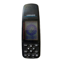
| Display Resolution | 240 x 320 pixels |
|---|---|
| High-Sensitivity Receiver | Yes |
| Waypoints/Favorites/Locations | 1000 |
| Routes | 50 |
| Geocaching-Friendly | Yes |
| Track Logging | Yes |
| Display Size | 2.2 inches |
| Display Type | Color TFT |
| Battery Type | 2 AA batteries |
| Waterproof | Yes (IPX7) |
| Ability to Add Maps | Yes |
| Accepts Data Cards | Yes, microSD card |
| Tracks | 10, 000 points |