Do you have a question about the Lowrance HOOK-4 and is the answer not in the manual?
Lists FCC and CE compliance standards met by the HOOK series units.
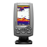
Describes the function of each physical control button on the unit.
Provides initial setup steps like turning the unit on/off and adjusting backlight.
Guides users through initial unit configuration upon first power-on.
Explains how to select and navigate between different data views.
Describes how to access context-sensitive menus for specific pages.
Explains pre-configured multi-panel page layouts for data display.
Details how to navigate to the main settings menu for unit configuration.
Explains how to select menu options and open submenus using the keypad and ENTER.
Covers scrollbars, on/off features, dropdown menus, and dialog boxes.
Guides on inputting text for waypoints, routes, or trails.
Explains how fishing modes optimize sonar settings for specific fishing conditions.
Details how the keypad controls the cursor for map scrolling and item selection.
Explains how to navigate the unit to a specific cursor location.
Lists features enabled when the unit is in Advanced Mode.
Covers power saving via standby mode and resetting settings to defaults.
Displays compass, current track, destination, and navigation data.
Shows the water column data moving from right to left on the unit's screen.
Displays water column information with Downscan sonar.
Shows a real-time moving map with navigation details.
Step-by-step guide on how to add and configure overlay data on sonar, chart, or downscan pages.
Details CHIRP transducer technology and its frequency options.
Guides on creating a new waypoint by inputting name, icon, and location.
Adjusts display detail, distinguishes structure, and auto-optimizes sensitivity.
Sets upper and lower depth limits for viewing a specific section of the water column.
Controls the rate transducer sends sonar waves, affecting interference.
Filters noise and reduces surface clutter for clearer sonar images.
Manages display views and visual appearance using color palettes.
Displays echo amplitude and fish symbols for target identification.
Allows selecting data to display on top of the Sonar page.
Optimizes sonar for fishing and resets fishing mode settings to defaults.
Adjusts depth, calibrates speed sensor, and calibrates temperature sensor.
Resets water distance and selects the unit's transducer model.
Allows reviewing recent sonar history by moving the sonar history bar.
Accesses options specific to the Downscan page via the MENU button.
Guides on creating a new waypoint by inputting name, icon, and location.
Adjusts screen contrast and selects display range for water column.
Configures depth range, transducer frequency, and ping rate for Downscan.
Filters noise and reduces surface clutter for clearer Downscan images.
Manages split zoom views and selects color palettes for Downscan display.
Prevents transducer transmission and displays data on the Downscan page.
Accesses the chart-specific menu from any Chart page.
Creates waypoints at current location or cursor position on the chart.
Navigates and manages waypoints, routes, and trails via dedicated screens and menus.
Allows editing name, icon, and latitude/longitude of selected waypoints.
Displays and manages routes, allowing creation using waypoints or chart points.
Explains how to sort waypoints and delete individual or all waypoints.
Describes creating routes by selecting points directly from the chart.
Explains how to navigate routes in forward or reverse direction.
Details the steps to cancel an active navigation route.
Covers editing route names, displaying routes, and deleting routes.
Guides on creating and customizing trails, including name and color.
Covers editing trail names, colors, display, and recording status.
Explains how to save a trail as a route for navigation.
Allows selecting data to be displayed on top of the Chart page.
Selects map orientation and accesses chart settings menu.
Displays ahead-estimating line and latitude/longitude grid values.
Selects map data source, Lowrance or Navionics regional maps.
Controls arrival radius, off course distance, and WAAS/MSAS/EGNOS settings.
Sets thresholds for arrival and off-course alarms.
Controls bearing calculation and magnetic variation settings.
Guides on setting up AIS and matching the unit's Baud rate to the AIS device.
Illustrates AIS target symbols and allows filtering targets by distance/speed.
Adjusts unit language, audio, time, and advanced mode settings.
Configure language, audio alerts, time, and monitor GPS status.
Track trip data, enable advanced features, and restore default settings.
View files saved to the microSD card.
Details arrival, off course, anchor, shallow water, and fish alarms.
Explains the conditions that trigger arrival, off course, anchor, shallow, and fish alarms.
Selects units of measure for distance, speed, depth, temperature, and bearings.
Simulates GPS/sonar and configures NMEA 0183 data sentences.
Details sonar depth, speed, transducer frequencies, and cable length for HOOK-4.
Details sonar depth, speed, transducer frequencies, and cable length for HOOK-5.
Details sonar depth, speed, transducer frequencies, and cable length for HOOK-7.
Details sonar depth, speed, transducer frequencies, and cable length for HOOK-9.
Outlines terms for using databases, non-exclusive rights, and user responsibilities.
Specifies conditions voiding warranty and limits on liability.
Provides contact details for customer service and website support.
Directs users to the online store or local dealers for accessories.
| Display Size | 4.3 inches |
|---|---|
| Resolution | 480 x 272 pixels |
| GPS | Yes |
| Sonar | Yes |
| Waypoints | 3000 |
| Routes | 100 |
| Trackback | Yes |
| Display Type | Color TFT |
| Waterproof | Yes |
| Operating Temperature | -15°C to 55°C |