Do you have a question about the Lowrance Hook Reveal X Series and is the answer not in the manual?
| DownScan Imaging™ | Yes |
|---|---|
| CHIRP Sonar | Yes |
| Autotuning Sonar | Yes |
| FishReveal™ | Yes |
| GPS | Yes |
| Waterproof Rating | IPX7 |
| Display Resolution | 800 x 480 |
| Sonar Technology | CHIRP, DownScan Imaging™ |
| Sonar Frequencies | 455/800 kHz |
| SD Card Slot | Yes |
| Power Supply | 12V DC |
| Battery Voltage | 12V |
| Display Size | 5 inches or 7 inches |
| Display Type | SolarMAX™ HD |
Disclaims liability for product use and states the manual reflects the product at the time of printing.
Specifies that the English version of the documentation is the official and authoritative version.
Lists registered trademarks including Navico, Lowrance, and microSD.
Lists the Navico products the manual refers to, such as DownScan Imaging and FishReveal.
States the copyright holder and year for the manual's content.
Directs users to a separate document for warranty details and the brand website for queries.
Outlines declarations of conformity for Europe and the United States of America.
Indicates the manual is for the first software version and is updated periodically.
Explains how to find the unit's current software version in the System Settings dialog.
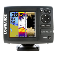
Details the function of each button on the front panel of the unit.
Specifies the location of the Micro SD card reader on the unit.
Describes how to access the Home page and its main components like Tools and Application Icons.
Explains the structure of application pages, including panels, menus, and dialogs.
Details the creation and modification of custom pages with multiple panels.
Instructions on how to power the unit on and off using the power key or dialog.
Provides quick access to basic system settings like standby and brightness.
Explains how to select and toggle functions on or off using icons.
Describes entering standby mode to save power, turning off sonar and backlight.
Covers adjusting screen brightness and activating night mode for low light.
Guide on navigating menus, selecting options, and interacting with dialog boxes.
Explains how to activate, position, and use the cursor for marking and selecting items.
Details how to save a MOB waypoint in an emergency situation at the vessel's current position.
Instructions for deleting a Man Overboard waypoint from the menu.
How to cancel navigation to a Man Overboard waypoint.
Procedure for taking a screenshot of the unit's display.
How to personalize the Home page background with custom images.
Explains how to add, delete, or change data overlays on a page.
Step-by-step guide to creating new custom pages with multiple panels.
Procedure for modifying or removing existing custom pages.
How to resize the display area of multiple panels on a page.
Details the components of the GPS plotter display, including data overlays and indicators.
Information on managing waypoints, routes, and trails for navigation.
Explains how to use the device for navigation to waypoints or along routes.
Describes the vessel symbol and how to adjust the GPS plotter page scale.
Instructions on how to move the map view in any direction.
Details on adding data layers and other options to the GPS panel.
Overlays StructureMap data from SideScan onto the GPS panel for visualization.
Provides real-time depth contour mapping based on live sonar soundings.
Configuration settings for Genesis Live, including transparency and depth palette.
Sets a safety depth threshold, shading areas shallower than the minimum.
Specifies how the GPS image is rotated, such as North up or Course up.
Adjusts the view to maximize sight ahead of the vessel.
Controls the display of basic information for panel items when selected.
Settings for range rings to show distance and grid lines for coordinates.
Options to turn on/off display of Waypoints, Routes, Trails, and Course extension line.
Access to advanced edit functions and settings for waypoints, routes, and trails.
User-generated marks positioned on the GPS plotter panel.
Instructions on how to save new waypoints by holding the Cursor/Waypoint key.
Procedure for repositioning an existing waypoint using the cursor and menu.
How to edit all information about a waypoint using the Edit Waypoint dialog.
Methods for deleting waypoints via the Edit Waypoint dialog or menu option.
Setting proximity alarms for individual waypoints within a defined radius.
A route consists of a series of routepoints entered in order for navigation.
Step-by-step guide to creating a new route by positioning routepoints on the panel.
Procedure to edit routes, move or remove routepoints, and manage details.
Instructions on how to delete a route via the menu option.
How to convert trail data into a route using the Edit Trail dialog.
Allows adding/removing routepoints and changing route properties.
How to start a new trail recording from the Trails dialog.
Configures trail point positioning based on time, distance, or course changes.
Instructions for setting the color for trails in the Edit Trail dialog.
Introduction to navigating to cursor, waypoint, or along a predefined route.
Details options available while navigating, such as skipping waypoints or restarting.
How to initiate navigation to a selected cursor position on the panel.
Procedure to start navigation towards a saved waypoint.
How to follow a predefined route on the display.
Configuration options for navigation, including arrival radius and XTE limit.
Enables or disables the Cross Track Error alarm.
Converting trails into routes for navigation purposes.
Sets how trail points are recorded based on time, distance, or course changes.
Details the components of the sonar display, including fish arches and bottom structure.
How to zoom the sonar image and use the cursor for detailed analysis.
Explains how to pan the image to review past sonar data.
Procedure to start, manage, and stop recording sonar log data.
Covers filename, file format, save location, and time remaining for sonar logs.
Describes how to convert SideScan logs into StructureMap data.
Instructions on how to properly stop the recording of sonar log data.
How to review internally and externally stored sounder records.
Adjusting sonar image settings for optimal viewing.
Enables manual tuning of sonar settings in specific fishing modes.
Setting the display depth and selecting available transducer frequencies.
How to adjust sensitivity manually or use auto sensitivity for optimal detail.
Covers ping speed, scroll speed, noise rejection, surface clarity, and colorline.
Resets all customized sonar settings back to their default values.
Available configurations for split screen sonar displays.
Details on using zoom levels and zoom bars to magnify sonar images.
Useful for viewing targets close to the seabed by flattening the bottom.
Describes flasher-style view and amplitude scope display for echo sounding.
Selecting display palettes and configuring fish identification features.
How to overlay DownScan images onto the regular Sonar display.
How to use the cursor to measure distances between points on the sonar image.
Access to sonar settings including logging and viewing sonar logs.
Determines available applications and frequencies based on the connected transducer.
Adjusting depth readings to account for transducer position relative to the boat.
Provides detailed images of structure and fish to the sides of the boat.
Explains display setup options for left side, right side, or both scanning.
How to specify the distance displayed to the left and right of the image center.
How to activate, position, and interact with the cursor on SideScan images.
How to pan the SideScan image to review past data.
Instructions on how to record and save SideScan data.
Guides on automatic and custom modes for optimizing SideScan display.
Details on range, frequencies, and contrast settings for manual tuning.
Reduces surface clutter by decreasing receiver sensitivity near the surface.
Resets customized SideScan settings back to factory defaults.
Flips the image sides to match transducer installation direction.
Adds range lines for distance estimation and selects display palettes.
Selects display sides and measures distances on the SideScan image.
Provides detailed images of structure and fish directly below the boat.
Details the components of the DownScan display, including depth and frequency.
How to zoom the DownScan image and use the cursor for analysis.
Navigates to a cursor position and reviews past DownScan history.
Instructions on how to record and save DownScan data.
Guides on automatic and custom modes for optimizing DownScan display.
Details on range, frequency, and contrast settings for manual tuning.
Resets customized DownScan settings back to factory defaults.
Enables display of fish arches, with sensitivity and colorline adjustments.
Reduces surface clutter and selects display palettes optimized for fishing conditions.
Reduces surface clutter and accesses additional features like range lines.
Selects display palettes and measures distances on the DownScan image.
Overlays SideScan images onto maps for better underwater visualization.
Displays StructureMap as an overlay on the GPS panel.
Provides advice for capturing better images of taller structures.
Uses log sonar option to record SideScan data for StructureMap conversion.
Transforms SideScan log files into StructureMap format (.smf).
Adjusts StructureMap settings like transparency, palettes, and contrast.
Controls water column display and clears live history data.
Continuously checks for dangerous situations and system faults, alerting the user.
Classifies messages by color codes (Red, Orange, Yellow, Blue, Green) and importance.
Explains how to acknowledge messages via Close or Disable options.
Provides access to general options and tools not specific to any panel.
Accesses core system configurations like language, boat settings, and text size.
Configures button beep volume, time/date format, and coordinate datum.
Sets coordinate display format and adjusts for magnetic variation.
View satellite status and reset system settings to factory defaults.
Accesses settings for user interface and feature visibility.
Prompts for registration and displays copyright, software, and technical information.
Provides access to specific settings for navigation, GPS, and sonar functions.
Enables siren, configures alarms, and sets measurement units.
Allows manual control of the unit's simulation mode for testing.
Lists navigational data and provides access to environmental information like Sun/Moon.
Accesses file management for browsing and managing internal and external storage.
Recommendations for basic preventative maintenance, including using a sun cover.
Instructions for cleaning the screen and housing using appropriate materials.
Ensuring proper connector seating and using the built-in service assistant.
Detailed steps for downloading and installing software updates for the unit.
Recommended procedures for regularly copying user data and system settings.
Backs up all navigational data from the system.
Selects an area for export and chooses the appropriate file format.
Deletes user data from memory and improves system performance.
Saves user settings and configurations to a storage device.
Allows users to see how the unit works in a stationary, simulated environment.
Demonstrates the unit's functionality for selected regions in a retail setting.
Enables selection of sonar data files for use with the simulator.
Selects the file for simulated GPS data.
Manually enters speed and course values when using simulated GPS.
Sets the simulated vessel's starting position to the current cursor position.