Do you have a question about the Lowrance iFINDER Pro IFINDER PRO and is the answer not in the manual?
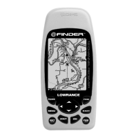
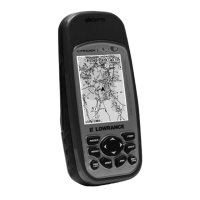
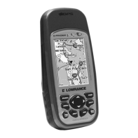
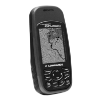
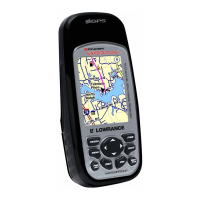
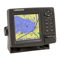
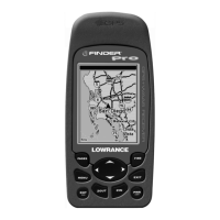
Details the hardware features and specifications of the iFINDER Pro GPS unit.
Explains the basic principles of how the iFINDER GPS receiver operates and acquires satellite signals.
Provides an overview of the Global Positioning System (GPS) and the Wide Area Augmentation System (WAAS).
Explains text formatting, symbols, and conventions used within the manual for clarity.
Identifies and describes the function of each key on the iFINDER Pro keypad.
Instructions for turning the unit on/off and navigating the Easy Mode Main Menu.
Explains the three main page displays available in Easy Mode operation.
Details how to find and display the current GPS position using the iFINDER.
How to pan, zoom, and move the cursor on the map display.
Demonstrates how to search for Points of Interest (POIs) like restaurants.
How to set a "Home" waypoint and navigate back to it.
Explains how to activate and use the Man Overboard feature for emergencies.
Instructions for navigating to map cursor locations and Points of Interest.
How to record, save, and view a trail of your path.
Methods for following a recorded trail, either forward or backward.
How to set and manage GPS alarms like arrival, off-course, and anchor alarms.
Explains the automatic search function for acquiring GPS satellite signals.
How to check MMC files and available storage space on the unit.
Setting up the NMEA 0183 communication port for data exchange with other devices.
Configuring DGPS receiver settings and specific NMEA sentences for data transmission.
Choosing the display format for position coordinates (e.g., Degrees, UTM, MGRS).
Setting up map fixes and customizing what information appears on page displays.
Displaying Navionics charts, viewing port services, tidal currents, and tide information.
Enabling pop-up help messages and configuring power saving settings for battery life.
Functions for stopping the GPS engine indoors and resetting unit options to factory defaults.
Adjusting screen contrast, brightness, display modes, and setting the unit's language.
Setting the local time/date and checking the unit's software version information.
Configuring sound styles, alarm settings, and track smoothing for improved trail accuracy.
Managing trail settings, update criteria, and configuring units for speed, distance, and depth.
Step-by-step guide to searching for specific street addresses using the iFINDER.
How to find map items like POIs or features selected by the map cursor.
Instructions on how to locate the pre-set "Home" waypoint in Easy Mode.
Searching for specific highway exits and their associated services.
Locating points of interest like hotels, restaurants, and landmarks by name or proximity.
How to search for specific streets and their intersections within the map data.
Searching for saved waypoints by name or proximity, available in Advanced Mode.
Lists the various geodetic datums supported by the iFINDER for position referencing.
Details the device's compliance with Federal Communications Commission (FCC) rules.
Provides details on the product's limited warranty and how to obtain customer service and repairs.