Do you have a question about the Lowrance LMS-334c iGPS and is the answer not in the manual?
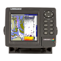
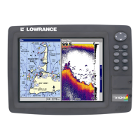
Details the hardware and software capabilities of the LMS-334c iGPS and LMS-339cDF iGPS units.
Explains text formatting and conventions used throughout the manual for clarity and ease of use.
Provides instructions for mounting transducers on transoms, trolling motors, or inside hulls for optimal sonar performance.
Explains how to connect the unit to the power source, including NMEA 2000 and NMEA 0183 interfaces.
Details the process for installing MMC or SD cards for storing sonar logs, maps, and GPS data.
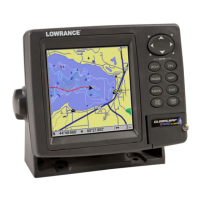
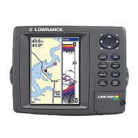
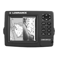
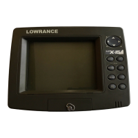
Describes the function of each key on the unit's keypad for navigation and operation.
Explains how to access and navigate the unit's main menu for various functions and settings.
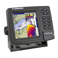
Outlines how to switch between the four main page displays: Satellite Status, Navigation, Map, and Sonar.
Details how to view and interpret the sonar chart, displaying echoes of fish, structure, and the bottom.
Explains the ASP feature for noise reduction and optimizing sonar display quality under various conditions.
Covers setting up Sonar, GPS, and NMEA 2000 alarms for depth, fish, zones, and other events.
Describes how to adjust sonar sensitivity for clearer target detection and reduced screen clutter.
Details various display options for the Sonar Page, including full chart, split zoom, and split frequency views.
Provides steps to diagnose and resolve issues when the unit fails to power on or respond.
Offers solutions for common operational problems like freezing or erratic behavior, often related to electrical noise.
Addresses issues with poor sonar readings, including transducer placement and electrical interference.
Explains the function of each key for navigating menus and operating GPS features.
Guides users on accessing and utilizing the main menu for GPS functions and setup.
Details how to view and interact with the map display, including zooming and panning for navigation.
Explains how to create and save waypoints for navigation and future reference.
Guides users on how to set a course and navigate to a previously saved waypoint.
Covers creating, saving, and navigating complex routes by linking multiple waypoints.
Explains how to create, save, display, and navigate trails, which record a path taken.
Details managing waypoints, including editing names, symbols, positions, and selecting them for navigation.
Explains how to configure various GPS alarms like arrival, off-course, and anchor alarms.
Allows users to choose different coordinate display formats for position data.
Describes how to customize data boxes on various page displays for at-a-glance information.
Covers options for controlling map display elements like detail level, pop-ups, boundaries, and overlays.
Explains how to search for specific streets within a city or across a region.
Details how to search for Points of Interest (POIs) like restaurants, airports, and landmarks.
Describes how to search for saved waypoints by name or proximity to the current location.
Lists the various geodetic datums supported by the unit for map coordinate systems.
| Display Size | 5 inches |
|---|---|
| Display Type | Color TFT |
| Display Resolution | 480 x 480 pixels |
| Sonar | Yes |
| Waterproof Rating | IPX7 |
| Operating Frequency | 200 kHz |
| Water Resistance | Waterproof |
| GPS Receiver | 12-channel |
| Sonar Capability | Depth |
| Memory | MMC/SD card slot |