Do you have a question about the Lowrance LCX-17M and is the answer not in the manual?
Details general and sonar/GPS specifications for the LCX-17M unit.
Explains the basic principles of sonar technology and its application.
Describes the fundamental operation of the GPS receiver and its navigation.
Explains the formatting and conventions used within the manual for clarity.
Provides instructions for installing the Skimmer transducer on transom, trolling motor, or hull.
Guides on choosing the optimal placement for transducer for best performance.
Details the assembly and mounting procedures for transom-mounted transducers.
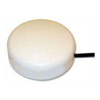
Covers the installation and connection of the GPS antenna/receiver module.
Explains how to connect the unit to the power supply.
Describes methods for mounting the main unit using bracket or in-dash.
Instructions for installing MultiMedia Cards (MMC) or Secure Digital Cards (SD).
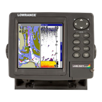
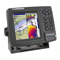
Overview of the unit's physical keys and their functions.
Procedure for turning the unit on, off, and adjusting backlight.
Explains how to access and navigate the unit's main menu.
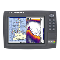
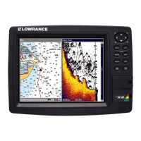
Describes the four main page displays: Status, Navigation, Map, and Sonar.
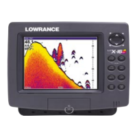
Details the Sonar Page display and its functions.
A simplified, 10-step guide for quick sonar operation.
General guidance on operating the sonar features.
Explains the ASP feature for noise reduction and display optimization.
Details the unit's sonar alarm types: Fish, Zone, and Depth alarms.
Covers automatic, manual, and upper/lower limit depth range settings.
Describes the Fish I.D. feature for identifying and displaying fish symbols.
Instructions for selecting transducer frequency (50 kHz or 200 kHz).
Explains the Grayline feature for distinguishing echo strength.
How to display additional data like GPS, Time, and Sonar data on screen.
Procedure to restore all unit features, options, and settings to factory defaults.
Covers adjusting sonar sensitivity for optimal echo reception.
Enables running the unit in a simulated mode for practice.
Troubleshooting steps for when the unit fails to power on.
Steps to resolve issues of the unit freezing or operating unexpectedly.
Solutions for poor bottom echoes and erratic sonar readings.
Diagnosing and minimizing electrical noise affecting sonar display.
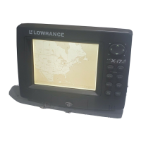
Overview of the unit's physical keys and their functions for GPS operation.
Explains how to access and navigate the unit's main menu for GPS functions.
Shows detailed GPS satellite lock-on and position acquisition status.
Describes the Navigation Page with compass rose and travel information.
Explains the Map Page for viewing course, track, and location on a map.
A quick reference guide for basic GPS operations and navigation.
Procedure for finding the unit's current GPS location.
Instructions on using the unit's search functions for locations and POIs.
Guide on creating and saving waypoints at current position or on map.
Steps for navigating to a previously saved waypoint.
Instructions for creating and saving a trail (path) of your travel.
Measure distance from current location to a selected map point.
Measure distance between two points on the map.
Create and manage graphic symbols (icons) on the map for points of interest.
Create, save, and manage routes composed of waypoints.
Instructions for following a saved route.
Options for managing trails: delete, edit name, color, and pattern.
Procedure to remove a specific trail or all trails from memory.
Configure GPS alarms such as Arrival, Off Course, and Anchor alarms.
Choose display formats for latitude/longitude and other coordinate systems.
Personalize on-screen information by customizing data boxes on pages.
Practice GPS navigation features using simulated conditions.
Options to control map display, boundaries, overlays, and data details.
Set map display to North Up, Track Up, or Course Up.
Instructions for displaying Navionics electronic charts on MMC cards.
Restore unit settings to factory defaults.
Adjust display contrast and brightness for optimal viewing.
Change the unit's menu language from the available options.
Search for specific addresses by entering street and city.
Locate highway exits and associated services.
Search for points of interest like cities, landmarks, and businesses.
Search for specific streets or street intersections.
Locate saved waypoints by name or nearest proximity.
List of geodetic datums supported by the unit for position accuracy.