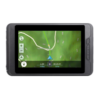
Specifications
113
Coordinate Systems
Available 11 plus 1 user grid.
Lat/Lon, UTM, OSGB, Irish, Swiss, Swedish, Finnish, German,
French, USNG and MGRS
Routes
Total Unlimited (using SD cards)
GOTO route
BackTrack route
Name Length 10 characters (including spaces)
Track Logs
Total Unlimited saved track logs (using SD cards) plus active track log
Points of Interest
User-entered
Total Unlimited saved points of interest (using SD cards)
Name Length 20 characters (including spaces)
Built-in (included with background map)
Categories Cities, highways, airports, waterways, and parks
Navigation Screens
Map Includes background map and 2 data fields (customizable)
Compass Includes graphical compass and 2 data fields (customizable)
Position Includes position, elevation, accuracy, date and time, trip odometer,
and battery life
Alarms
Anchor Alar
m Alerts when moved a user-defined distance
Of
f Course Alarm Alerts when more than a user-defined distance, left or right of
computed track
Arrival Alarm Alerts when within a user-defined distance of destination
Proximity Alarm Alerts when within a user-defined distance of destination
 Loading...
