Do you have a question about the Magellan RoadMate 9400-LM and is the answer not in the manual?
Covers temperature limits and battery handling precautions for safe device operation.
Guidelines for safe charging and the use of approved power adapters.
Device interference and radiation exposure compliance information as per FCC regulations.
Device interference and radiation exposure compliance information as per IC regulations.
Information regarding patents related to Bluetooth technology used in the device.
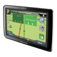
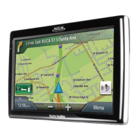
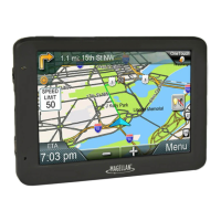
An overview of the Magellan RoadMate GPS receiver and its basic functions.
Description of the physical buttons, ports, and key features of the device.
Managing battery levels, speaker volume, and button sound preferences.
Adjusting screen brightness and navigating the device's main menu.
Using the on-screen keyboard, QuickSpell, and Smart City Search for data input.
Instructions for changing the screen orientation between Portrait and Landscape modes.
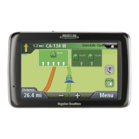
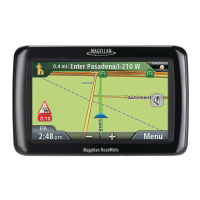
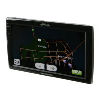
Understanding the differences between Normal and Routing map screen displays.
Customizing map display elements like Night Mode, 3D view, and Point of Interest visibility.
Features for panning, zooming, selecting map modes, and auto-zoom on turns.
Viewing route steps and details about the current geographical position.
Storing current or destination addresses for future use in the address book.
Avoiding specific maneuvers and changing route calculation methods.
Controlling the audio output volume from the map screen.
Navigating and utilizing the OneTouch menu for quick access to saved destinations.
Saving new addresses or searches and editing existing OneTouch assignments.
Storing Point of Interest search criteria to OneTouch buttons for later retrieval.
Step-by-step instructions for entering street addresses as destinations.
Setting destinations by specifying intersecting street names.
Techniques for efficient address input using software features.
Navigating to a city's geographical center when a specific address is unknown.
Retrieving and routing to previously visited locations.
Managing stored addresses and contact information within the address book.
Using the address book to plan routes to saved locations.
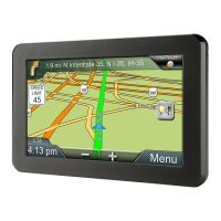
Understanding the device display during active routing, including map and maneuver details.
Managing route steps, viewing maneuvers, and excluding specific turns.
Selecting calculation preferences like fastest time, shortest distance, or freeway usage.
Setting default routing preferences and creating detours from the current route.
Instructions for ending an active route calculation or navigation.
Using real-time traffic data to optimize route planning and avoid delays.
Creating routes with multiple stops and managing the sequence of destinations.
Reordering, skipping, or removing destinations within a multi-stop trip.
Finding nearby points of interest by selecting from predefined categories.
Searching for specific POIs by name or finding those near highway exits.
Connecting a Bluetooth-enabled phone and configuring device settings.
Importing contacts, making calls, and handling incoming calls via Bluetooth.
Managing calls, entering data for automated services, and adjusting audio levels.
Customizing display brightness, map options, and Point of Interest visibility.
Setting route methods, turn warnings, spoken street names, and audio preferences.
Avoiding tolls/unpaved roads, and configuring traffic information display and alerts.
Configuring speed limit alerts, audible warnings, and camera-based Phantom Alerts.
Adjusting time zone, keyboard layout, and measurement units.
Checking GPS signal status and restoring device to factory default settings.
Accessing serial number, software version, and other product information.
Steps for resolving common device problems and unresponsive behavior.
| Display Size | 7 inches |
|---|---|
| Screen Type | LCD |
| Touchscreen | Yes |
| Preloaded Maps | Yes |
| Lifetime Maps | Yes |
| Lifetime Traffic | Yes |
| Bluetooth | Yes |
| Voice Command | Yes |
| Junction View | Yes |
| Lane Guidance | Yes |
| Speed Limit Indicator | Yes |
| Points of Interest | Yes |
| Battery Life | 2 hours |
| Display Resolution | 800 x 480 pixels |
| Weight | 1.2 pounds |