VQT4U14 (ENG)
22
Sensors (compass/altimeter/barometer)
are operated
The direction, altitude, and atmospheric pressure can be measured and recorded in the
recorded images.
• Information measured on this unit is only a rough indication. Do not use it for
technical purposes.
• When using this unit for full-scale mountain climbing, trekking, or underwater, use the
measured information (direction, altitude, depth, atmospheric pressure) only as a
rough indication, and always carry a map and purpose-built measurement tools.
Press [MENU/SET].
Press 3/4/2/1 to select [GPS/Sensor] menu, and then press
[MENU/SET].
Press 3/4 to select [Sensor Settings], and then press [MENU/
SET].
Press 3/4 to select [ON], and then
press [MENU/SET].
•
Exit the menu after it is set.
• To switch the environment information
screen, press [DISP.] several times.
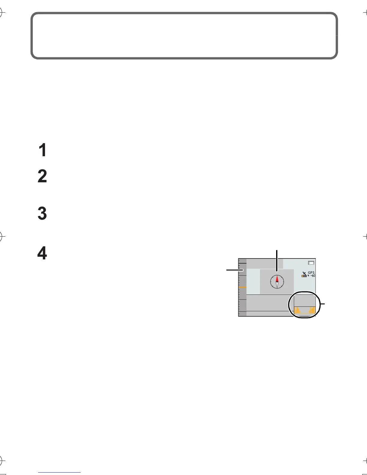
A Compass
16 bearings are measured based on the direction the lens of the camera is pointing in.
• The coloured portion of the compass needle points north.
B Altimeter
You can check the altitude of the current location.
• Displaying range is j600 m to 9000 m.
C Barometer
With the current atmospheric pressure as a reference, it is displayed on the graph within
the range of j10 hPa to _10 hPa.
(Atmospheric pressure out of range cannot be displayed in details)
10
0m
00' 00' 00.00
1013hPa
-
24H 0
H
000' 00' 00.00
GPS
5
0
-
5
-
10
N
E
N
N
10:00 1.DEC.2013
10:00 1.DEC
DMC-FT5&TS5GH-VQT4U14_eng.book 22 ページ 2013年1月30日 水曜日 午後12時8分
 Loading...